Glenshee
Devil’s Elbow Viewpoint


Introduction
The Devil's Elbow is a double hairpin a mile or so south of the Cairnwell summit, on the road between the Spittal of Glenshee and Braemar. For decades it was the thing drivers dreaded on the run north. Steep, tight, and a real handful in a 1950s motor car.
How steep is up for debate. Old postcards and local history put it at 1 in 3. More recent accounts reckon that's an exaggeration and the real figure is nearer 1 in 6. Either way, it was enough that buses used to drop their passengers at the bottom to walk up, lightening the load for the climb. The AA kept a well in a lay-by so people could top up engines that had boiled over.
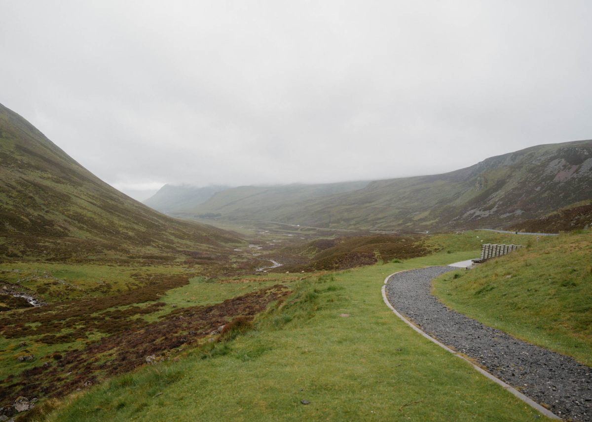
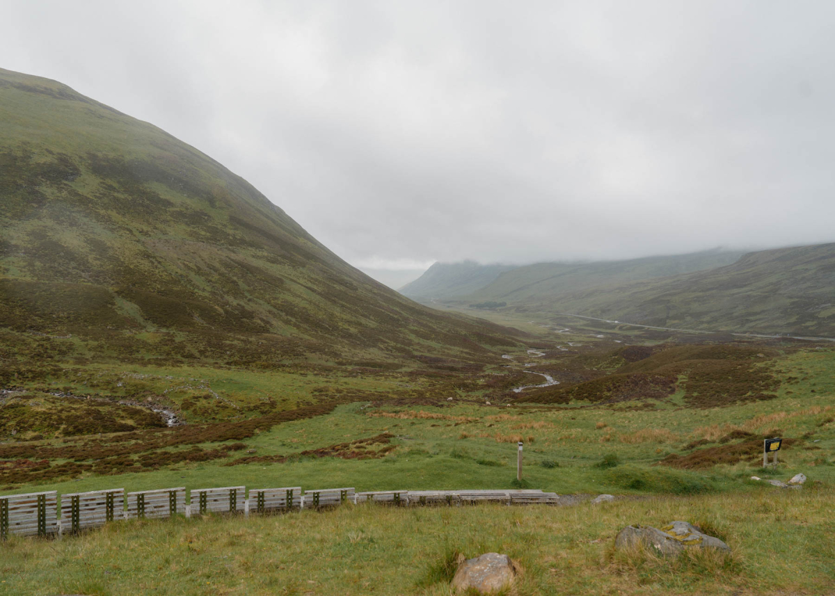
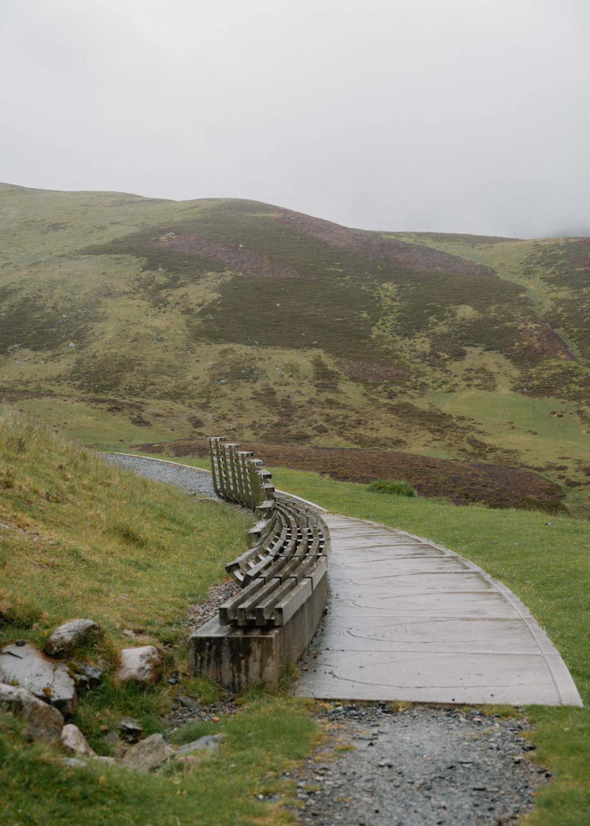
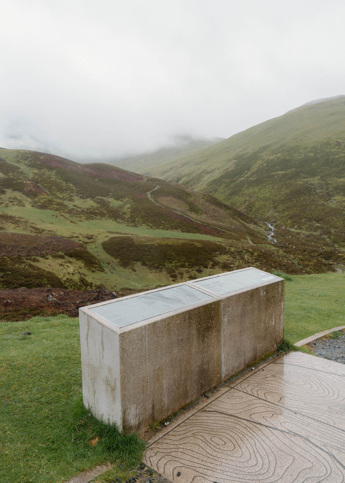
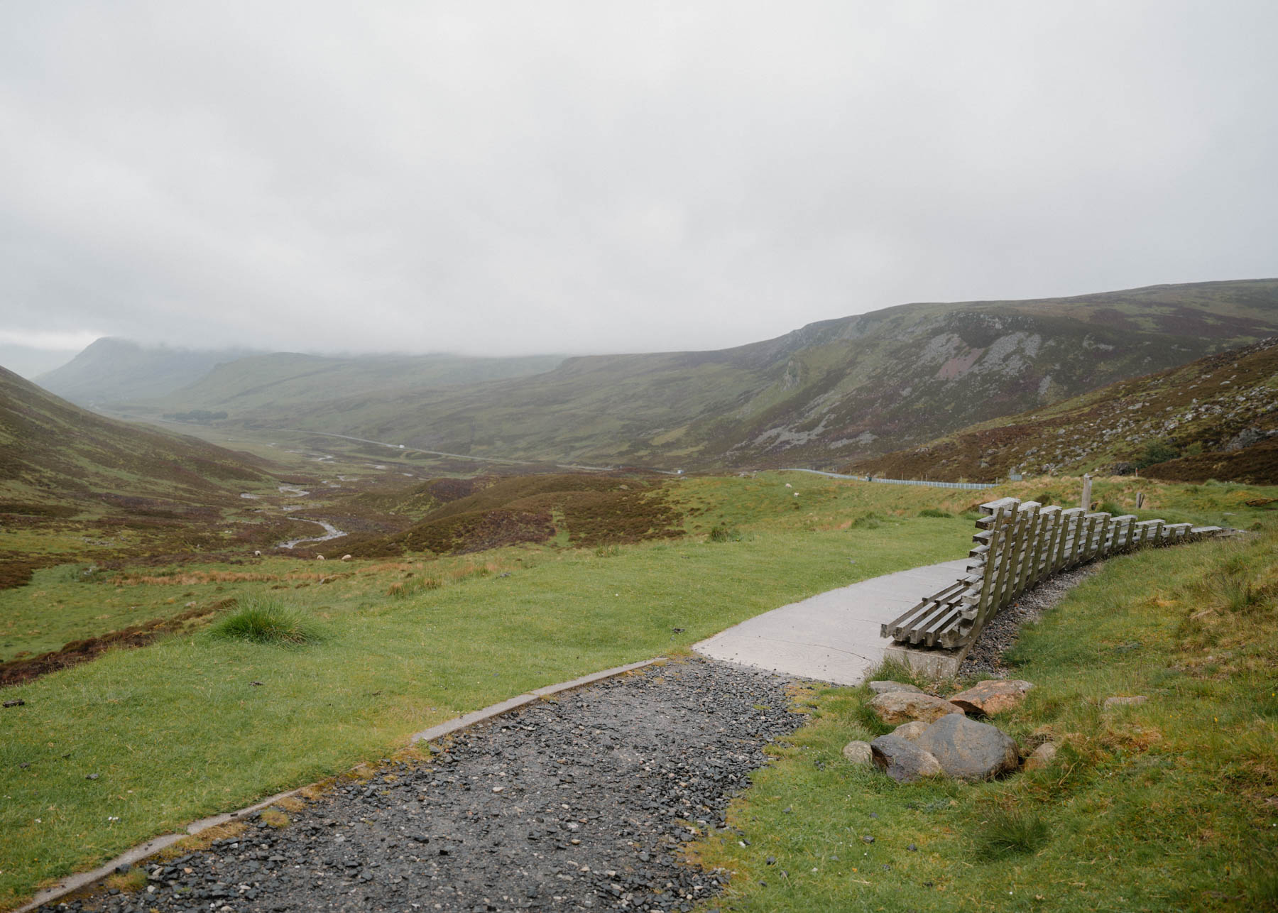
A new, straighter road was built alongside and opened in 1971, leaving the old bends to walkers and cyclists. They're still there. You can park at the viewpoint off the modern A93 and follow the original route on foot, the tarmac cracked and the rusting barriers still in place.
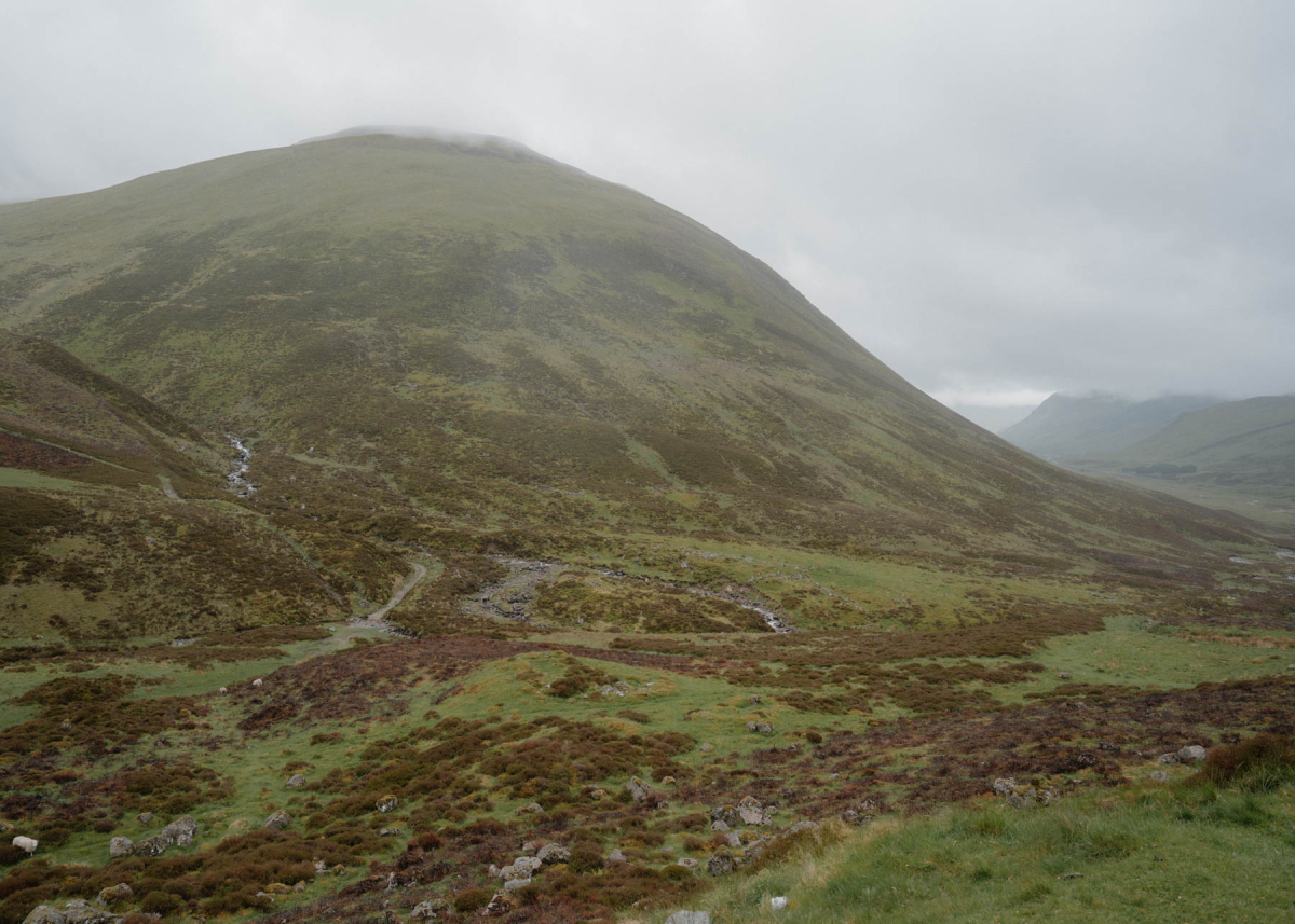
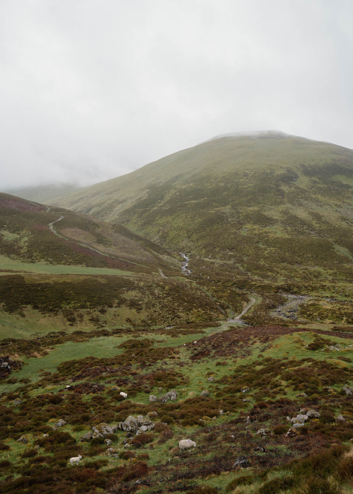
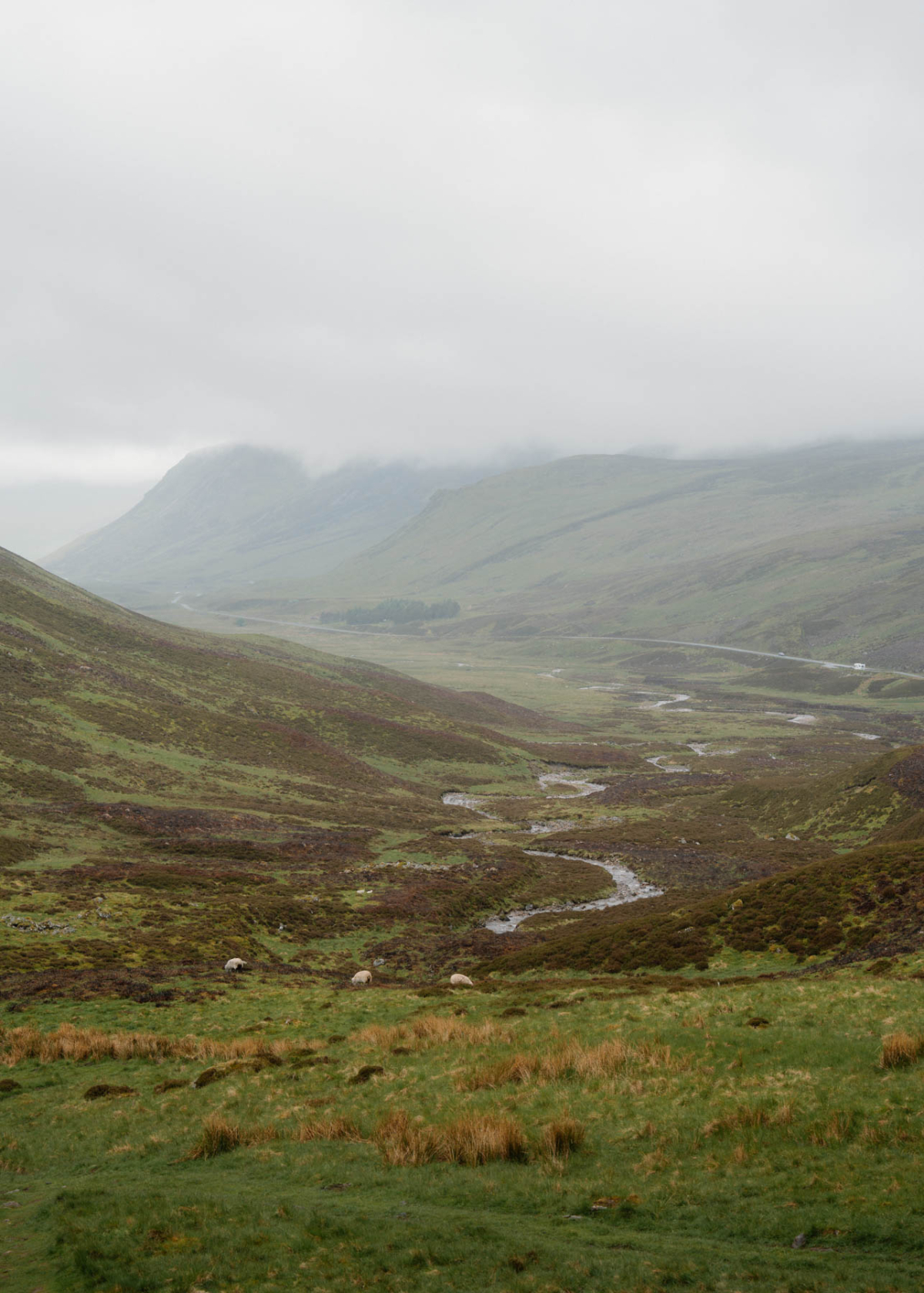
It's a good stop if you're driving the Cairnwell anyway. Pull in, stretch your legs, take in the view down Glen Beag. The pass is the highest main road in Britain, so the scenery doesn't disappoint.
History
The road over the Cairnwell is old. It started life as a military road, surveyed in 1748 and built from 1749 under Major William Caulfeild, the line running from Blairgowrie to Braemar by way of the Spittal of Glenshee. The idea was to move troops through the Highlands after the Jacobite risings. Once the soldiers had less use for it, the drovers took over, walking cattle and sheep south to market over the pass. You have to admire them for it.
The Devil's Elbow itself was the worst of it. A double hairpin a mile or so below the summit, and a real test in the early days of motoring. Just how steep is still argued over. Old postcards and the warning signs said 1 in 3. Later accounts reckon that was talked up and the true figure is nearer 1 in 6. Steep enough, either way. On Braemar Games day in the 1920s something like a thousand vehicles a day would have a go at it, and plenty didn't make it cleanly. Coaches dropped their passengers at the bottom to walk up and lighten the load. Some people had to get out and push.
Engines boiled over on the climb in summer, so the AA kept a well in a lay-by where drivers could top up their radiators. In winter the opposite problem, radiators freezing. During the war, concrete tank traps lined the Elbow, part of the defences against a feared German invasion from the north.
People had been calling for a better road for a long time. A writer in 1922 grumbled that the pass was little better than in the days of the horse and gig. A local petition in 1936 called the road a danger to motorists and pedestrians. Nothing happened for another 35 years. The new, straighter road was finally built alongside, funded by grants of more than £1.5 million, and opened on 7 October 1971. The Queen and Prince Philip had driven the old bends in their Daimler only four years before, in 1967.
The old road is still there, mostly out of sight of the modern A93. These days it's left to walkers and cyclists, and that's the way to see it, on foot or by bike rather than behind the wheel.
Location
The Devil's Elbow sits on the A93 over the Cairnwell, between the Spittal of Glenshee and Braemar. It's on the Perthshire side, a mile or so below the summit. The bend was bypassed in 1971, so you'll find it just off the modern road, with parking at the viewpoint.
What's nearby
The Elbow sits on the Cairnwell, so most of what's worth seeing is the drive itself and what's strung along it. Coming up from the south, Glenshee Café & Gift Shop at the Spittal is the obvious stop before the climb. It's on the A93, open ten till four every day, and it's more than a café. Homemade food and barista coffee, yes, but also a gift shop with Glenshee keepsakes, a farm shop for local produce, and a tourist information point if you want maps or tips. Dog-friendly, with views over the neighbouring deer farm. A good place to fuel up before the bends.
A mile or so north of the Elbow is the summit of the pass, 670 metres up, the highest main road in Britain. That's the Glenshee Ski Centre. Out of ski season the Cairnwell Chairlift runs through the summer, seven minutes up to near the top of the Cairnwell, one of three Munros on the west side and reckoned the most accessible in Scotland. Walk up and ride down, or the reverse. You can take a bike up and ride the track back too. Watch for mountain hares, ptarmigan and red deer on the tops.
North over the summit, Braemar is about nine miles down the hill. Castle, shops, the Fife Arms, and the Highland Gathering every September.
The whole run is part of the Snow Roads scenic route, so there's no shortage of places to pull in and take it in.
Where to stay nearby
You're spoilt either side of the pass. South, on the Perthshire run down to Blairgowrie, Larch House is a good shout. Three bedrooms, sleeps up to six, log burner, and the dog's welcome. A handy base if you want to drive the Cairnwell one day and have the rest of Perthshire on the doorstep.
Over the top to the north, Braemar is nine miles down the hill and has the pick of the area. The Fife Arms is the headline act. A Victorian coaching inn dating to 1856, reopened in 2019 by Iwan and Manuela Wirth of the Hauser & Wirth gallery, and now stuffed with art, an original Picasso, a Lucian Freud, even a watercolour by a young Queen Victoria. Forty-six rooms, all done differently. Not cheap, but nothing else in the Highlands is quite like it.
If you'd rather self-cater, Glen Tanar near Aboyne is further down Deeside, a 25,000-acre estate with a handful of cottages sleeping two up to eleven. And back towards Crathie, Faunoran House is a big group house a short walk from Balmoral, five en-suite bedrooms over three floors.
 Sign in with Google
 Sign in with Email