Isle of Skye, Isle of Skye, Minginish and The Cuillin Hills
Biod Ruadh and Preshal Beg


Key Information
Distance 10.5km Ascent 625mTime 4 hours
Terrain Pathless walk over tough terrain, dense heather cover, tussocky moor grass, boggy in places. Care is needed on exposed and crumbling cliff edges, especially in windy conditions. Good navigational skills are essential.
Map OS Explorer 411 Access No bus to Talisker
The Walk
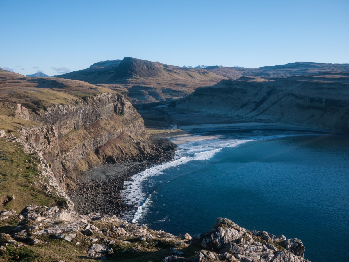
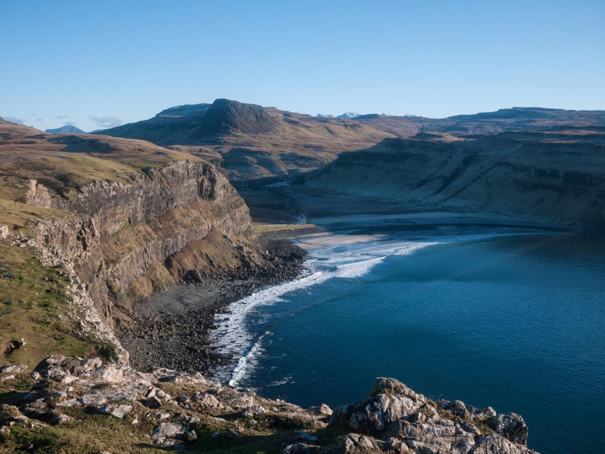
Lying at the end of the long single track road through Gleann Oraid, the small settlement of Talisker has a sublime setting, a short way inland from magnificent Talisker Bay on the west coast of the Minginish peninsula. Talisker itself comprises a farm and a manor house together with a few estate residences; the eponymous distillery is actually at Carbost on the east coast of the peninsula. Talisker Bay is fringed with a fine beach of sand and pebbles, which is best visited at low tide. The northern side of the bay is framed by sheer cliffs and a mighty waterfall, while the southern side is bounded by tiered basalt cliffs and a huge sea stack.
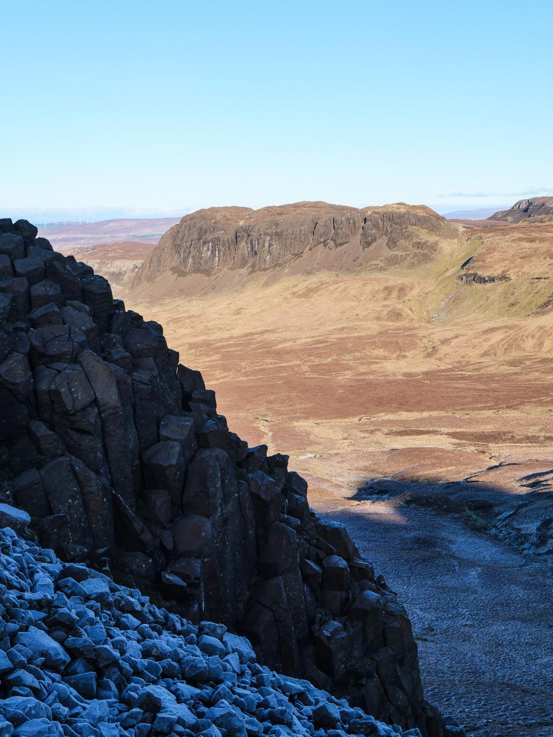
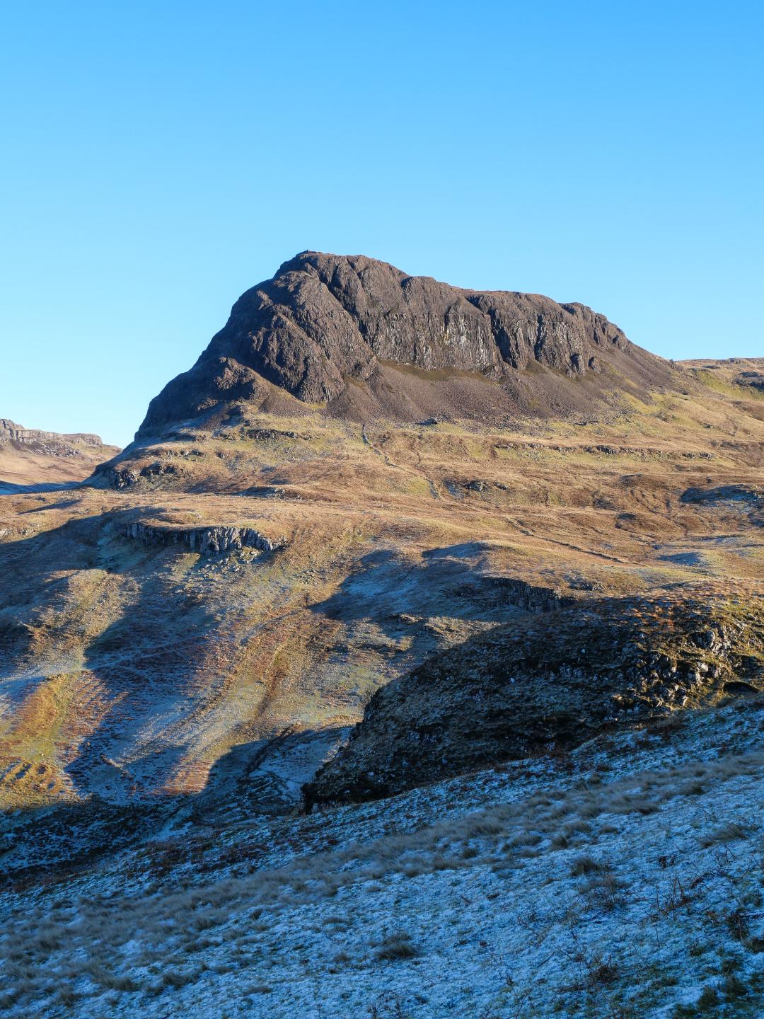
The rocky prow of Preshal More looms portentiously above Talisker; its sheer flanks present a daunting prospect although it can in fact be climbed with relative ease. However, the route described here visits Preshal More's sibling, Preshal Beg in a circular walk from Talisker, which also involves walking out along the highest cliffs of the Minginish coast, rising to 280m at mighty Biod Ruadh. The return from Preshal Beg visits the impessive ruin of Dùn Sleadale Broch.
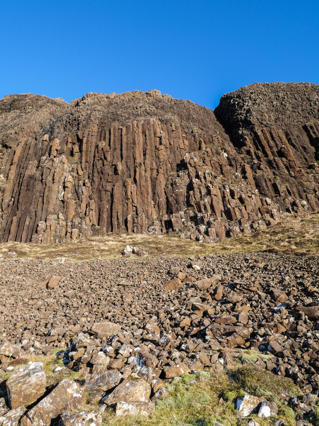
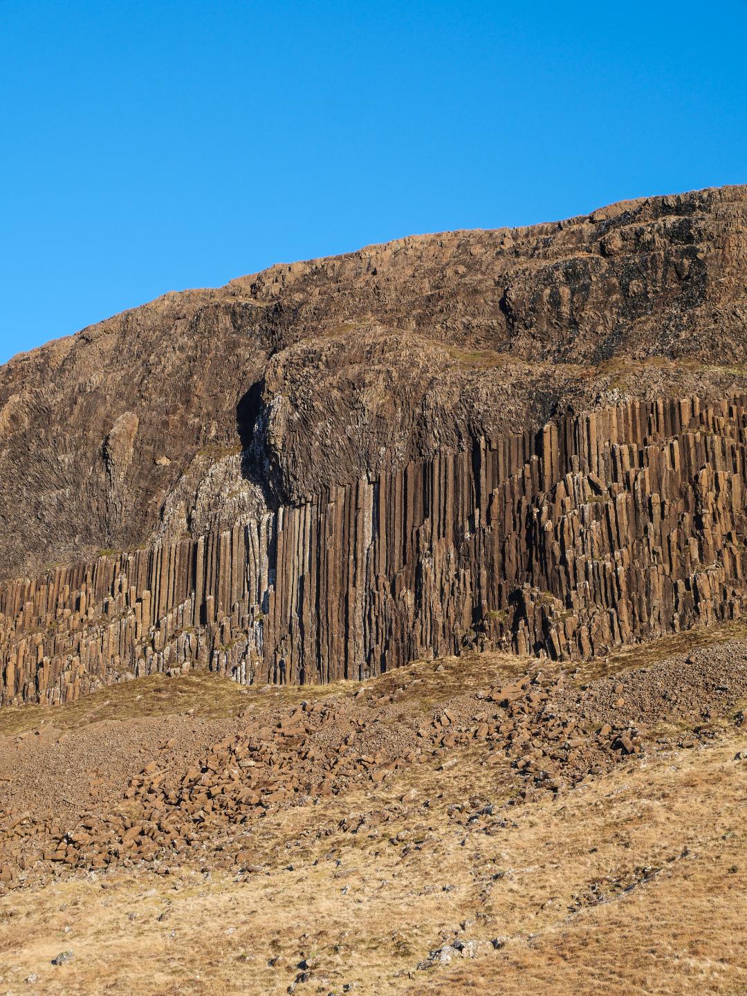
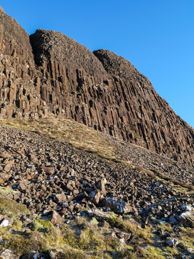
At close-quarters these unusal hills reveal their truly outstanding feature, remarkable hexagonal basalt columns, like those on the Inner Hebridean isle of Staffa and the Giant's Causeway in County Antrim, swarming high up the flanks of both hills – although Preshal Beg has the most impressive array.
Park carefully near the end of the tarmac road to Talisker, taking care not to block the turning area or any passing places – a small disused quarry on the left 300 metres before the road end is probably the best bet.


The Route
1. From the road end, fork left along the track where a sign indicates 'To The Beach'. Continue along the track, go through a gate and pass by the handsome, white-painted Talisker House. Continue along the track, cross a bridge over the Sleadale Burn and go through another gate. Looking back, the prominent dome of Preshal More dominates the horizon beyond the houses.
2. Around 750 metres along the track from the house, opposite a gate in the fence on the right, turn left to head up the very steep, grassy slopes of Leathad Beithe. Sheep paths can be used to aid a zig-zag ascent. Continue up the tiered basalt escarpment, eventually pulling yourself up over a small, rocky outcrop; as height is gained the views over Talisker Bay are tremendous.
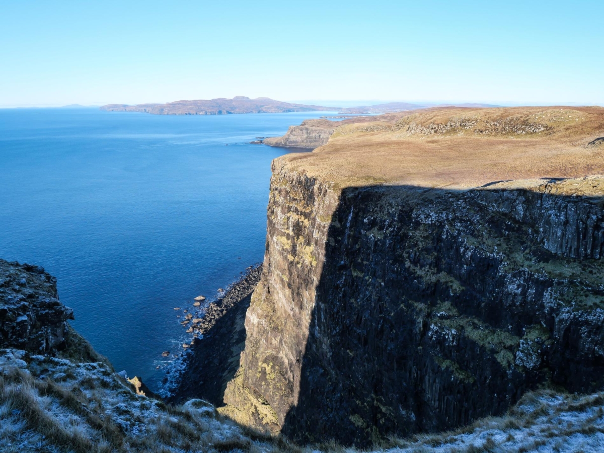
3. Once the gradient eases, bear south-west across rough moorland to reach the coastal cliffs. Continue southwards as the going improves along the grassy clifftops, which rise over Beinn na Cuithean with the mighty profile of Biod Ruadh beyond. Climb steadily along the spectacular, airy clifftops to reach Biod Ruadh – the highest point of the Minginish coastline – its sheer cliffs rising 280m from sea level. To the east the ground drops steeply down to a bealach at the head of a narrow glen, which runs northwards back towards Talisker. Rising beyond the bealach is the otherworldly summit of Preshal Beg; a wedge of scree-skirted rock, its flanks fluted with remarkable dolerite columns. Rather than descending to the bealach to approach the hill, it's worth continuing along the coast for a further 650 metres to the head of a magnificent deep inlet for the tremendous views.
4. Now head initially northwards towards the bealach to avoid boggy ground before swinging right to climb the slope to the bottom of the screes below the cliffs on Preshal Beg's south-western flank. The lower portion of the cliffs is clad with hexagonal dolerite columns, while the screes beneath are littered with collapsed columns. These striking features were formed when hot, liquid magma was forced to the surface then shrank as it cooled, cracking in regular patterns that resulted in the distinctive hexaganol jointing. The uniformity of the lava's composition and the speed of cooling are contributory factors.
Continue around the south-west flank just below the scree, cross some rocky ground at Preshal Beg's south-east corner then climb the obvious grassy slope to the col between Preshal Beg and the smaller rocky hill immediately to its east.
5. From here its an easy detour up to the summit – a rocky plateau with the summit marked by a stone pile cairn . There are expansive views west to Rùm and Canna with the Western Isles visible on a clear day. To the north across the Sleadale moors Preshal More looms imperiously over Talisker. Return to the col then bear left, trending westwards beneath the northern flank of Preshal Beg. Make for the northern side of the bealach between Preshal Beg and Biod Ruadh, losing some height to cross a narrow burn running down from the bealach.
6. Continue westwards over a low rise then turn north to follow an assortment of sheep paths and ATV tracks through a shallow valley avoiding wet ground as best you can. Hold your course and after 1km you will reach a grassy hummock topped by the tumbled stone ruins of Dùn Sleadale Broch.
7. Continue northwards for 600 metres or só to the head of a steep gorge, crossing a tumbled drystane dyke en route. Now bear right and continue initially southeastwards down the flank of the brae forming the western side of the glen through which the Sleadale Burn flows. Swing around to the north as you descend, following an old grassed-over stony track down towards a thicket of gorse. Pick up an obvious path bearing left through the gorse, cross a burn and descend to the track from Talisker where easiest. Turn right for Talisker and left for the beach.

Location
Biod Ruadh and Preshal Beg create a rugged circuit near Talisker Bay. This map marks a 10.5-kilometer path over pathless terrain, heather-covered slopes, and high cliffs. Points of interest include the hexagonal basalt columns and the remains of Dùn Sleadale Broch along the route.
 Sign in with Google
 Sign in with Email