
Westside Hikes with History – Temple, Settlement and Broch
A day by car, from Lerwick and back.
Written by Laurie Goodlad
The West Mainland is arguably the least explored of all Shetland’s regions, yet it has some of the most beautiful landscapes and walks. The area is rugged and exposed, yet gentle and rolling. It’s a place of intrigue and mystery where a significant Neolithic population lived thousands of years ago, settling the land and farming the soil.
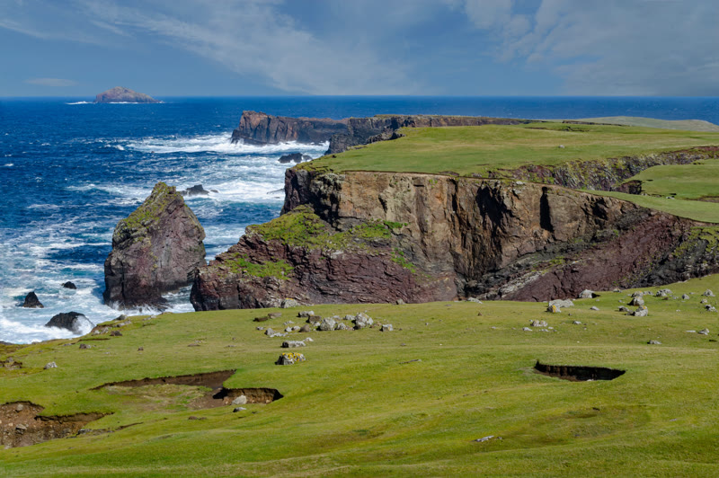
Shaped by the mighty North Atlantic and the regular winter storms that assault Shetland’s western boundary, the coastline has been moulded, altered and scarred by the sheer power of the ocean, creating some incredible coastal walks.
Inland, the gently rolling hills of the West Mainland are thronged with some of the most notable and extensive archaeological remains on the islands, dating back to the Neolithic, some 4-5,000 years ago, including the Stanydale Temple, a megalithic structure, tucked into the landscape that continues to baffle archaeologists to this day.
Referred to simply as the ‘Westside’, Shetland’s West Mainland begins as you pass over the Weisdale Hill towards Tresta and Bixter and is represented on the map as the ‘left-arm’ of the islands, bulging out from the long, narrow central spine into the North Atlantic.
Although you’re likely to want to spend more time exploring the extensive West Mainland, this one-day itinerary will give a few of the highlights and act as a springboard to explore more.
Shetland’s West Mainland is a relatively large area, encompassing the Mainland area, including the communities of Aith (Eid), Walls (Waas), Sandness and Skeld. It also includes the outlying islands of Foula, 25 miles west of Shetland, Papa Stour, a stone’s throw from Sandness across the treacherous Papa Sound, and Vaila, a small island off Walls with a population of two.
We will explore the Mainland only for this itinerary – saving the islands for another itinerary and another day!
You may wish to base yourself in the West Mainland to enjoy the walking, wildlife and varied landscapes of this corner of Shetland. The West Mainland feels quieter, and it’s less densely populated and slightly off the main tourist trails of the north and south. There are also fewer ‘attractions’ – and by attractions, I mean visitor centres and museums. You’ll find this is a place for quiet contemplation, hiking, and just enjoying the scenery.
The Taing, Reawick, sits at the head of the beautiful Reawick Beach. Listen, from your bed, as the sea gently washes over the orange sands. The Taing is a beautifully curated self-catering cottage set in the rural idyll of Shetland’s West Mainland.
Westshore is set in the middle of the West Mainland. This unique architect-designed self-catering cottage ties old and new together perfectly, while the property itself enjoys spectacular sea views.
Despite being quite a large area, the West Mainland has few eating options. Thankfully, those that are available are excellent!
The Original Cake Fridge & Tearoom – near Aith, pick up a picnic at the Cake Fridge, or sit in the cafe inside the converted traditional crofthouse.
Cafe in the Church – held in the Walls kirk every Friday, serving delicious homemade soup and sweets.
Bonhoga Cafe – be sure to check out the exhibition space in the gallery upstairs in this converted watermill.
Honesty Boxes & Cake Fridges – including the Original Cake Fridge near Aith, you’ll find several roadside honesty boxes and fridges selling cakes and bakes, farm produce and eggs. Simply make your selection and leave the correct money in the tin provided. The Mussel box selling shellfish at Tresta and the Sand Honesty Box are a few to look out for.
Shops – you may want to pick up a picnic from Eid Community Coop, Walls Shop or Bixter Shop.
Top tip: If you’re planning to visit the West Mainland on a Sunday, be sure to check the What’s On guide in the weekly Shetland Times newspaper or check roadside signs advertising Sunday Teas in any one of the local public halls. Sunday Teas are quintessentially Shetland. Basically, a team of volunteers will open the hall for an afternoon selling tea, coffee, cakes, bakes, sandwiches, soup. For a nominal fee, visitors can tuck into an all you can eat buffet-style spread with the best local home-baking and hospitality.
Planning is key to making the most of your time in the West Mainland – make sure you factor in where you’ll be stopping for lunch, or ensure you bring a picnic with you. There are some fantastic walking options in this area, and you’ll find that most of them are quiet – even at the height of the tourist season.
Top tip: If you’re setting off from Lerwick in the morning, The Peerie Shop Cafe make fantastic picnic lunches that you can pre-book and collect anytime after 8 am.
The following are a few suggestions for itineraries for your day, based on the activity level you expect and whether or not you are travelling with children.
Of the three, this is Laurie Goodlad's day of hikes with history, in her own words.
For lovers of hiking and history, the West Mainland has several sites of interest. The following itinerary includes two short walks and one longer hike, taking in some of the best of Shetland’s Neolithic and Iron Age.
The route
Before you go
Book a picnic lunch
Bring a picnic: the Bixter Shop on the A971, on the way to Stanydale, opens at 8am Monday to Saturday (7.30am on Friday); on a Sunday it opens at noon, so buy lunch in Lerwick the day before.
The day
Hikes with history
2 hr 2 min at the wheelAbout 64 miles
Stanydale Temple
An attraction
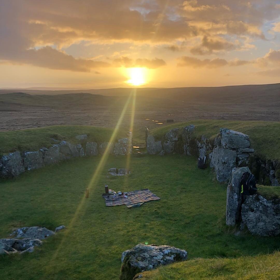
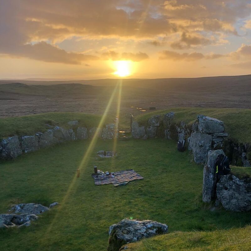
Begin the day at Stanydale Temple. To get to Stanydale, follow the A971 towards Walls, turning at the sign marked ‘Gruting/Staneydale’ just a few miles beyond Bixter. Stanydale Temple is a short walk taking visitors into the heart of Neolithic Shetland and back in time some 4,000 years. The heel-shaped megalithic structure or temple – the only one of its kind in Shetland – remains shrouded in mystery and intrigue, tucked into the empty landscape. Archaeologists are still unsure what the purpose of this structure was. The heel-shaped façade is similar to Islesburgh (Delting) and Punds Water (Northmavine), but Stanydale is far larger than anything else in Shetland, and its purpose remains a mystery. The fascinating thing about Stanydale is its connection to equinoxes and the path of the sun as it moves through the sky. On the approaches to Stanydale, there are two standing stones, demarcating a passage of sorts, where the sun’s rays will pass through and into the back of the temple at sunrise on the equinox. This is something that I was keen to experience, so I went on a showery March morning to meet the dawn of the equinox. It was an almost otherworldly experience; that moment as dawn arrives and the world stops, where just for a moment everything falls silent. The birds stop singing; the sheep grow quiet, the wind lulls and life is suspended as that first ray of sunlight makes contact with the earth. March brings with it an urgency, an expectation of spring. The light is returning – a welcome sight after a long winter at 60 degrees north and the earth is awakening from its winter slumber. There’s a balance in these days of equal light and dark, but there’s also a sense of polarisation. It feels as if we are hanging on a pendulum in free-fall; suspended as the world is about to be set into motion, like a rollercoaster just before the drop. Our ancestors were carefully tuned into the cycles of the earth and land; carefully labouring, tilling and ploughing. Sowing the seeds and watching them grow. One eye skyward eyeing the weather, the other embedded in the soil willing growth. Hands ingrained with dirt. Sweat exchanged for life. Just as our bodies are governed by cycles, so too is the earth and the way we interact with it. Farmers are still tuned into this cyclical way of life, but for the vast majority of us, it bears little relevance to our day-to-day lives. It’s difficult not to wonder at Stanydale's sense of place in our history. Was there a spiritual significance to its location? Was it a sacred place of worship? Did our pagan ancestors dance around bonfires on these special calendar occasions as folklore would lead us to believe or did it have a much more practical, utilitarian purpose? These are questions we will never answer, and perhaps that is its greatest lure. The catalyst which leads people to places like this is the questions it prompts us to ask, safe in the knowledge that these age-old questions will remain unanswered for eternity. And in a time of technology, and information at the click of a mouse, this is a novel and comforting reality.
About 10 min by car
Scord of Brouster
After wondering at Stanydale’s secrets, head to the Scord of Brouster, following the road signs towards Bridge of Walls for a few miles, at the Bridge of Walls, turn right towards Sandness for about a quarter of a mile. The site is marked with a simple brown sign and arrow pointing towards the hill, and, like Stanydale, cars pull over and park in the layby. The Scord of Brouster, in many ways, is an underwhelming site until you consider its cultural significance. This is the oldest known Neolithic settlement in Shetland, dating to around 2,200 BC and in continual occupation for several generations. Interpretation panels on the site explain the structures and land use patterns in the area. Lunch: A picnic lunch is likely to be the best idea for today; otherwise, it’s a case of backtracking to Aith and The Original Cake Fridge & Tearoom. Alternatively, Brouster is only a mile or so from Walls and, if it’s Friday, the Cafe in the Church will be serving soup and sweets.
About 18 min by car
Culswick Broch
An attraction
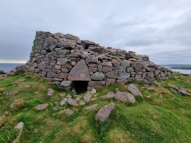
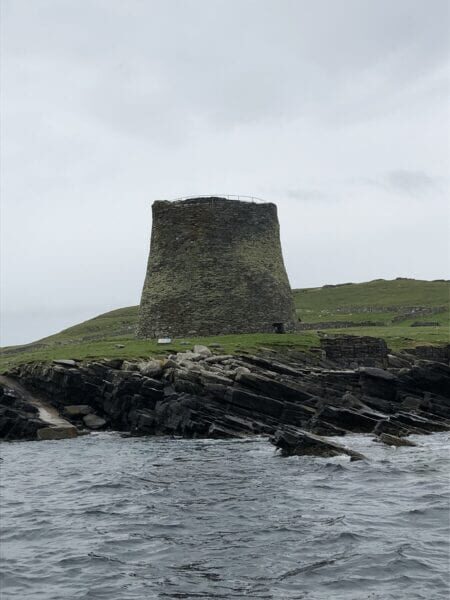
In the afternoon, you’ll need to lace up the hiking boots for a slightly longer walk to the Culswick Broch. This is a three-mile walk. Head towards Culswick, following the same route along the single-carriageway roads that you took from Stanydale. Rather than turning towards Stanydale (marked as ‘Hulmalees’), continue towards ‘Selivoe and Hestinseter’. Follow this road for several miles before turning towards Culswick (B9071). Follow this road, forking to the right towards ‘Culswick’ before parking at the stone building with a red British phone box outside it. The track passes the small Culswick Chapel – this tiny Methodist kirk still has services (although not weekly), and the annual carol evening is a firm favourite for people throughout Shetland who want to soak up the atmosphere of this peerie [small] place of love and worship. At the end of the track, the imposing broch stands high on the hill with commanding views out to sea. The broch, constructed from red granite, is an excellent example of a 2,000-year-old Iron Age broch. Allow an hour each way with an additional hour for exploring the ruined houses of Sotersta, a 19th-century township, as well as the broch and spectacular coastline. The valley of Culswick itself is dramatic and lush, forking into two with a bog in the centre, separating the east and west side – at the head of the valley, a storm beach now blocks the sea from entering the sheltered confines, or basin, into what would have been a sea loch. Top tip: this is also a fantastic track for mountain bikes.
If it rains
All three sites are open ground, and the Culswick track is very wet at its lowest point, so in heavy rain or low cloud keep to Stanydale and the Scord of Brouster and leave Culswick for a dry day. The Shetland Museum in Lerwick is free and indoors, with Pictish and Viking finds, and is usually open in summer from noon to 5pm on Monday and Sunday and from 10am to 5pm from Tuesday to Saturday.
Make it a weekend
More days out in Shetland.
More days by Laurie
Laurie has written these too.
Photograph by MRH via Google