
Shetland’s North Mainland – Ollaberry, Eshaness and the Drongs
A day by car, from Lerwick and back.
Written by Laurie Goodlad
Shetland’s North Mainland is alluring in its beauty and can appear both stark and awe-inspiring in the same instance. With harsh and dramatic landscapes that are breathtaking in their presence, this area continues to draw in hikers, explorers and those who want to get into the wild and discover the landscape and wildlife in this fascinating part of Shetland.
The North Mainland stretches from Mavis Grind – just beyond the town of Brae – north to the most northerly point of Mainland Shetland, Fethaland, east to the picturesque village of Ollaberry with its lush green pastures, and west to the dramatic cliffs and rugged beauty of Eshaness and the village of Hillswick.
The North Mainland – or Northmavine – begins at Mavis Grind, where a large metal sign announces a “Welcome to Northmavine” to visitors. Northmavine begins at Mavis Grind, a narrow juncture point where the North Sea and North Atlantic almost meet. This narrow point almost separates Northmavine from the rest of Mainland Shetland.
In many ways, this area feels ‘apart’ from the rest of the Mainland. There’s a real sense of community in Northmavine, and those who live there are proud to be ‘fae nort’. Traditional culture is strong, and there are still rich pockets of dialect speakers who proudly talk with a Shetland accent. It has an ‘island’ feel despite being connected to Mainland Shetland.
The North Mainland is probably best known for its dramatic northwest corner, around Eshaness. The name, Eshaness, gives us a clue about what might be discovered here. Translating from Old Norse, Eshaness means ‘the ashy headland’. This area of impressive lava formations and sheer ash-black cliffs represent the best section through the flank of a volcano found anywhere in the UK.
It’s also dominated by Shetland’s highest hill, Ronas Hill, an extraordinary batholith that protrudes from the landscape and is visible from almost everywhere in Shetland.
For those seeking a little more adventure and who want to get off the beaten track, the North Mainland is the place for you.
Although you’re likely to want to spend more time exploring the North Mainland, these suggestions will give a few of the highlights and act as a springboard to explore more.
Explore Shetland’s Geopark!
This day trip explores some of the fantastic places that make up Shetland’s Geopark, but these areas are much more than just ‘geological sites’, so don’t let the title put you off! These are some of the most outstandingly beautiful and photogenic places in Shetland.
For some background, Shetland was awarded Unesco Geopark status in 2009 for its outstanding landscapes and internationally important rocks. For its size, Shetland has an incredible array of geology which give rise to the varied terrain and the island’s overall charm and allure.
The route
Before you go
Book a table for dinner at Busta House, near Brae, on 01806 522506: the hotel serves non-residents dinner only, every day from 5.30pm to 8pm, with last orders at 7.45pm.
The day
North Mainland
2 hr 59 min at the wheelAbout 91 miles
Mavis Grind
An attraction
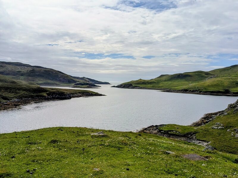
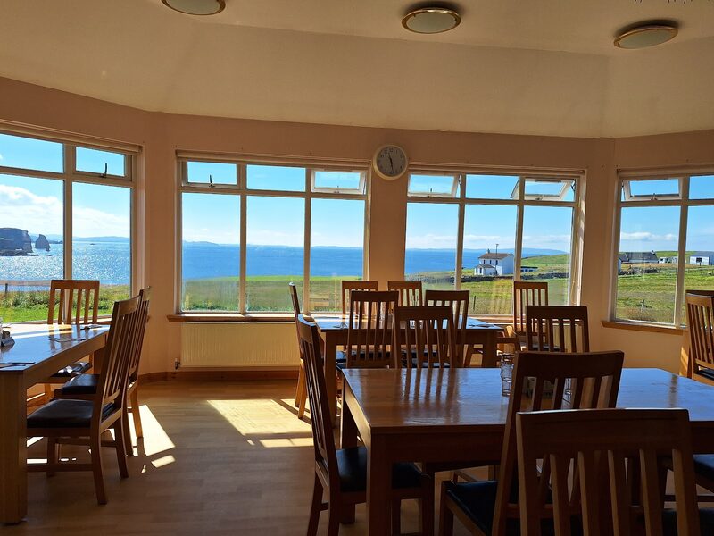
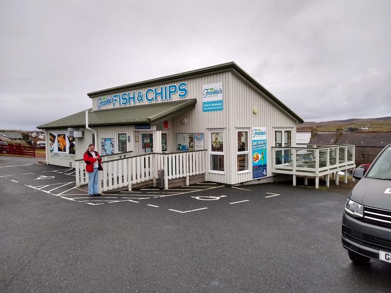
Top tip: Time your day around food; stop for coffee in Busta’s Longroom before continuing north, where you can have lunch and make the most of the stunning views at the Braewick Cafe. Book a table at the St Magnus Bay Hotel for dinner or head back to Brae for a bar supper at Busta or fish and chips at Frankies. Start the day at Mavis Grind, the gateway to Northmavine, where it’s said you can throw a stone between the North Sea and the North Atlantic. This narrow point of Mainland Shetland has almost split the island in half – almost creating another island in the north. This is a spot steeped in lore; it’s where the Vikings hauled longships overland to save lengthy – and dangerous – crossings around the south or north of Shetland. This practice continued by fishermen right up until the 1950s. It’s also an area where you can see remnants of wartime Shetland. A tank trap on the western side was placed here during the Second World War as a defence for the strategically important Sullom Voe on the other side. These concrete pyramids cover the beach and act as a reminder of Shetland’s important role during the war. This is also a great place to get to know the Geopark. A Geo Wall sculpture made up of all the rock types shows the diversity of the area’s geology and acts as a springboard for understanding Shetland’s dramatic north.
About 19 min by car
Ollaberry – Walls Boundary Fault
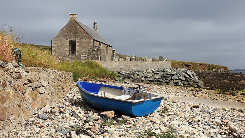
Continue north for 10 miles along the A970 and B9079 to Ollaberry. Ollaberry appears like a green jewel amid the harsh landscape that surrounds it. It’s a beautiful village with a real community feel. Stop at the shop just before the village and pick up a little picnic snack before following the B9079 through Ollaberry, where you can park at the church behind the wooden council housing beside the shore. To the left of the kirkyard, a gate leads to grazing fields. Head north towards the Back of Ollaberry and Back Sand, where the Walls Boundary Fault sits. It is possible to scramble down to the beach to view the fault from the beach. This is part of the Great Glen Fault – a series of splits in the Earth’s crust between the Great Glen of Scotland and Shetland. One side of the fault is a granite wall, and on the other side is schist. This is the best example of a shear fault in Britain, and the crumpled folds of schist on the western side of the fault are a testament to the powerful forces that shaped them.
About 21 min by car
Braewick Café
A café
From Ollaberry, it’s time for lunch at Hillswick or Braewick before heading on towards Eshaness.
About 6 min by car
Eshaness
An attraction
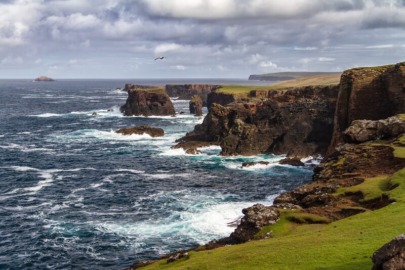
Eshaness is an exposed peninsula in the northwest Shetland Mainland, about an hour’s drive from Lerwick. Head north on the A970 until the double road ends and follow the signs for Eshaness. As you arrive at the designated car park, the first thing that you see is the impressive Stevenson-built lighthouse. This was the last lighthouse in Shetland, built by the famous Stevenson family and completed in 1929. The light is now automated (1974), and the lightkeeper’s buildings are now used as holiday lets – although they require some modernisation, and there are better places to stay in the area. The area around Eshaness is geologically fascinating. This rugged and sea-ravaged peninsula was formed about 360 million years ago when Shetland lay close to the equator. The cliffs show a series of lava flows dating back millions of years to a landscape of volcanoes, fire and lava. The Eshaness Circular walk is well advertised on an interpretation panel at the car park. Highlights of the walk include the Kirn o’ Slettans – a blowhole that plunges vertically into the sea below. Thought to have been a side vent/cone in what was the Eshaness volcano. Other highlights are the Hols of Scradda – a collapsed sea cave that has created a vast gloup inland from the sea – and Da Grind o’ Da Navir – an impressive natural amphitheatre with storm-thrown boulders strewn across the surrounding landscape. Archaeological highlights include the ruinous Broch of Houlland found on the circular walk. From Eshaness, the small island, Muckle Ossa, the solidified lava vent channel that would have fed the volcano’s main vent is visible, and, on a clear day, the offshore Clair oil field 75km (47 miles) west of Shetland can be seen on the horizon. Calder’s Geo is the first part of the coastline that you reach – this is where most of the iconic photos of Eshaness are taken. A cave at Calder’s Geo is believed to be Britain’s largest sea cave. A recent scientific study of its inner chambers found that the actual dimensions of the cave are greater than previously thought, 60ft tall and spanning a floor area of 5.600 square metres. This makes it one-and-a-half times bigger than the cave at Cheddar Gorge in Somerset. To make the most of this fascinating area, allow three hours.
About 3 min by car
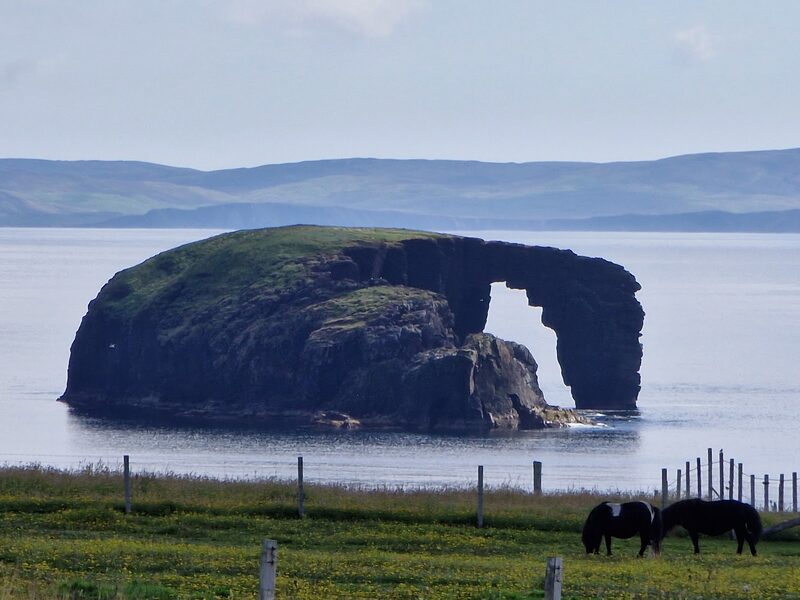
Stenness & Dore Holm
Top tip: make some photo-stops There are some pretty incredible photo opportunities around this area, including: The Dore Holm – this offshore natural arch appears like a horse taking a drink and is best seen from the road just before the final turn towards the Eshaness Lighthouse or, on foot, park at Stenness and follow the coast south until the Dore Holm comes into view.
About 5 min by car
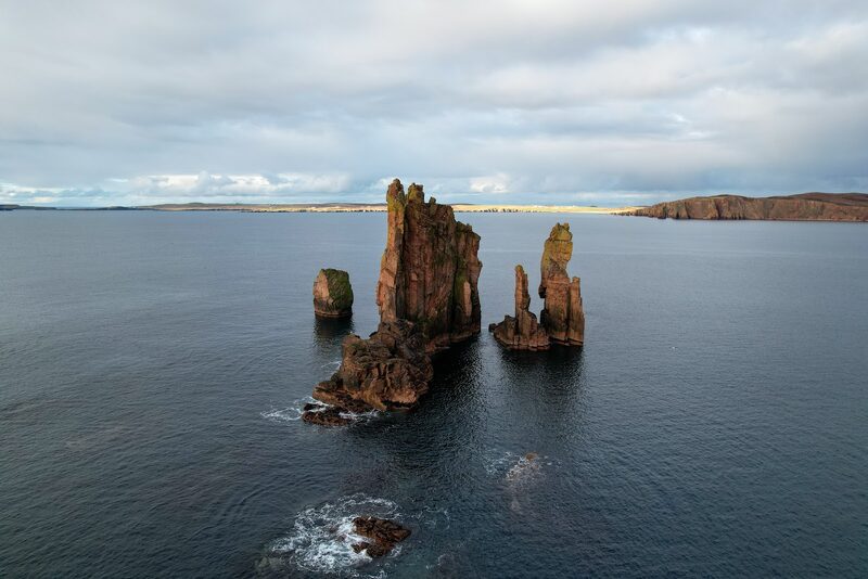
The Drongs
The Drongs – the Drongs are offshore sea stacks that stand like teeth off the west side of the Ness of Hillswick. There are several laybys that you can photograph these from, or park at Braewick Cafe, which has the best views of the stacks!
About 13 min by car
Heylor
Heylor – Follow the road signs from Urafirth to Heylor. Heylor sits on the water’s edge at Ronas Voe with uninterrupted views across to the dominating Ronas Hill. This former fishing station has remnants of old buildings and the original pier that the shifting beach has almost swallowed up. Magnus Bain’s House – for any Shetland TV series fans, the house that sits on the road to Eshaness overlooking the beach at Sandwick and across to the Ness of Hillswick was used as a filming location in Series One and is incredibly Instagrammable in its rugged beauty.
If it rains
Most of this day is out in the open. The cliffs at Eshaness and Stenness are no place to be in fog, heavy rain or a gale: look from the car park and keep well back from the edge. Under a roof are the Braewick Café, open from Wednesday to Sunday, 10am to 4pm, and the Tangwick Haa Museum, 6 minutes from the Eshaness car park. The museum opens every day from 11am to 5pm, mid-April to the end of September (the 2026 dates: check its website for 2027).
Worth a detour
- Tangwick Haa Museum
Tangwick Haa Museum – Tangwick Haa Museum in Eshaness is a former Laird’s House – known as a Haa – used as a community museum. The museum has excellent local history displays and a fantastic gift shop stocking local gifts and knitwear from local crafters, artists and knitters.
- Hillswick Wildlife Sanctuary
Hillswick Wildlife Sanctuary – tucked away down by the sea in Hillswick is the Wildlife Sanctuary which has been rehabilitating otters and seals for over 30 years. Jan and Pete welcome guests by appointment. It offers a rare opportunity to view seals in outdoor pools and learn more about the rehabilitation process and environmental problems facing the island’s marine wildlife.
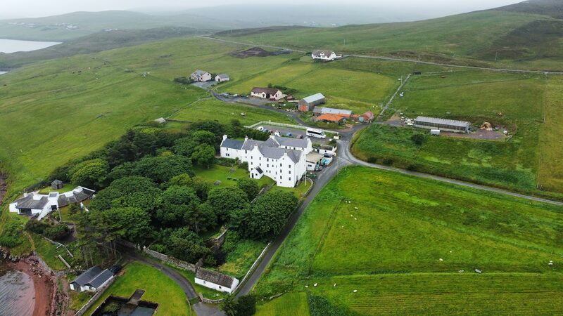
Photographs by Barbara Bowen, Sandy Matthew, Gill P, Jaap Fijma, Roger Unwin and Blake Davies via Google