Walk the Edge of Skye on This 9-Mile Route Through Castles and Crofts

Written by Jack Cairney
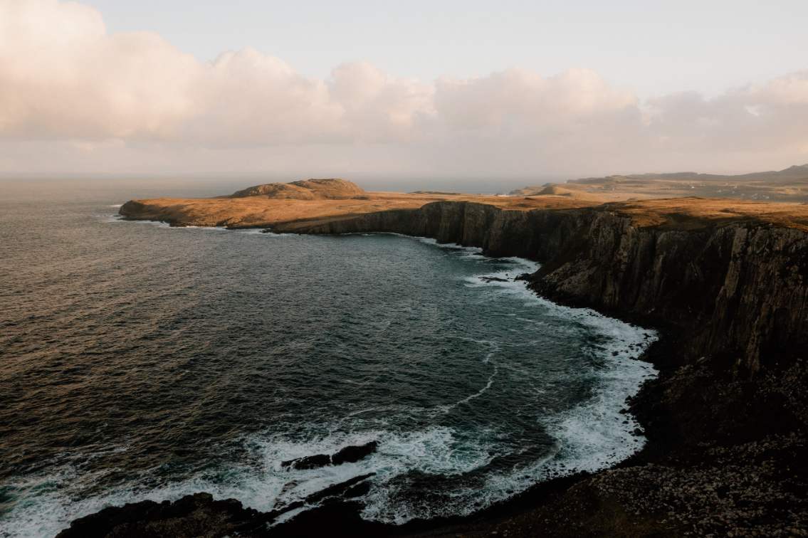
There’s a northern edge to Skye where the map thins and the crowds fall away. This 9-mile stretch near the tip of the Trotternish Peninsula doesn’t announce itself loudly. It isn’t packed with cafés or coach parks, and the route lacks the drama of the Cuillin or the draw of Fairy Pools. But something else lingers here. A kind of spaciousness. A stronger sense of place.
This itinerary follows a rough arc from the crofting settlements around Kilmuir out toward Duntulm and on to Rubha Hunish, the northernmost point of the island. The ground is shaped by weather and time—stone walls lean into the wind, cattle paths twist through grass softened by sea air, and the road itself stays narrow and close to the coast. The scale feels more human. Sites aren’t far apart, and there’s no need to rush between them.
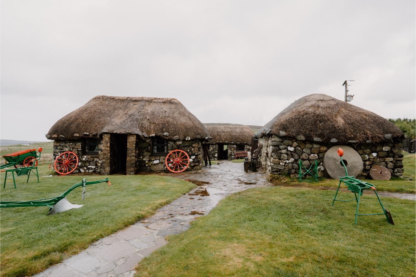
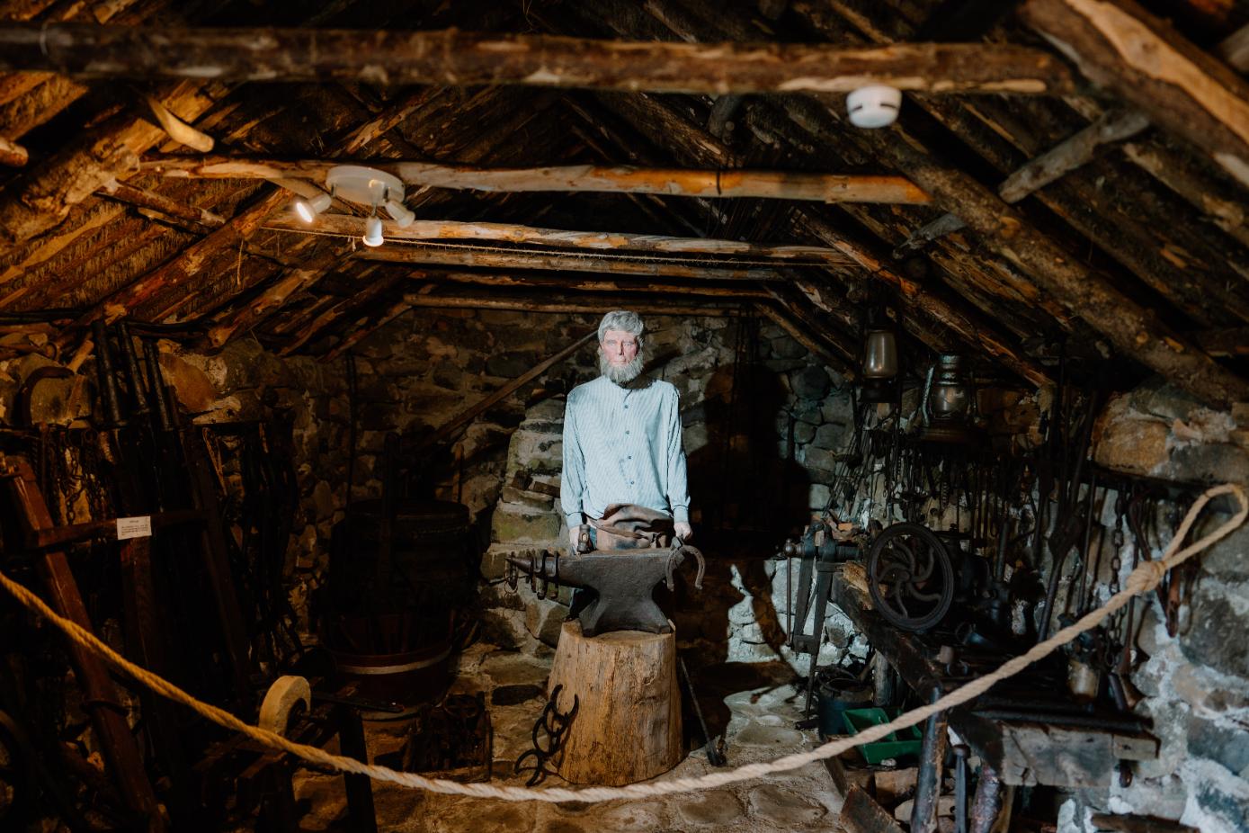
You’ll begin with the past made tangible—thatch, wool, old tools, and photographs at the Museum of Island Life. Then just up the hill, Flora MacDonald’s grave. She’s the woman who smuggled Bonnie Prince Charlie across the sea, her story long folded into the romance of Jacobite myth but rooted here in the physical ground of Skye. A few miles on, Kilvaxter Souterrain sinks you further back, into Iron Age hands and hollowed earth. The entrance feels casual—a farm gate, a short path—and then suddenly you’re underground, surrounded by dry stone and cold air.
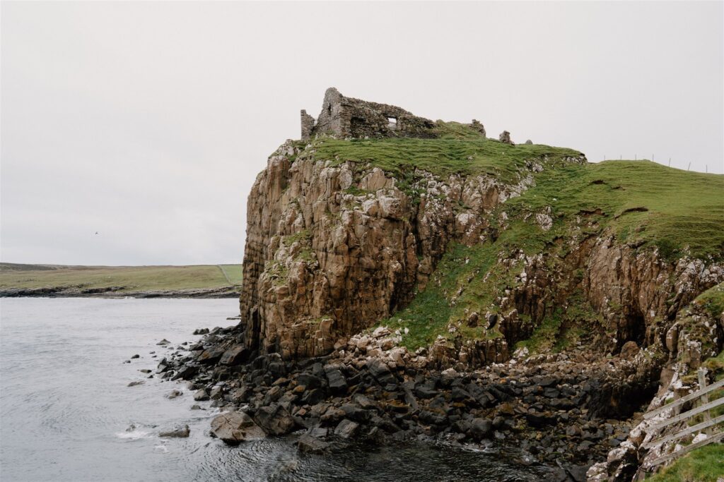
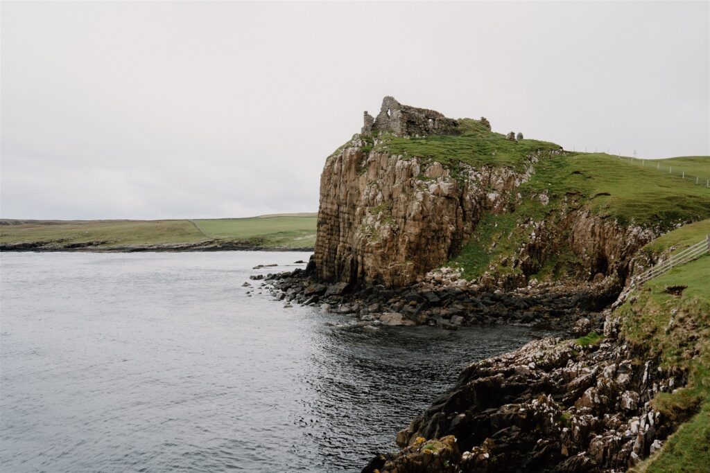
From there, Duntulm. The ruins of the MacDonald stronghold perch on a headland that drops steeply into the sea. There’s little signage, just stone and sea and wind. It’s stark, but never bleak.
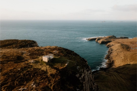
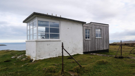
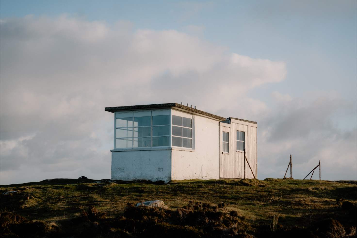
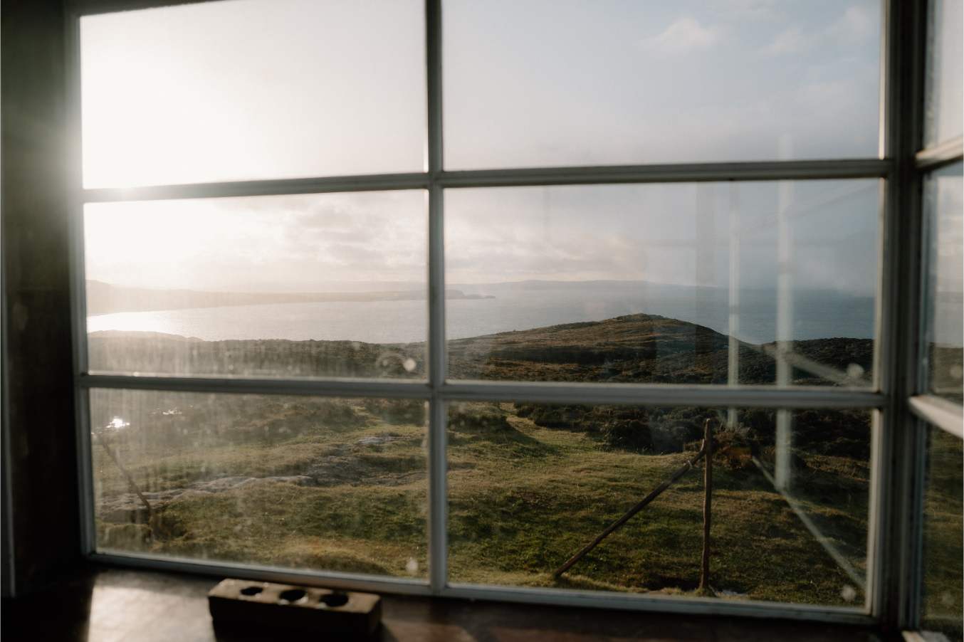
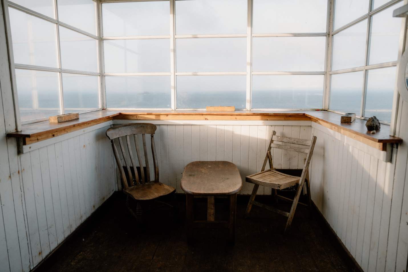
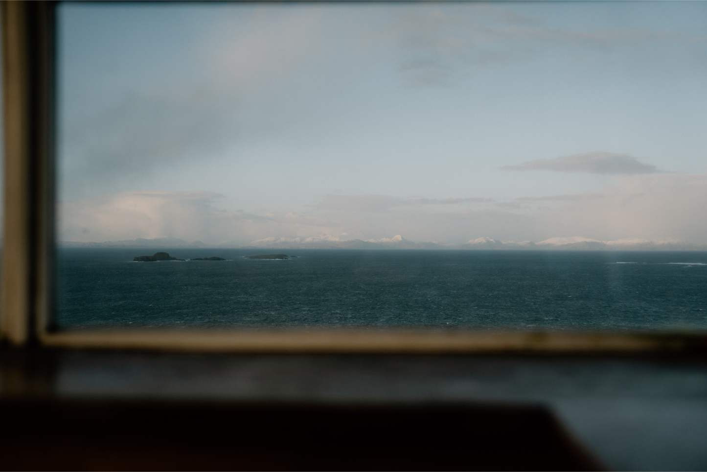
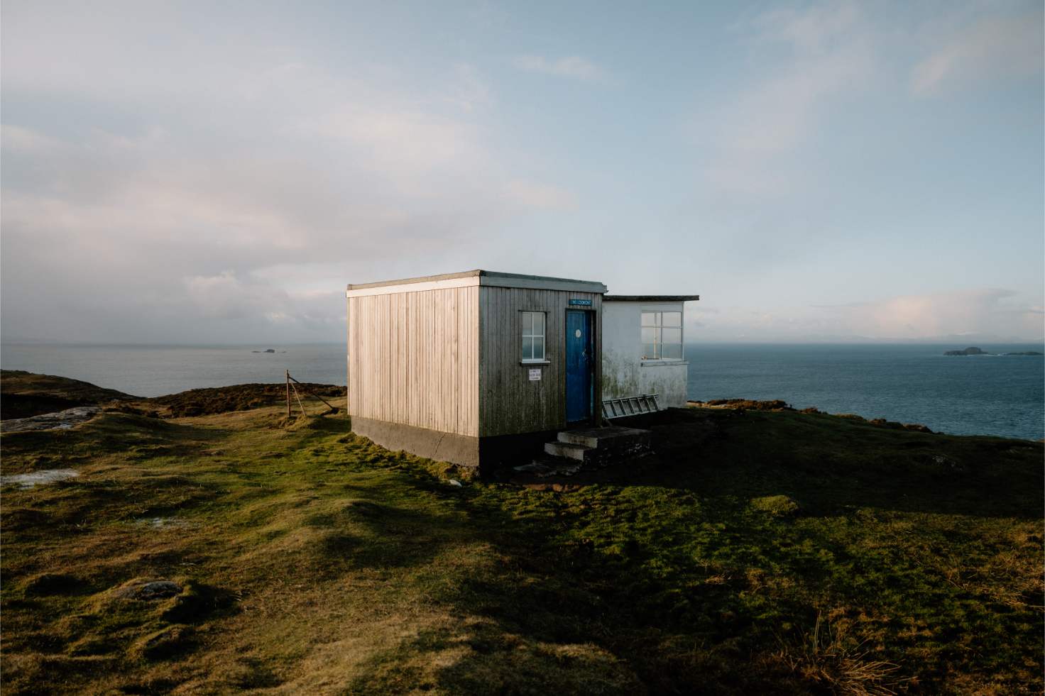
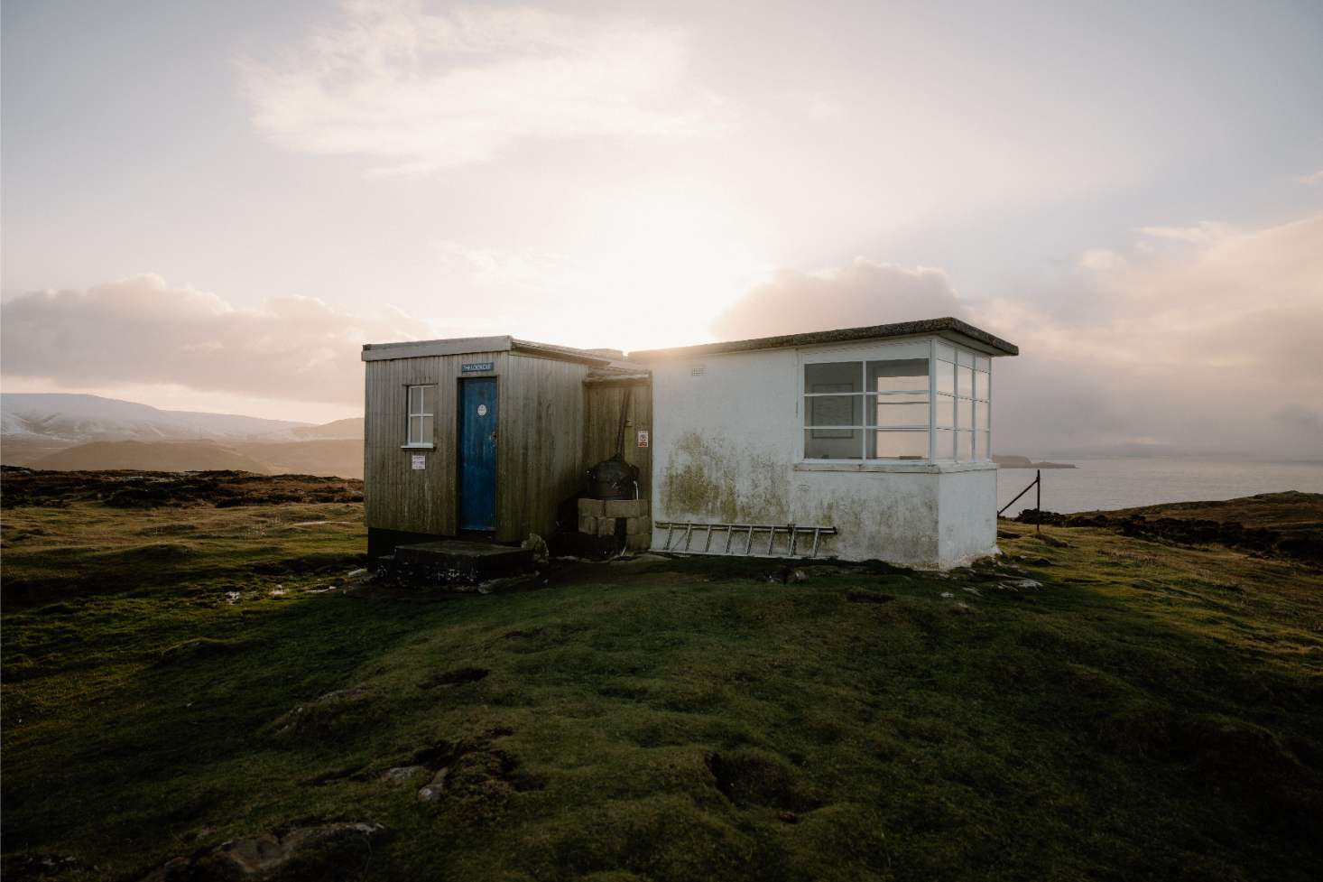
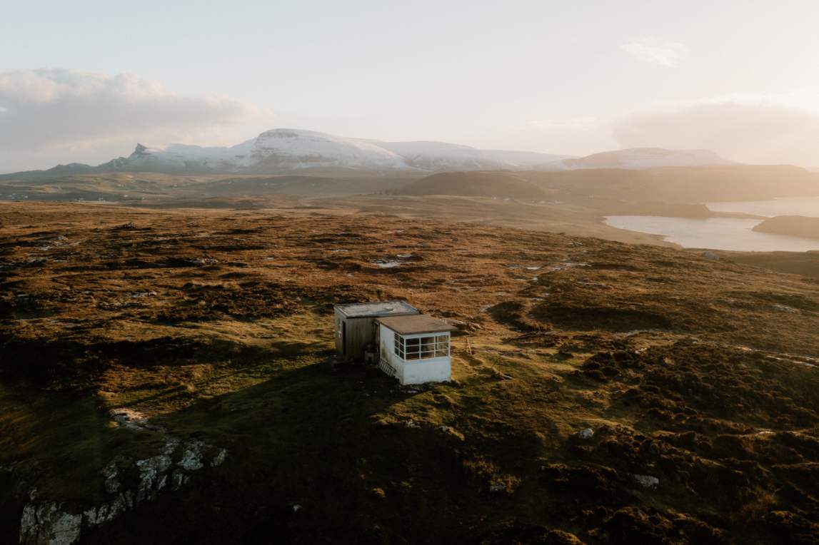
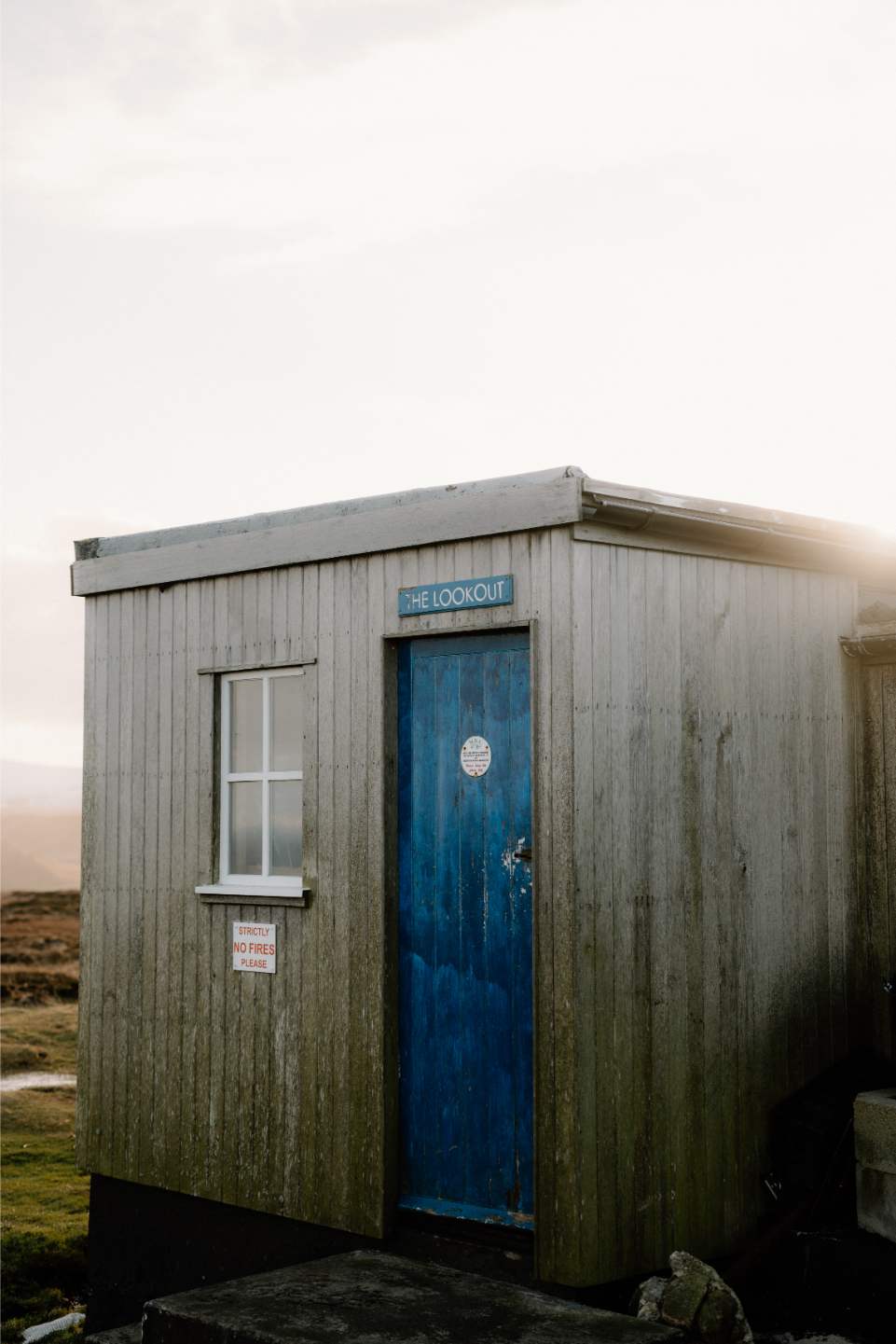
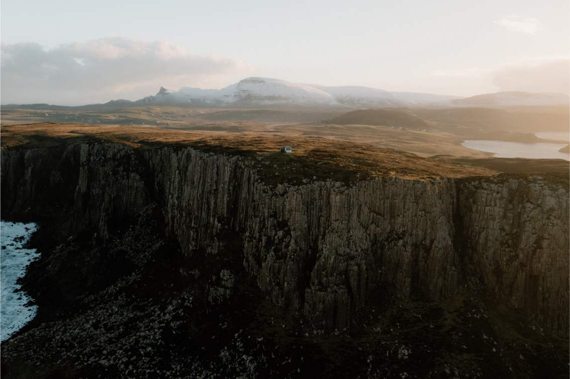
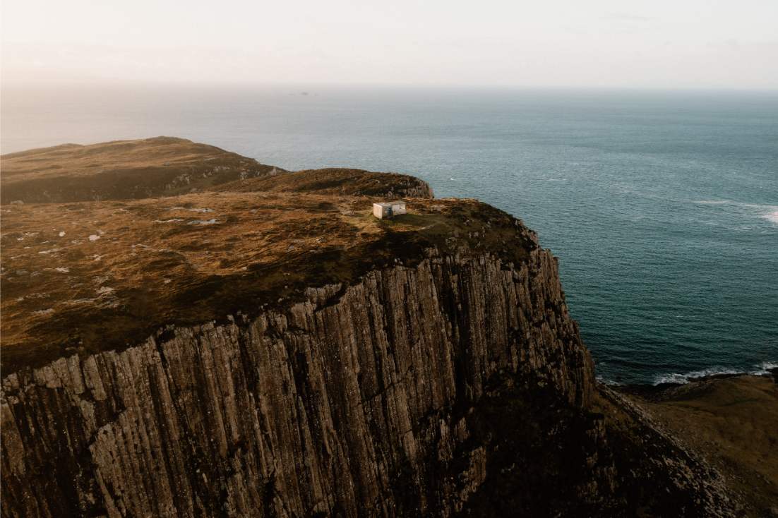
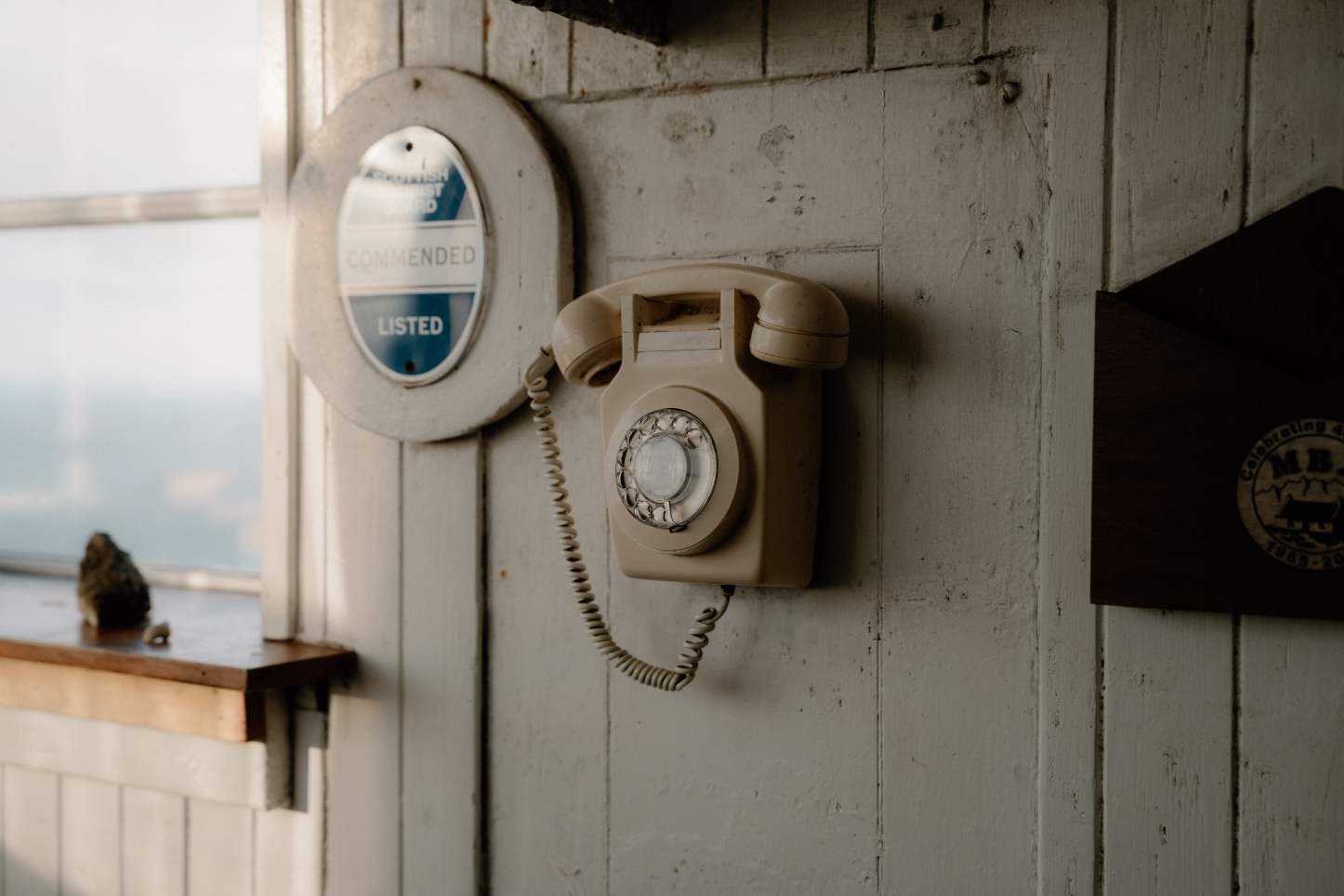
The final stop takes a little more effort. A short drive north leads to a small car park above Rubha Hunish. From here, a 2.25-mile round-trip walk (around 45 minutes each way) takes you out along a grassy path to the Lookout Bothy, perched on the very tip of the island. The trail is manageable for most, though uneven in parts and exposed to the elements. It’s not technical, but best done in boots—and in good weather. The bothy itself is simple, wooden, with panoramic windows looking across the Minch to the Outer Hebrides. No ticket, no barriers, just the sea and a quiet place to sit with it.
This isn’t about ticking off sights. It’s about walking—or slowly driving—through a pocket of the island that still feels held together by weather, story, and stone. It ends not with a grand finale, but with a view that stretches far beyond Skye.
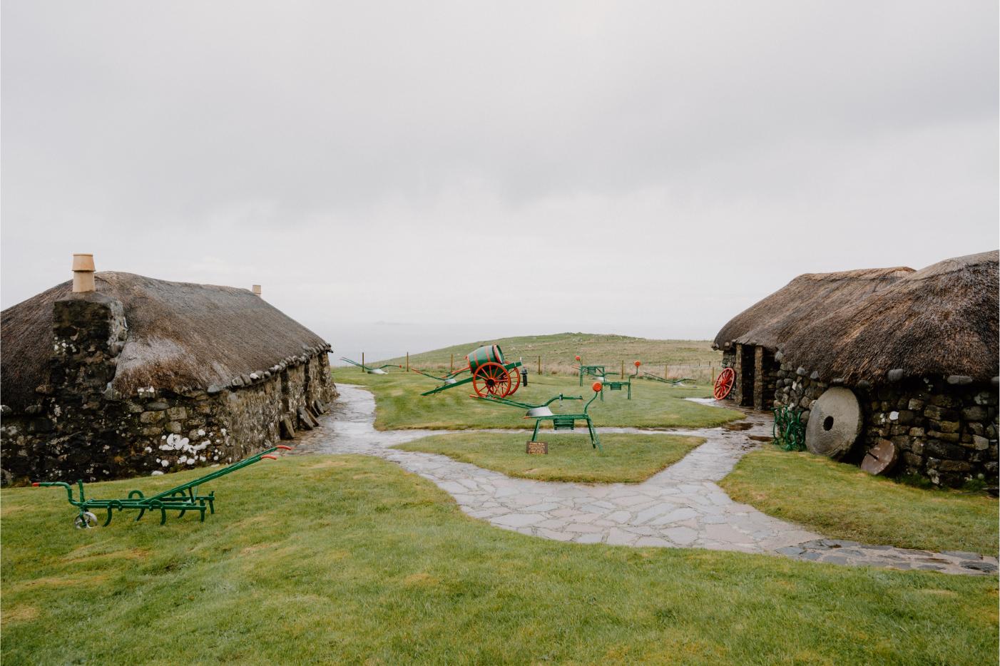
Skye Museum of Island Life
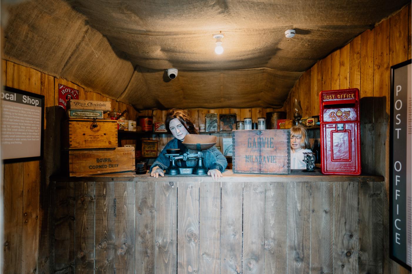
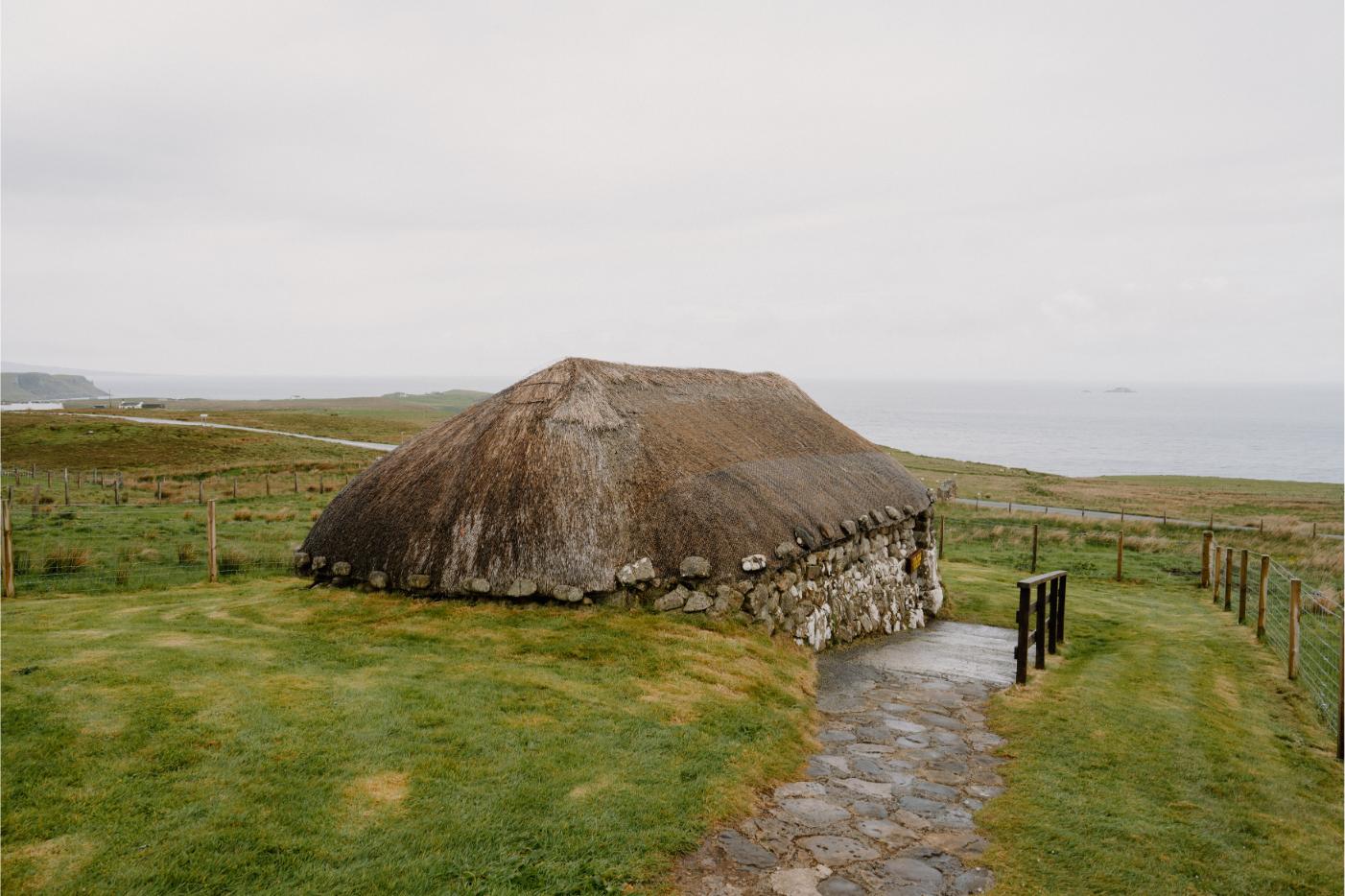
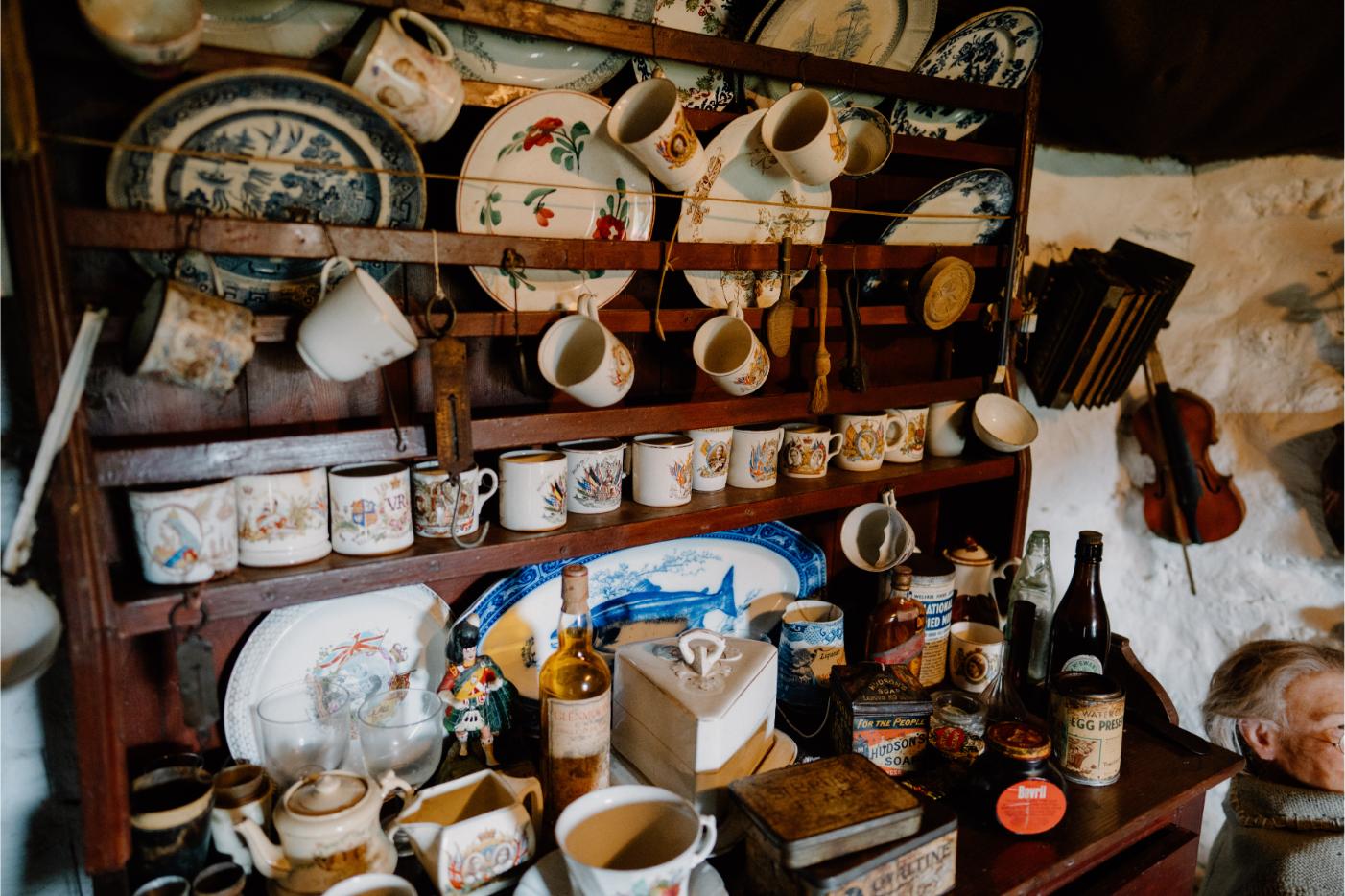
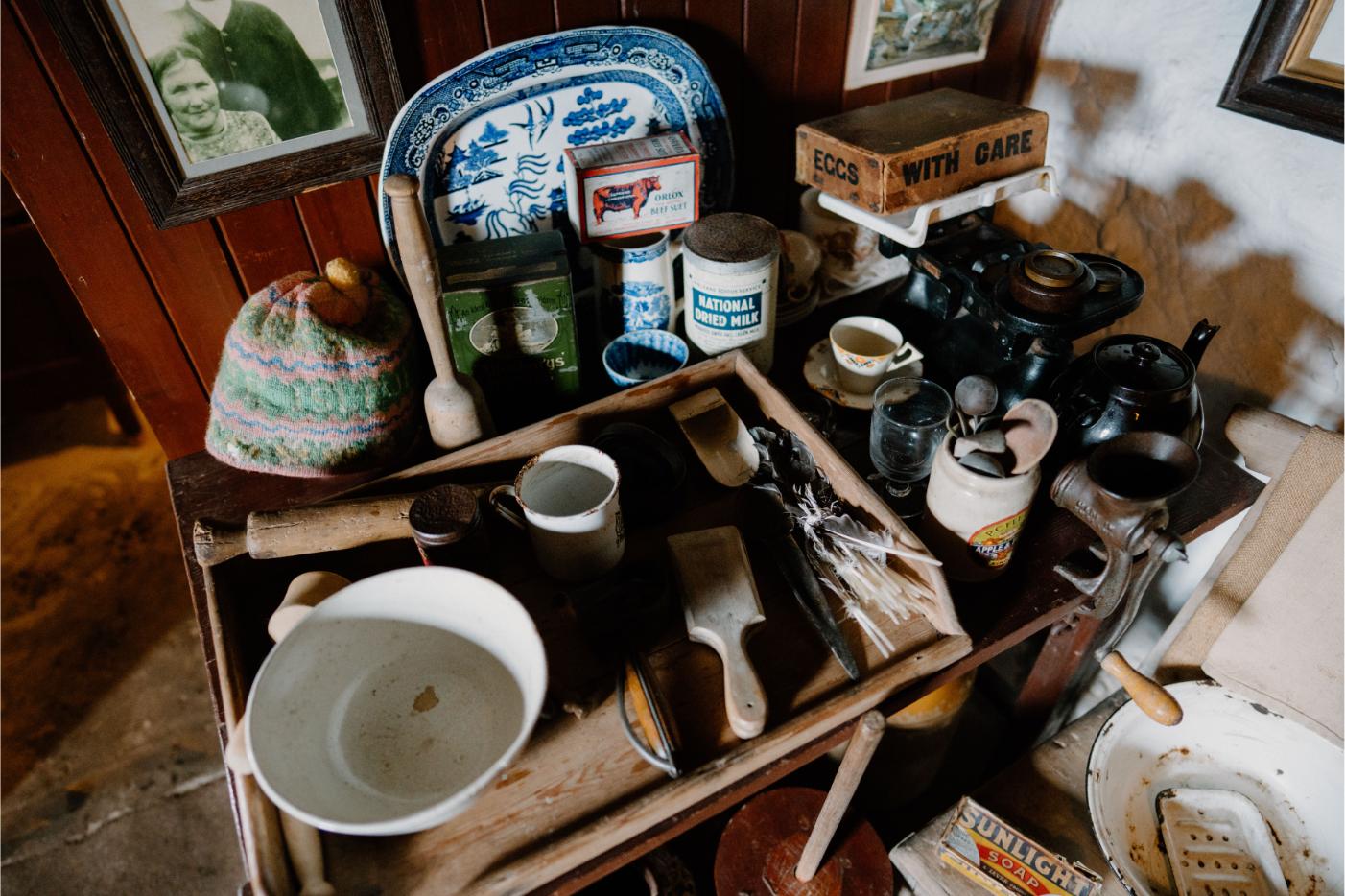
Set just off the single-track road near Kilmuir, the Skye Museum of Island Life feels quietly self-contained. A group of restored thatched cottages set against open moorland, it offers a clear-eyed glimpse into how people lived here just a few generations ago. Crofting wasn’t a relic; it was a way...
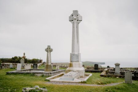
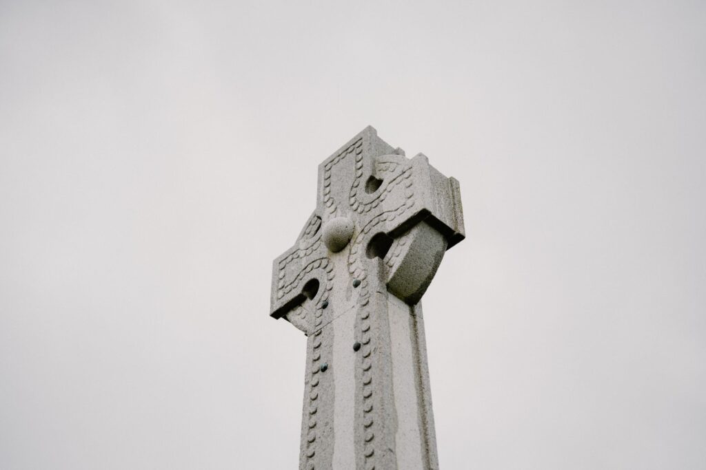
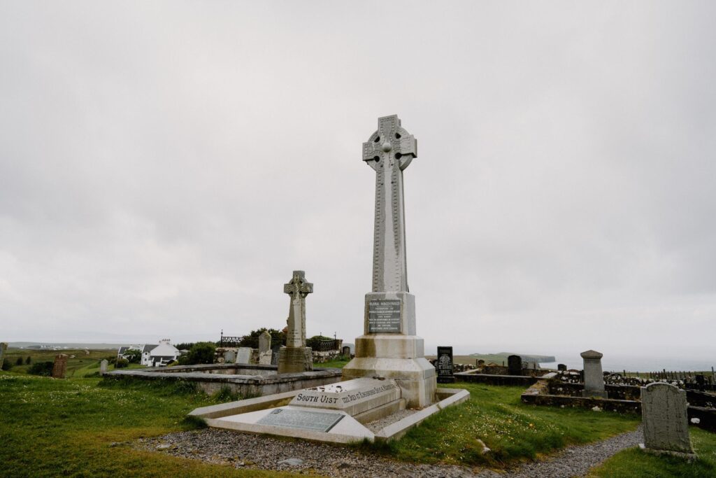
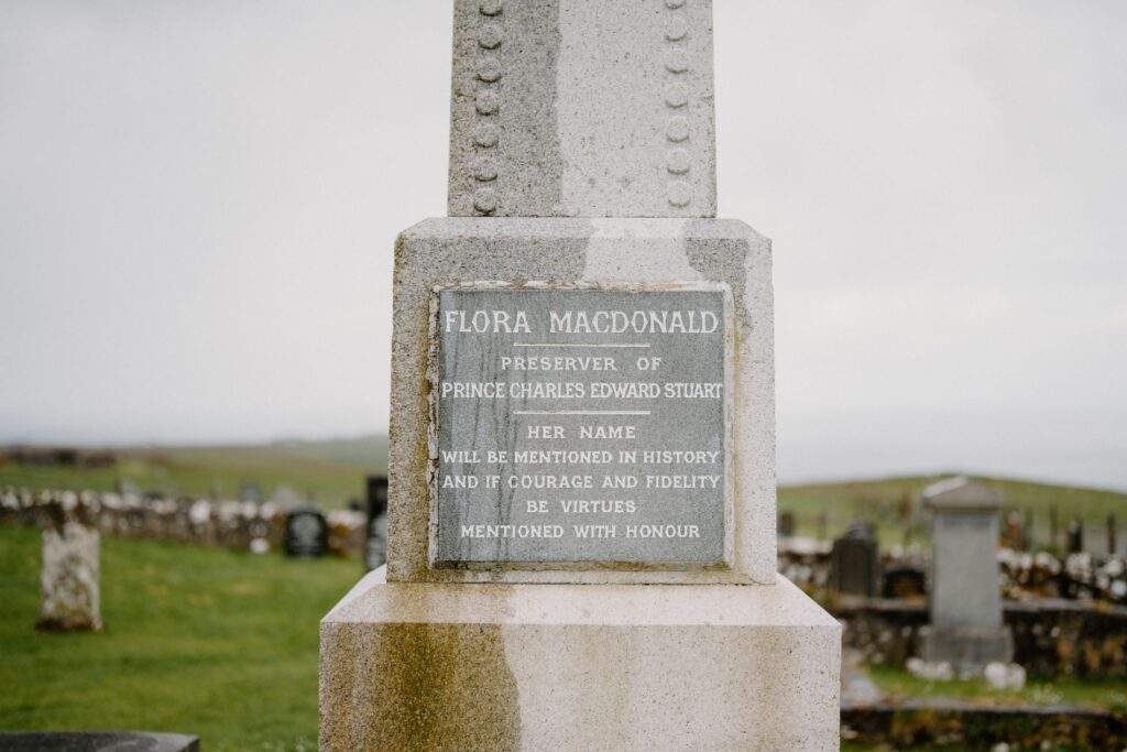
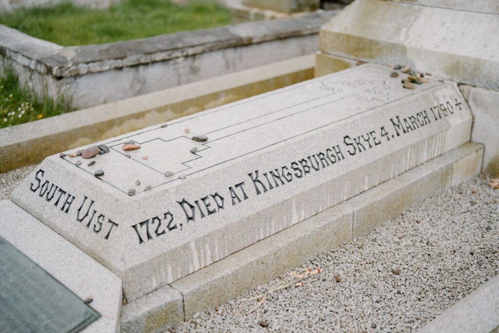
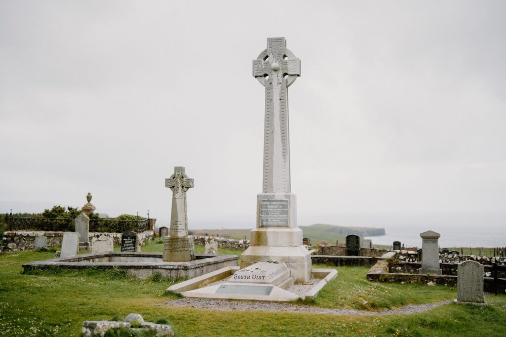
The Grave of Flora McDonald
Just uphill from the Skye Museum of Island Life lies Kilmuir Cemetery, marked by a low stone wall and a gate that rarely shuts properly. At the far end stands a tall Celtic cross, visible from the road. This is the grave of Flora MacDonald—one of Skye’s most enduring historical...
Kilvaxter Souterrain
A few miles south of Kilmuir, just off the A855, a discreet turning leads to one of Skye’s lesser-known ancient sites. Kilvaxter Souterrain doesn’t draw crowds or headlines, but for those with an interest in the island’s deeper past, it offers something quite rare—an underground structure left behind by Iron...
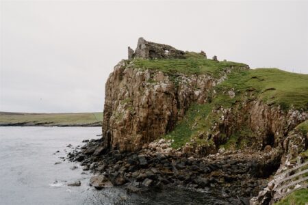
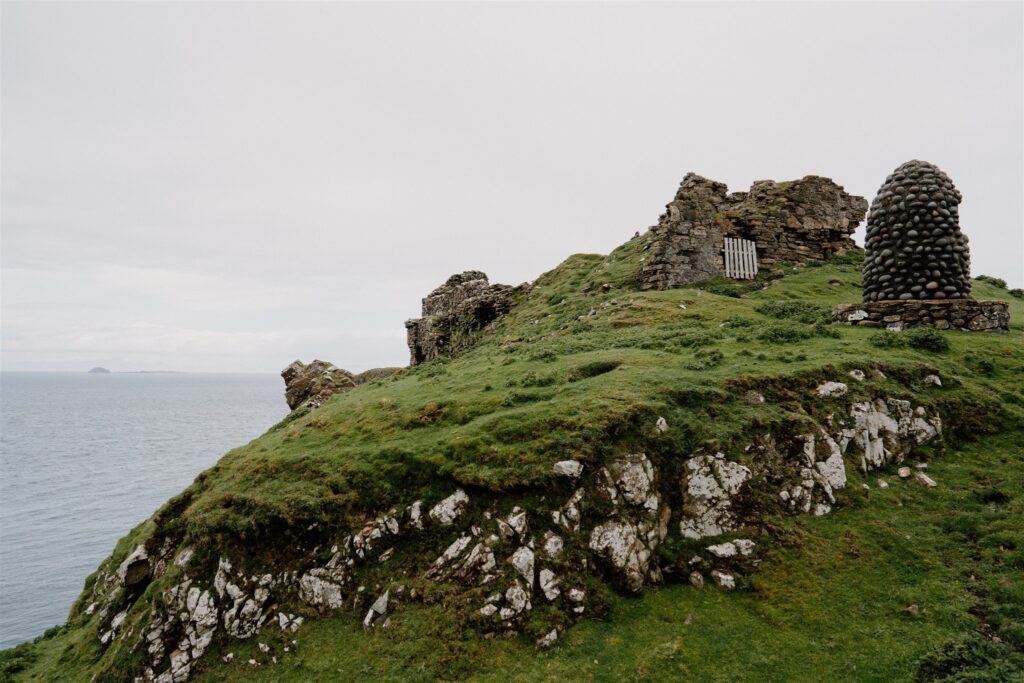
Duntulm Castle
From Kilvaxter, it’s a short drive north to Duntulm, where the road ends in a wide arc of tarmac and a scattering of cars, usually facing the sea. There’s no formal visitor centre, just a gate and a grassy path leading out along the headland. What’s left of Duntulm Castle...
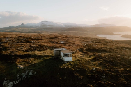
Rubha Hunish and The Lookout Bothy
At the very tip of Skye’s north end, Rubha Hunish offers one of the island’s most striking and isolated viewpoints. The walk begins just off the A855, where a small car park at Kilmaluag marks the start of a 1.5-mile route to the headland. The trail starts gently, crossing open...

 Sign in with Google
 Sign in with Email