
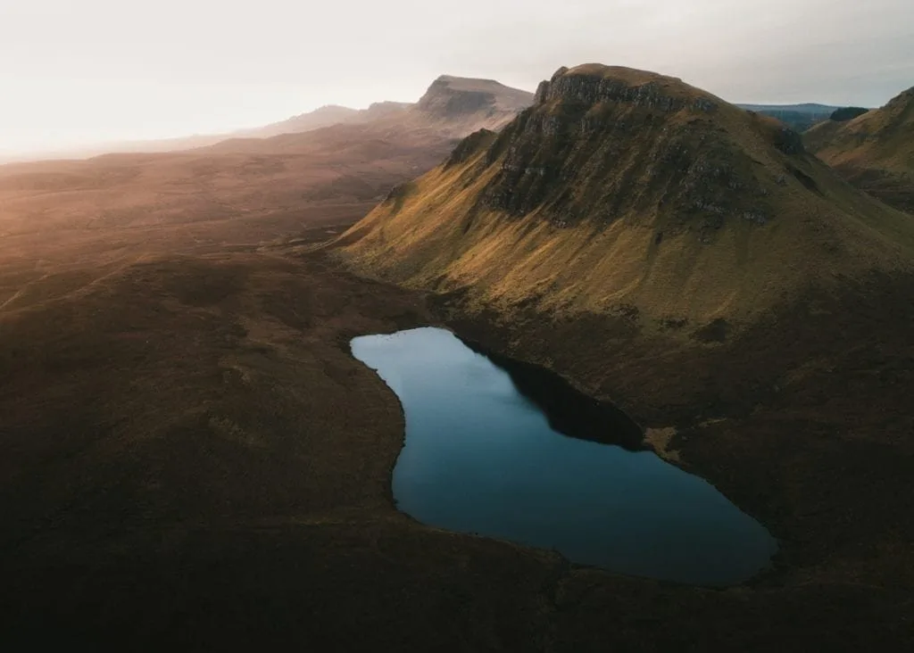
Guide to Drone Photography in Scotland
A guide to drone photography in Scotland by photographer Chris Houston.
Words by Hidden Scotland
The complete guide by Chris J Houston
Tired of seeing things from the ground? Bored of the same old views? Why not take to the skies with a drone and bring a whole new perspective to your photography.
Drones have completely transformed what is possible with photography and it is easy to see why; the ability to project a camera 100m into the sky opens up a huge range of possibilities and otherwise unattainable perspectives. As a result it has become the adventure photographer’s bread and butter.
There really is no better place than Scotland to take to the skies; our spectacular coastlines present endless opportunities, our remote ruins are just sitting there waiting to be snapped and our glens surrounded by vast mountain ranges offer up all sorts of interesting perspectives.
Flying a drone anywhere in the world now throws up a fair few challenges and as the drone market has become more popular we are experiencing increasing legislation and regulations, which is completely understandable.
This article takes you through the basic principles of drone flying, the key rules and regulations, getting the most out of your flying time and offers some guidance on the best locations to fly in Scotland.
The Rules and Regulations
Before we get into the fun stuff, it is important to set the context and talk through some of the key rules and regulations that must be followed while flying.
In the UK, drone flying is regulated by the Civil Aviation Authority (CAA), which sets out the rules for everyday flying in the Drone and Model Aircraft Code. Many of its rules are legal requirements, and the CAA updates the Code from time to time, so read the latest version before you fly.
What you need depends on how heavy your drone is and whether it has a camera:
You need a Flyer ID, which you get by passing the CAA’s online theory test, to fly any drone that weighs 100g or more.
You need an Operator ID, which must be labelled on the drone, if you own or are responsible for a drone that weighs 250g or more, or 100g or more with a camera. You must be 18 or over to get one.
New drones sold in the UK carry a class mark, from UK0 to UK6, which tells you which rules apply to them. Older drones usually have none, and you follow the rules for their weight.
You are responsible for following the Code whenever you fly, and breaking it can mean a fine or, in the most serious cases, prison. Bottom line folks, follow the rules, they are there for a reason.
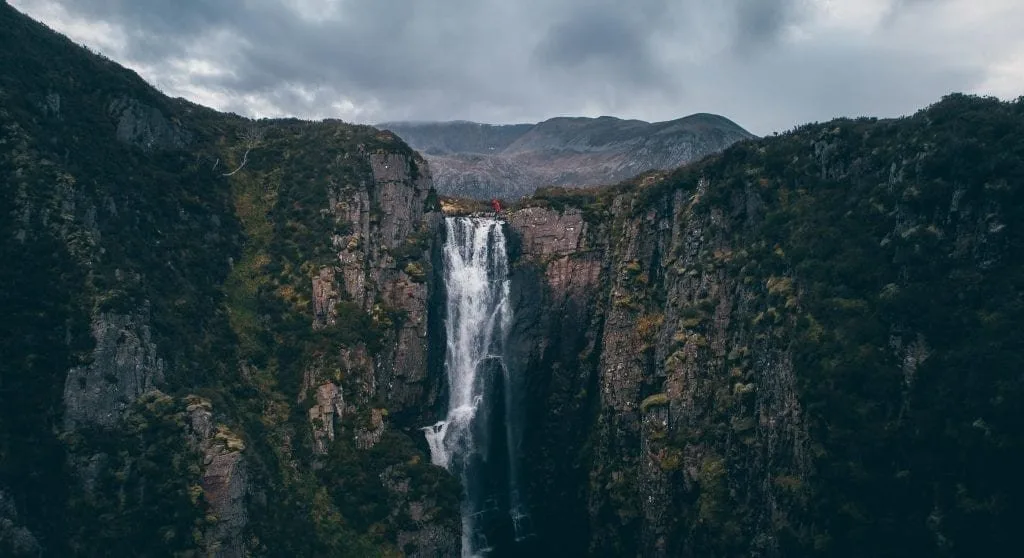
Where can I fly?
Firstly, you must adhere to the drone code. In the context of flying in the Scottish countryside the following rules are key:
These are the bare minimum requirements however it is good practice to go beyond this. Generally, I don’t launch my drone if there are any other people close by. Drones are noisy bits of kit and the last thing people want when out enjoying the tranquil sounds of Scotland’s nature is a drone buzzing around their heads. Have respect for other users of the countryside, don’t just throw your drone up next to a group of walkers, it’s disrespectful and inconsiderate. If you are desperate to catch that shot and there are people around, it is good practice to ask any other users, walkers, climbers, bikers, etc for permission. I’ve done this from time to time when in a pinch and have never been refused. Generally people welcome the engagement. Under these circumstances plan the shot you want before flying and get your drone up and down as quickly and safely as possible. If at any time someone challenges you respond calmly, ask them if they object to the drone flying and if they do just bring your drone down and move on. There are plenty of other locations to shoot.
Landowner Approval
You may need landowner approval. Although not certain, it is generally accepted that the use of drones for leisure (i.e. non-commercial) purposes fall within the scope of “recreational purposes” in terms of the Land Reform (Scotland) Act 2003 and are subject to the Scottish Outdoor Access Code. In that respect, landowners have very little power to prevent drone flying in Scotland.
Small aircraft, drones fall within the scope of the Civil Aviation Act 1982, section 76(1) of which provides that no action of trespass or nuisance may arise solely out of the flight of an aircraft over property (whether for commercial or leisure purposes).
This is subject to the flight being at a reasonable height and again complying with the drone code.
With that said, generally speaking in the majority of remote areas of Scotland you can launch your drone without issue. Most of Scotland is dominated by large estates and you can be away from people and built up environment and therefore your flight goes relatively unnoticed.
However, there are some key things you should watch out for. If a landowner has put up a ‘no fly’ sign my recommendation is that you comply with this.
As already noted above legally landowners have little recourse under the Land Reform Scotland Act, however some landowners have passed bylaws to allow the prohibition of drone flying on their properties.
While the airspace above the landowner’s property is fair game, you may need landowner approval to launch your drone legally under these circumstances.
There are some key land owners with strict drone rules in place that you should be aware of:
In addition to the above, you will find no fly signs at some popular places such as Glenfinnan, Kilchurn Castle and Castle Stalker.
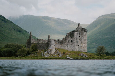
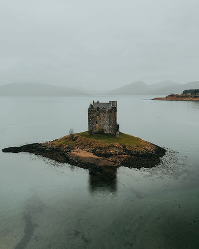
However, note there are possible launch locations at Castle Stalker (which we will come on to below) and at Glenfinnan you should contact the estate before you plan to fly. Bottom line, it is key that you check the land ownership of your proposed launch site before you fly.
Thankfully, for the time being, there is a lot of land in Scotland without such rules. In fact there are a number of key landowners who approve it provided the drone code is followed. A key landowner on the coast is Crown Estate Scotland, which manages just under half of Scotland’s foreshore.
The foreshore is the area intermittently covered by the sea, between mean high water and mean low water.
This makes the foreshore a good place to launch from, as long as there are no other restrictions in place, but not all of it is Crown land: in Aberdeen, for example, the foreshore belongs to the city. A good guide is to look for the highest seaweed line and launch between this and the sea. Remember that the Drone Code counts beaches as recreational areas, so with a drone of 250g or more a quiet stretch of shore is a better choice than a busy beach. You can also fly on land run by Forestry and Land Scotland without asking first, for personal or recreational flying and low-impact photography, as long as you follow the Drone Code and the Scottish Outdoor Access Code.
Flight Restrictions
One further key consideration is airspace restrictions. Scotland is covered in restricted flight zones, most notably commercial airspace (buffer surrounding airports and aerodromes) and military practice and exercise areas (PEXAs).
Most airports and airfields have a flight restriction zone, and you must never fly in one without permission. Many drones warn you as you approach restricted airspace, but their built-in maps are not always up to date, so check a current source before every flight.
However, PEXAs are slightly more complex. These are areas used by the military for flight practice and you should be aware of the key PEXAs and their rules for drone operators. NATS publishes a map of airspace restrictions on its drone website, and several drone apps show the same information.
There are a number of PEXAs on the Scottish mainland, some with rules, flight time restrictions and the Drone Assist app will provide guidance on this. Much of the Highlands lies within a military PEXA. Generally you can fly at any time in this area, however check for any Notices to Air Missions (NOTAMs) for your area on the day of your flight. Many drone apps show them, and they are also on the NATS drone website. A NOTAM contains information regarding planned operations and will include details of any flight restrictions. If you do find yourself in the air and hear a helicopter or jet in the distance, bring your drone to the ground immediately and wait for it to pass by. If you are in the mountains and a search and rescue is under way, the Drone Code says you must stop flying straight away and keep out of the way unless the emergency services give you permission.
Getting the most out of your flight
Now we have covered all the guidance on rules of flight, let’s get in to the nitty gritty of flying. This section provides an overview of how to get the most out of your drone flight and will hopefully help you come away with stunning photos and film.
Pre Flight Planning
Plan your flight before you set out. Use google maps to check the area and locate suitable launch sites away from public highways, population centres and properties.
Use an up-to-date airspace map to check for any flight restrictions. If flying in a PEXA which you almost always will be in the Scottish Highlands check the NOTAM service to see if there are any military operations planned.
Google maps satellite view or google earth are also really useful tools for planning shot locations.
Use it to get the lie of the land and try to plan out specific shot and / or film ideas before you set out.
While you may not stick exactly to your plan in the air, it is a good idea to go out with a set of specific shot ideas.
Your batteries only last approximately 30 minutes so having a shot list helps get the most out of that time. Once you’ve grabbed your shots, if there is nothing left to shoot bring your drone down and move on to the next location.
The Flight
Here are some pre-flight checks to undertake:
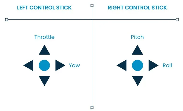
You are now ready to fly, the below image shows the typical drone controls and the following steps take you through a typical flight.
Taking Off
This is probably one of the more complex skills to hone. When the drone is hovering close to the ground the craft is more unstable due to the uplift experience. When taking off increase the throttle quickly and move the drone to about eye height and hover.
In-Flight Checks
Now you are in the air, move the drone to a couple of metres above head height and check all the controls respond as expected and look for any imbalances or irregularities. This is known as a flight control check. From there; pitch, roll and yaw to test control the drone’s response and sensitivity. Once you’re happy you should be good to proceed with your flight.
Landing
When it comes to landing your drone, check there are no unexpected incursions to your landing space and once you are sure it’s safe to land, cut back the controller’s throttle slowly bringing the drone to a couple of feet off the ground.
The same uplift is experienced as per take-off and therefore it is good practice to land your drone swiftly but in control. Lower the throttle so your drone gradually drops and when about four or five inches off the ground, cut the throttle completely and let the drone go to the ground.
Tips for New Pilots
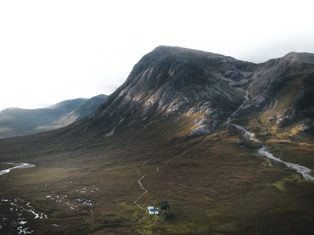
If you are new to drone flying practicing somewhere safe is a must before you unleash your drone in the highlands of Scotland.
It’s a good idea to take your drone to a quiet unpopulated open space to test fly. Here are some useful manoeuvres that can help you develop your flying skills:
Fly in a box using only the right stick, pitch and roll. The camera should maintain its forward looking position at all times. Mastered that? Do it in the opposite direction.
Fly in a box with camera tracking forward using both sticks, yaw, pitch and roll. Again you can reverse this in the other direction once you have mastered it.
Fly in a figure of eight using only the pitch and roll. Reverse it.
Fly in a figure of eight with the camera in the forward looking direction using yaw, pitch and roll. Reverse it.
Do the same with the camera looking backwards, i.e. fly in reverse using the yaw, pitch and roll.
Once you have cracked the above, it is a good idea to practice flying in ‘ATTI’ mode short for ‘attitude’. In this setting GPS is turned off and the craft will therefore move with the wind. Practice holding position and once you have cracked this you can run through the above steps all in ATTI mode. This is excellent practice and in addition it prepares you for a situation where you have a GPS or compass failure.
It’s important to note that while the new drones have a number of really good follow features you will always be able to obtain more interesting photo and film positions flying in manual mode. Practice hard until you are confident you have complete control over the drone, you’ll be better than the follow features.
Camera Settings
Photos
Firstly, if your drone camera has a RAW picture option and you plan on editing the photos in Lightroom or Photoshop make sure this is turned on. For good quality drone pictures it is essential that you shoot in RAW, this gives you a flat picture with the maximum dynamic range and opens up considerably more scope for manipulation while post processing.
Generally the same settings as per your hand held camera apply to drones, i.e. aperture, shutter speed and ISO (light sensitivity). The camera modes and basic picture settings are discussed below.
Camera Modes
Drones typically have manual, aperture and shutter priority modes. Generally it is always good practice to shoot in manual, however shutter and aperture priority offer the ability to make quicker adjustments on the fly.
For photos my preference is to always shoot in either manual or aperture priority mode. In aperture priority I set the aperture to f/4 and use the exposure compensation to adjust the shutter speed.
Aperture
Check your camera’s optimal settings. As with any other camera and lens combination there are optimal settings in terms of sharpness. For the DJI Mavic and Phantom range this is aperture f/4 to f/5. Within this range you are getting the best picture quality in terms of sharpness. I only ever reduce the f-stop number in low light.
Shutter Speed
Drones are in the air being buffeted by the wind and while they are stabilised by a gimbal it is not as good a platform as your hands. For this reason it is always good to maintain a high enough shutter speed to ensure your pictures are not affected by the movement of the drone. Generally I don’t go below 1/60 of a second. However in low light in the right conditions 1/30 of a second is achievable.
Light Sensitivity
The sensors of most consumer drone cameras are small and not capable of high ISO settings without producing considerable noise. As a general rule of thumb try to keep your ISO setting at 100 at all times while maintaining a shutter speed of no lower than a 1/60 of a second.
When the light starts to fade you can try raising as far as ISO 400, however, be prepared to see considerable noise with ISO settings above 200 to 300.
Pro Tips
Give bracketed shots a go. This can be found in the camera settings menu.
Take 3 to five shots exposed 1 to 2 stops of light above your current camera settings. Combine these in post using Lightroom’s ‘HDR’ function.
This produces incredible results with considerable dynamic range and offers even more editing potential. You will need a fast shutter speed for this to work: 1/60 of a second should be sufficient.
If shooting single images in good light, expose for the highlights. Shadows are much easier to recover while blown out highlights are for the most part impossible to recover. You may however want to shoot with blown out highlights if you are trying to achieve a particular look in your image.
Use ND / Polariser filters. These attach to the front of the lens and stop down the amount of light hitting the sensor. They are more applicable to film however with photos I often find you achieve a much deeper and more contrasty image.
Film
Shutter Speed
In terms of shutter speeds, to achieve the smoothest footage, you need to maintain your shutter speed at no more than twice your frame rate. For example, when shooting at 25fps, your shutter speed should be 1/50 of a second.
If your camera can shoot at 50 or 60 fps, your shutter speed should be 1/100 or 1/125 of a second. The reason for this is that drones and DSLRs take a single image for every frame and therefore if your shutter speed is too quick you won’t catch any motion blur which results in choppy footage, especially if the subject is moving.
My preference on the Phantom 4 Pro is to shoot at 2k 60fps at all times. This allows a maximum shutter speed of 1/125 of a second. Additionally, you can slow this down in post for buttery smooth slow motion footage.
If there is too much light to maintain this rule, apply an ND filter that is strong enough to reduce the light and allow you to lower your shutter speeds.
Picture Profiles
Most consumer drones come with a range of picture profiles for film. If you don’t plan on editing and colour correcting your footage in post, just use one of the standard coloured picture profiles. For those looking to colour correct, use the flat Log profile. On DJI drones this is known as D-Log. Akin to RAW pictures, this captures the most dynamic range and allows more manipulation in post. It should however be noted that switching to D-log increases the minimum ISO setting and can result in slightly noisier footage.
Gimbal Settings
Cinematic movement is always smooth; it doesn’t judder, jump or glitch. Creating cinematic shots is really about practice, however there are a few useful tweaks that you can make to your settings that help. Set your gimbal action to a less sensitive setting. This slows the gimbal movement down and is more forgiving when you make sudden movements on the sticks.
Scottish Drone Locations
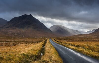
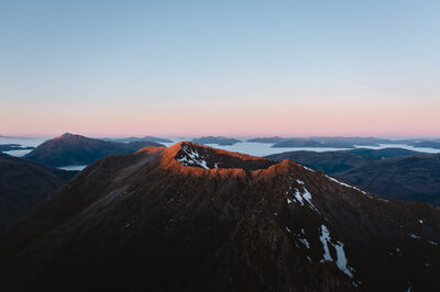
Glencoe is one of Scotland’s many gems and a location that photographers from across the globe travel to. Characterised by its rugged, rocky mountains and deep furrowed glens it is a great place to launch your drone. However, as already noted much of the land is owned by NTS and therefore you should be aware of the NTS ownership boundary which is provided below.
There are however some great locations outwith the boundary including much of
the land on the northern side of the A82 and on the southern side of
Glen Etive. This takes in Beinn a’Chrulaiste, most of Aonach Eagach, the devils
staircase which are fantastic drone locations.
Glencoe is very popular with
tourists, hikers and climbers and therefore please be respectful of other
users of the countryside. Find remote locations away from people and bring
your drone down when others are passing through.
The full NTS land ownership map can be viewed here this covers all of their estates across Scotland.
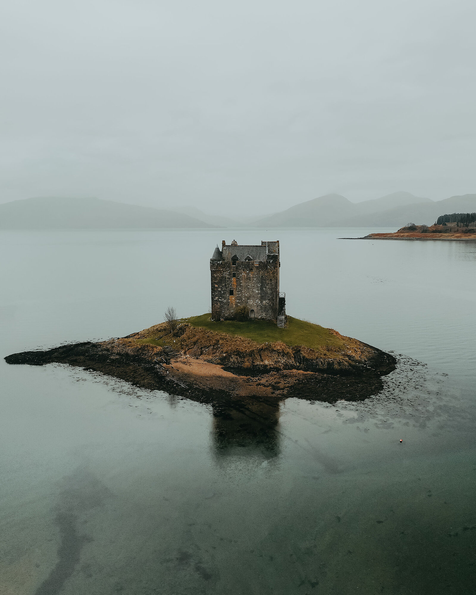
Castle Stalker
This is one of the most dramatically positioned castles in Scotland located on a small island near Port Appin in Argyll and Bute.
The beach front has no fly signs and therefore I would recommend not launching on the beach immediately in front of the Castle.
Instead walk north along the beach to the other side of the small bay and on to the tip of the small peninsula to the North of the castle. From here you are close enough to keep the drone in direct sight and can safely launch your drone from the foreshore.
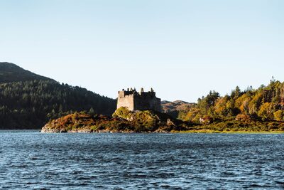
This is by far my favourite castle in Scotland. The Castle is located on a tidal island in loch Moidart on the Ardnamurchan peninsula. The area is stunning, especially in autumn and at sunset. There are numerous places to launch here including the foreshore.
It’s best caught at high tide when the island is cut off from the mainland, but prioritise good light over this as it really does look spectacular at all tide levels.
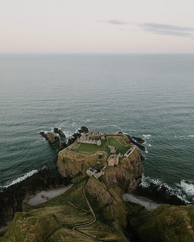
Dunnottar is a very popular castle and looks great from the air. Be aware that it is very busy so can be hard to launch safely. It is best caught during the summer, very early at sunrise. It’s a painful start to the day but if the right conditions happen you will come away with incredible shots. Note the castle doesn’t allow drone flying during open hours. A good launch spot is the beach on the northern side of the castle.
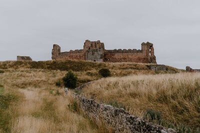
Located on a small peninsula on the top of steep cliffs to the east of North Berwick in Oxroad Bay. This is a stunner of a castle but again it’s popular and care should be taken when launching. As with Dunnottar, it is best caught at sunrise during summer hours and you can launch from the foreshore to the north of the castle.
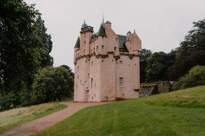
This castle is pink. Enough said I think? It’s located south of Alford in Aberdeenshire and looks great snapped from the south. Note this is an NTS property so make sure you are outside of the castle Gardens when you launch.
Other Castles
The above is not an exhaustive list, just some suggestions. There are estimated to have been over 2,000 castles in Scotland built between the 1100s and early 1600s many of which can still be seen today in various states of ruin. If you do your research before heading out you will without doubt find castles on or close to your route that may only be a short detour. Make sure and research your take off locations sufficiently and ensure you can plan your flight safely and in line with the regulations.
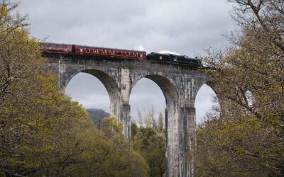
The viaduct made famous by the Harry Potter films is a great location to fly your drone, however as already mentioned above, contact the estate before you fly, and remember that the 50m rule covers the people on the trains that cross it.
-full-1718622494.jpg)
Taking in Kishorn, the Bealach Na Ba, Applecross and the coastal route, Torridon and Gairloch, this is by far my favourite section of Scottish landscape. It’s quite far north, being approximately 4 to 6 hours from Glasgow and therefore it is really quiet. There are very few areas that you can’t fly in this area of the highlands although note that most of the highlands has a military PEXA over it so you should check the NOTAM before flying and if you hear jets or helicopters in the distance bring your drone down immediately.
Kishorn and Bealach Na Ba
There are endless possibilities in this area, with the highlights being Loch Coire nan Arr and the road (C1087) cutting through the glen over the Bealach Na Ba. It is worth doing the Meall Gorm ridge and Sgurr a’ Chaorachain loop if you have the energy which gives you some unbelievable perspectives over the road and some fantastic exposure is to be had.
Wester Ross Coastal Route
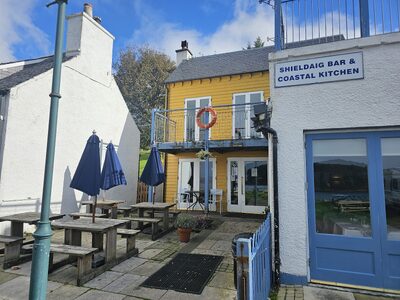
The route from Kishorn to Shieldaig adds about 40 minutes to your journey north but it is absolutely worth it. Stop in the Applecross Inn for food if you get a chance, you won’t be disappointed. North from there look out for derelict cottages, beautiful bays and sections of road that contour towards the Torridon mountain range. So many possibilities on this section of road, you can stop almost anywhere. Be sure to launch more than 50m away from the road.
Torridon
Torridon has one of if not the most impressive mountain ranges in Scotland with its highest peak Liathach dominating behind the village of Torridon itself. Note much of this area is owned by NTS so check the ownership boundary before you launch. The landscape is barren, rugged and covered in beautiful red Torridonian sandstone. There are plenty of small lochs and mountain trails worth exploring with your drone. Can be busy at times with climbers, walkers and cyclists so be sure to respect others.
Assynt
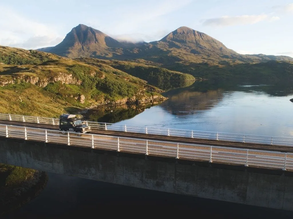
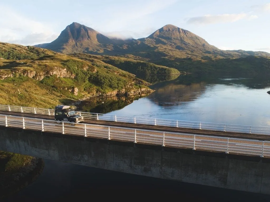
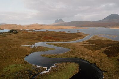
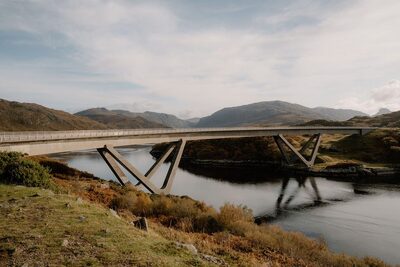
Assynt is very much a continuation of Torridon’s landscape with similar landform and the same geology. There are a few gems here worth checking out including the Kylesku Bridge and the Wailing Widow falls.
 Out now
Twice a year, to your door
One hundred and sixty pages of Scotland, every photograph commissioned, every word written by someone who went. Members get both issues posted and everything on screen.
 The Last Stop Before Nowhere
 A Weekend Exploring the Isle of Mull
 What's On in Scotland: Autumn and Winter