The Macdonalds of Skye and Their Castles
The Clan Donald descends from Somerled, a 12th century nobleman of mixed Gaelic/Norse descent who held lands in Argyll. He is credited with driving the Norse out of Argyll and the isles. Let’s take a step back in time and follow the history of Clan Donald.
-full-1749570609.jpg)
ARMADALE
Armadale Castle can be found in the area of southern Skye known as Sleat, about a mile north of the terminal for the ferry to Mallaig on the mainland.
There was a house at Armadale since at least the 1670’s when it was written, “The Southern part of this Isle is called Sleatt. Its chiefe place is Armidile one of the chief places of residence belonging to McDonald it is adorned with a house and fine gardens.”
In 1690 following the Jacobite rising the previous year, the house at Armadale was burnt to the ground by Government troops searching for Sir Donald MacDonald, 10th of Sleat. Despite this a house of some sort continued to exist at Armadale and was used as a Dower House during the first part of the eighteenth century.
In 1738 the house was leased to Alexander MacDonald of Kingsburgh. In 1745 Armadale became the home of Hugh MacDonald of Camuscross, who acted as factor to the Sleat Estate. Flora MacDonald married there in 1750 to Alexander of Kingsburgh.
In Boswell’s Journal in 1773, he wrote, “We reached the shore of Armidale before one o’clock Sir Alexander McDonald came down to receive us. He and his lady were then in a house built by a tenant at this place, which is in the district of Slate, the family mansion there having been burnt down”. During the last years of the eighteenth century the MacDonalds had a new mansion house built near the site of the old house. The family made it their main home about 1798, having moved from Monkstadt House in Trotternish. This house was extended to create the gothic Armadale Castle, work having started about 1815 under the direction of the architect James Gillespie Graham. The main part of the castle was completed about 1819, with the kitchen and other rooms following a few years later. The main staircase was lit by a stained glass window showing a full length representation of Somerled, founder of Clan Donald. Sometime after 1855 part of the castle was destroyed by fire and was replaced by a new extended wing which was designed by David Bryce. By 1925 the castle had been abandoned by the MacDonald family, who moved to the nearby Ostaig House. In 1972 the ruinous castle and a considerable portion of Sleat was put up for sale by Lord MacDonald and was purchased by the Clan Donald Lands Trust which continues to own the castle and land today. In 1981 the west part of the castle was demolished, creating a sculptured ruin, while the David Bryce section remained as a shell. The oldest part of the building was converted, initially to house a museum, until this was relocated to a purpose build building nearby.
-full-1749570609.jpg)
DUNSCAITH CASTLE
Dunscaith can be reached from the Broadford to Ardvasar A851 road. After parking near the bay to the west of Tokavaig, the castle is approached by walking round the eastern shore of the bay.
In the 14th century Sleat belonged to the Earls of Ross, from whom it was held by the MacLeods as vassals. It was fought over by the MacLeods and MacDonalds during the fifteenth century until in 1469 it was granted to Hugh MacDonald, younger brother of John, Lord of the Isles, Hugh was the 1st MacDonald of Sleat. His position was later confirmed by royal charter in 1495.
A bond signed in 1521 was signed by “Donald of Dunscagth” who was the 4th MacDonald of Sleat. In 1549 Dean Monro wrote of the “castill of Dunskay pertaining to the said Donald Gromson”, 6th of Sleat. Donald Gormson signed an obligation to the Bishop of the Isles at “Dounsceiche” in 1572. By 1618 Dunscaith had been abandoned by the MacDonald in favour of Duntulm in Trotternish.
The castle stands on a rock, about 40 feet above sea level, some 20 feet from the mainland. A walled bridge originally connected the castle to the mainland. The bridge led to a drawbridge, then a staircase up to the castle. Most of the buildings have now gone, but parts of the curtain walls remain to a thickness of about five feet. At either end of the curtain wall were small towers.
Within the castle was a courtyard containing a small well. To the north of the well can be found a raised square area, on which may have stood a tower, and to the west of the courtyard stood a later single-storey rectangular building with a doorway near the southern part of the curtain wall. The ruins are in a dangerous condition and it may be more appropriate to view them from the mainland.
-full-1749570610.jpg)
KNOCK CASTLE
Knock Castle, also known as Castle Camus, stands on a headland on the east coast of Sleat, overlooking the mainland. It can be reached by taking the A851 south from Broadford past Isle Ornsay. About 2km further on is a minor track on the left. After parking walk past a farm steading, taking a track to the left and across a small bridge to a gate. Go through and follow the path past a stream to the castle ruins.
The castle first appears on record in 1402 when it was in the hands of the MacLeods. It passed to the MacDonalds by royal charter in 1469 being granted to Hugh MacDonald, younger brother to John, Lord of the Isles. Sometime after 1549 Dean Monro recorded that the castle was “pertaining to Donald Gromsome”. It later became the residence of James, younger son of Donald Gruamach, 4th of Sleat, who was the founder of the Kingsburgh family, into which Flora MacDonald married. In 1596 a new charter to the lands of Sleat was granted to Donald Gorm Mor MacDonald, 7th of Sleat, containing a provision that Knock Castle was to be maintained as a residence for the King. This provision was repeated in charters granted in 1614 and 1618, although the King never took up residence. The last record of the castle being occupied was in a bond signed there in 1632. By 1689 stone from the castle was being taken to use in the building of the House of Knock. In 1795 the Rev. Martin Macpherson referred to the castle as a sad ruin. To the north of the ruins are the remains of a ditch, part of the original defences. A curtain wall ran along the cliff edge, of which there are only slight traces remaining. The oldest structure of which anything is visible is the large tower of at least three storeys with walls 1.5 meters thick. The south-east wall still exists to a height of over 10 meters. It has a window at ground level. The south-west and north-west walls are only visible as grass mounds. To the north-west of the tower was a courtyard with a smaller rectangular building built in the late 16th or early 17th century. The south-west and north-west walls are still standing to a height of about 5.75 meters.
Historic Environment Scotland states that Knock is a “monument of national importance as the remains of a complex and multiphase high-status medieval secular building.”
-full-1749570610.jpg)
DUNTULM CASTLE
The ruins of Duntulm Castle can be found at the far north of the island in the area known as Trotternish. To reach the castle follow the A856 northwards, turning off onto the A855 at Uig. On reaching Duntulm, park in the car park and walk through the gateway and along a path to the castle which should be explored with care.
The castle was built during the 14th and 15th centuries with later improvements. It was initially held by the MacLeod clan who held large parts of Skye from the Earls of Ross. The castle was held briefly by the MacDonalds towards the end of the 15th century before being granted again to the MacLeods in 1498. Ownership changed hands several times during the first part of the 16th century until finally it became the property of Donald Gruamach MacDonald, 4th of Sleat, sometime before 1528. The MacDonalds continued to hold Duntulm throughout the remainder of the 16th century. Sometime after 1549 Dean Munro wrote that the “castell of Donntwyline” was held by Donald Gormson MacDonald, 6th of Sleat.
In 1618 Sir Donald Gorm Og MacDonald, 8th of Sleat received a new charter to the lands of Trotternish. He was required to “mak his residence and dwelling at Duntillum”. The castle having fallen into disrepair he was required to carry out a great deal of work before it was habitable. The castle was abandoned in the early 1730’s and much of the stone was removed and used in the building of the new MacDonald residence, Monkstadt House, some five miles away. The ruins, which are in poor condition, stand on a promontory overlooking the sea. It was defended by a ditch on the landward side. There are the remains of a square tower, which was originally four storeys high, one wall still standing to parapet level until the late 19th century. The ground floor was divided into two rooms and the first floor contained a fireplace on the north wall. The tower was built against a curtain wall which ran alongside the cliff edge. The only entrance which is now to be seen is in the centre of the north wall. A second smaller and later tower, possibly three storeys high abutted the main tower. The upper part of this collapsed as recently as 1990. A later building, built around 1650, stood near the north-eastern corner of the castle. It was a rectangular hall with doors on the west and east walls. Historic Environment Scotland states that Duntulm is of “national importance as a fine example of a 14th – 15th century courtyard castle.”
-full-1749570610.jpg)
words // DAVID MCDONALD, Author of Clanranald - A History of the Clanranald Regiment 1745-6 & Clan Iain Abrach - A History of the MacDonalds of Glencoe.
Promoted Post
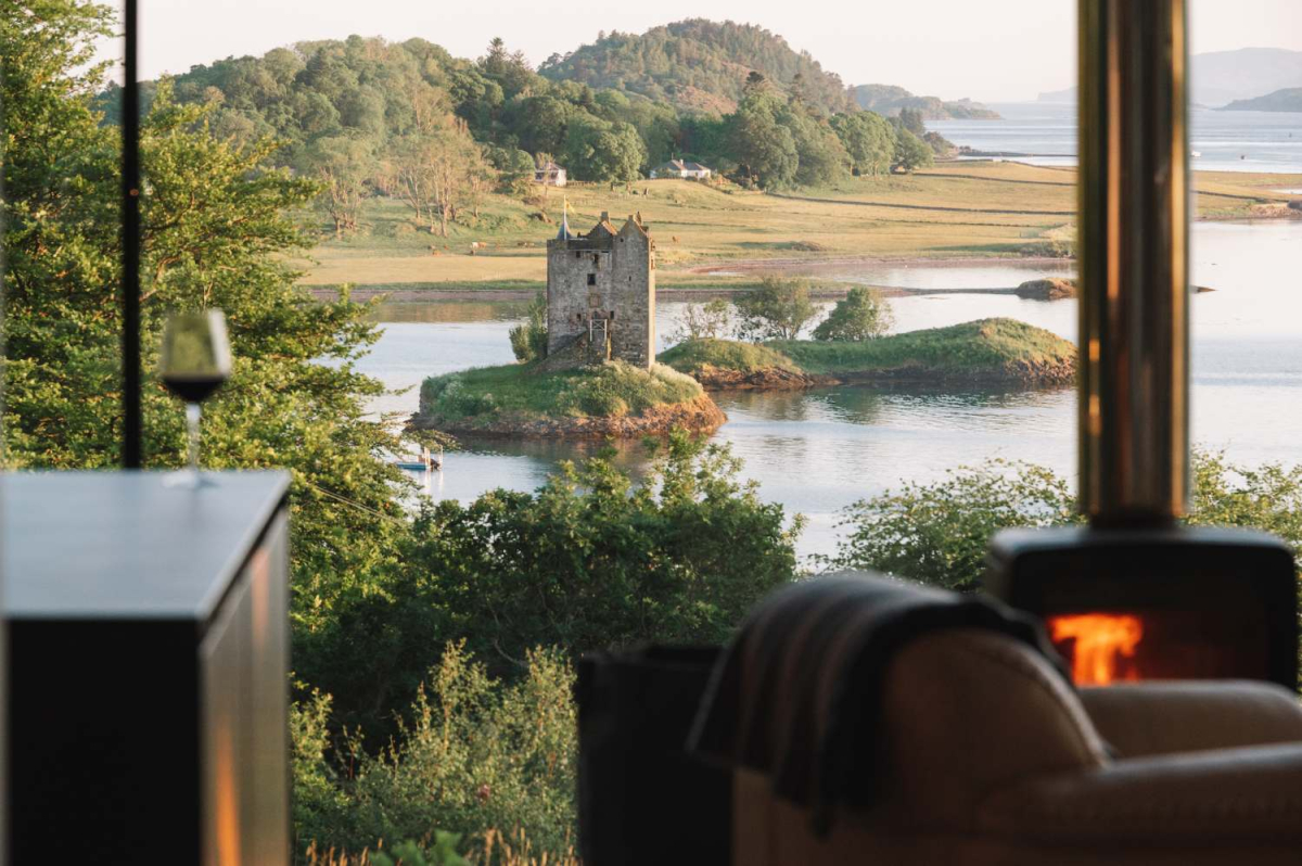
Stormhouse
Escape to the wild, rugged landscape of Scotland’s west coast, perfectly located between mountain and sea
 Sign in with Google
 Sign in with Email