The Moray Pictish Trail – 50 Miles of Stones, Forts, and Forgotten Symbols
Written by Jack Cairney
.jpg)
This route through Moray follows the echoes of a people who left no written records, but carved their presence into slabs of sandstone and the bones of old strongholds. The Picts weren’t a single tribe or kingdom, but a loose weave of communities across northern Scotland, active from the Late Iron Age through to the early medieval period. What they left behind is scattered, fragmentary — but if you know where to look, it’s enough to map a day around.
The trail begins quietly near Forres and ends at the harbour in Portsoy. Along the way, it passes standing stones, fortified headlands, ritual spaces and ruined towers — and just enough sea air to blow the dust off the early parts of the day. You’ll cover around 50 miles, mostly on quiet A-roads and coastal lanes. It’s possible to complete it in one unhurried day, with six main stops and a well-timed lunch.
There are no admission fees except your own attention span. Interpretation is light in some places, so bring a sense of curiosity and shoes you don’t mind getting wet. If the tide’s right, you’ll walk into a cave marked with symbols that outlived the culture that carved them. If not, there’s still more than enough above ground.
Rodney’s Stone
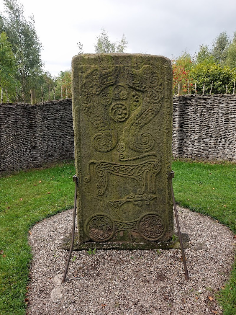
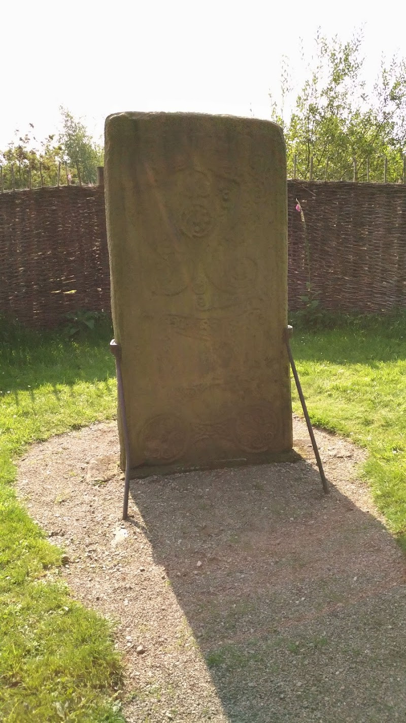
There’s nothing grand about the setting — a small patch of grass beside the village road, partway between Dyke and Brodie. But this stone is one of the most important Pictish cross-slabs still standing in Scotland. Over 1,200 years old, Rodney’s Stone bears a rare combination of pagan and Christian symbolism that speaks to a period of transition, when the old Pictish kingdoms were beginning to adopt the religion of Rome but hadn’t yet let go of their own ways of seeing the world.
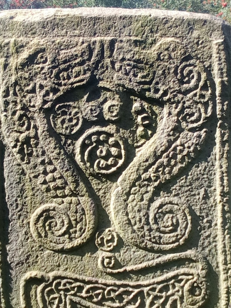
At two metres high, the stone is large but not imposing. What draws attention is its detail. One face carries a finely proportioned ring-headed cross, typical of later Pictish slabs. The other is more arresting — a double disc and Z-rod at the top, followed by a menagerie of Pictish symbols: a beast that might be a hunting hound, a mirror case, a serpent, and possibly a fish. These were not ornamental. They likely held tribal, religious, or familial meaning, part of a symbolic system now mostly lost to time.
The stone didn’t always stand here. It was discovered nearby in the 18th century, repurposed as a gatepost on the Brodie estate, and later moved to its present spot for preservation. The name “Rodney” was added during that time to honour Admiral Rodney — an 18th-century naval hero — giving the monument a layer of Georgian patriotism unrelated to its true origin.
There’s a layby for parking beside the lane, and a short walk brings you face to face with the stone. There’s no visitor centre, and signage is minimal. But you don’t need much. The carvings are sharp, the air is still, and the presence of the thing — carved by hand over a thousand years ago — is enough.
Sueno’s Stone
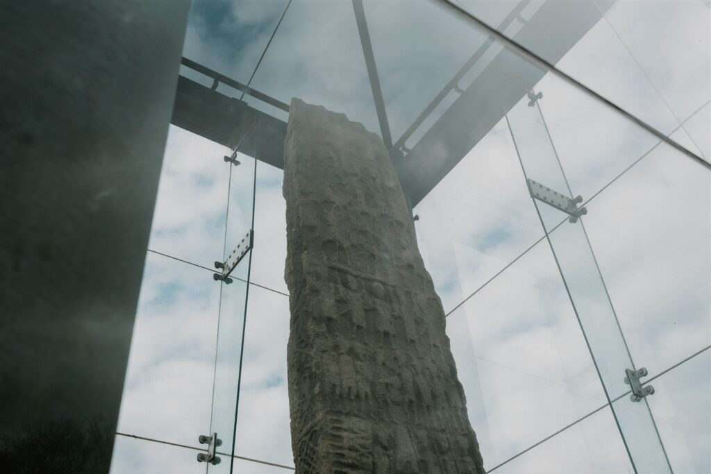
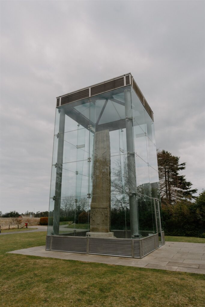
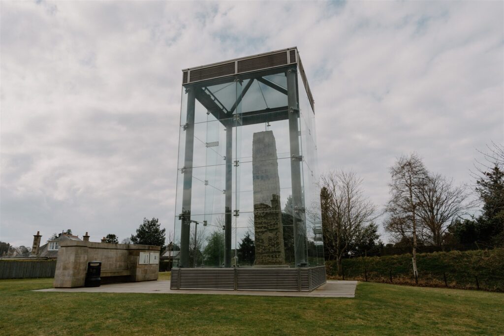
If Rodney’s Stone shows the quiet collision of old belief and new faith, Sueno’s Stone reveals the fallout. Just ten miles east, at the edge of Forres, this massive sandstone cross-slab stands over 20 feet tall — the largest of its kind in Scotland. It’s not only remarkable for its scale, but for what it dares to show: war in detail.
One side holds a formal, ring-headed cross — the Christian anchor, finely carved and carefully framed. The other side is something else entirely: four stacked scenes depicting what looks like a full military campaign. Warriors march in ranks. Cavalry ride into battle. Captives are decapitated and their heads displayed in trees. At the top, victors stand triumphant beneath a smaller cross. This is not a symbolic fight of good over evil. It’s likely a record — or a claim — of conquest.
Most scholars date it to the 9th or 10th century, when the Kingdom of Alba was pushing north and absorbing what remained of independent Pictish rule. The story it tells may not be literal, but it reflects real upheaval: alliances shifting, dynasties falling, old territories redrawn. Its sheer size and visibility — set beside an old route through the Laigh of Moray — suggests it marked something publicly. Whether warning or commemoration, it was meant to be seen.
It’s now housed in a glass enclosure beside the Findhorn Road, easy to reach on foot or by car, with good interpretation panels nearby. The name “Sueno” comes from a 17th-century guess linking the stone to a Danish king, but that theory has long been dropped. The carving belongs to a deeper, local story — of kings who ruled from nearby strongholds and left no written record, just carved stone and scattered ruins.
To follow them, the road continues northeast. Ten minutes away, on the edge of the sea, lie the remains of one of the most powerful of those strongholds — Burghead.

Burghead Pictish Fort
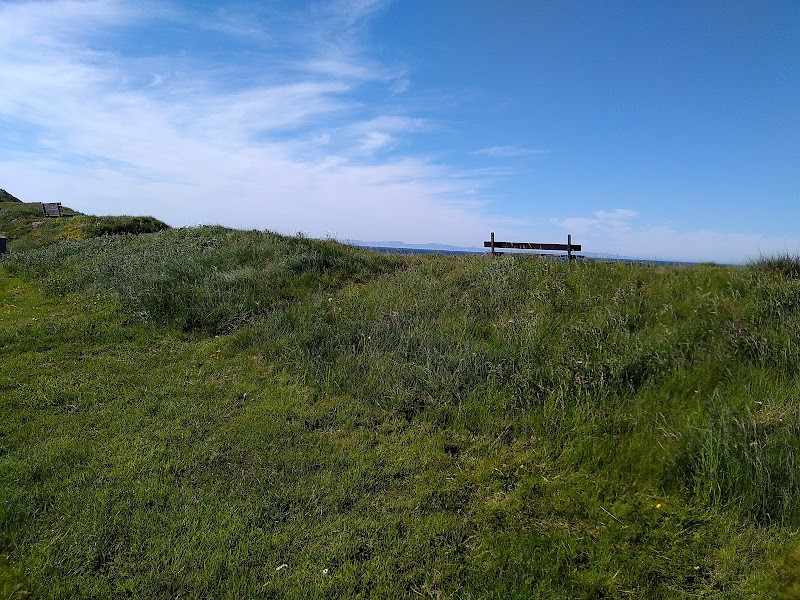
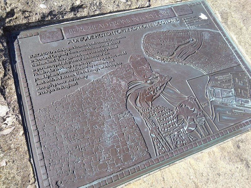
From Forres, the road east curves towards the coast. And at the end of a narrow promontory, caught between two sweeping bays, lie the buried remains of what was once the largest Pictish fort in Scotland. Most of Burghead Fort is gone — carved away by later development or lost to the sea — but what survives still hints at power.
It would’ve been vast in its time. Triple ramparts enclosed the headland, some built with interlocking stone blocks up to three metres thick. A single entrance faced inland, tightly controlled. The sea surrounded the rest. Strategically, it made sense: whoever held Burghead controlled not only the Moray Firth but the inland routes running west towards Forres and south into Speyside. Archaeologists believe it was more than a military outpost — possibly the royal centre of Fortriu, the most powerful Pictish kingdom in the seventh and eighth centuries.
Two things remain that help give shape to what’s otherwise been erased. The first are the Burghead Bulls — carved stone panels depicting horned cattle, found embedded in the old ramparts when the modern town was built in the 1800s. They’re thought to represent strength or tribal identity, and a few are now on display in the small visitor centre near the harbour.
The second is the underground well. Cut deep into bedrock and reached by steep stone steps, it’s unlike anything else on the trail. Some believe it was a ritual site, predating Christianity. Others see it as a baptistry or protected spring. Its original use may never be known, but its construction suggests deliberate planning and enduring significance. Access is by request — usually through the Bothy Bistro or the visitor centre itself. Ask politely, and you’ll likely be given the key.
Allow at least 45 minutes here. Walk the ramparts. Look out to sea. Even half-lost, this was once a centre of power. The trail doesn’t get much closer to the political heart of early Pictland than this.
Sculptor’s Cave
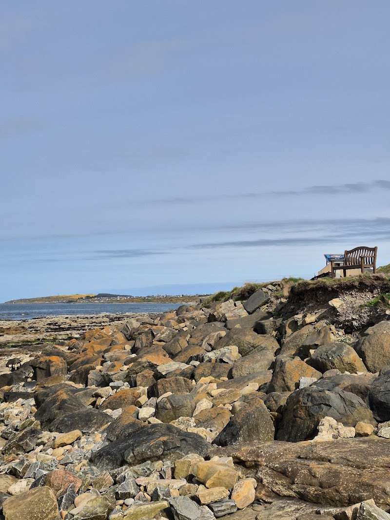
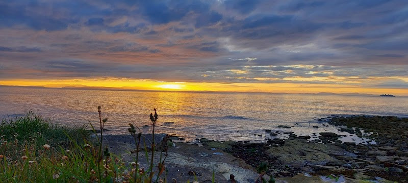
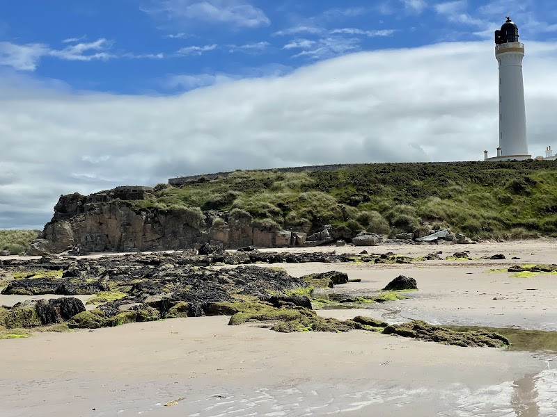
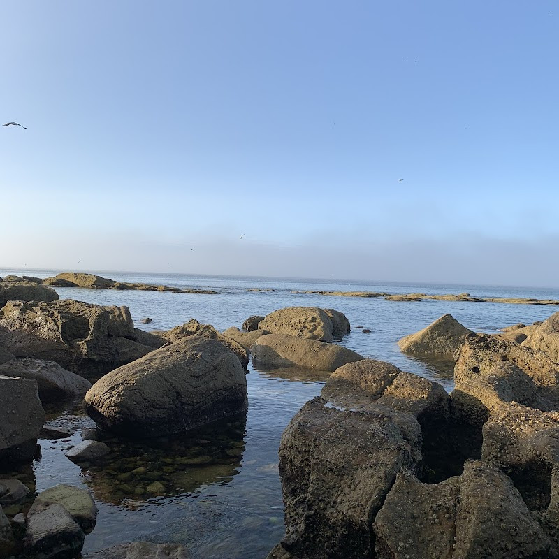
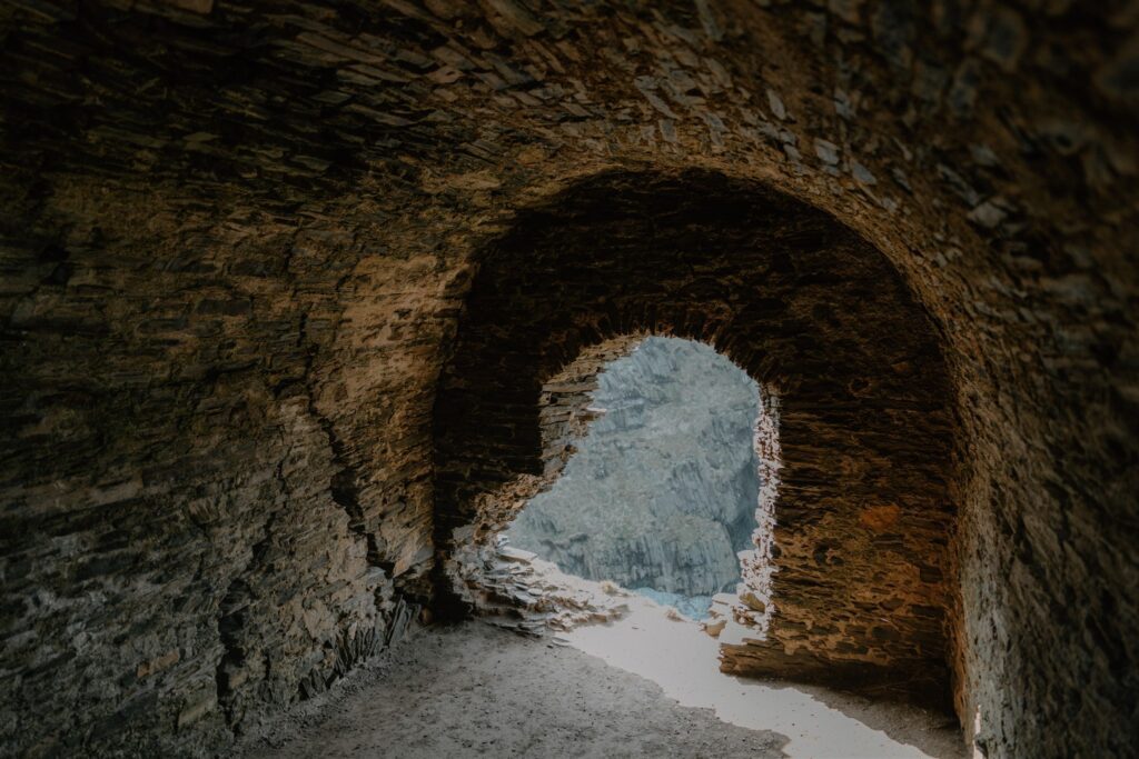
From Burghead, the route follows the coast eastwards, past Lossiemouth’s harbour and dunes, to a more hidden spot below the cliffs. The Sculptor’s Cave sits at the base of a sandstone headland west of Covesea. It’s tidal — only accessible at low water — and there’s no signage or barrier to entry. But if you time it right, this is the most atmospheric stop on the route.
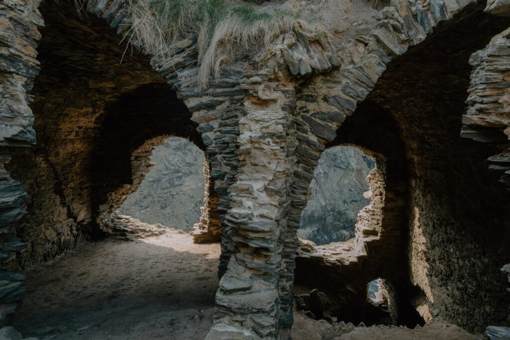
The cave itself is not large. Two arched openings face the sea. Inside, it’s dark and cool, the rock walls scored with natural erosion and, more faintly, manmade markings. High above the entrance are carvings — crescents, fish, and double discs — scratched into the stone sometime in the 6th or 7th century. These are classic Pictish symbols, and they give the cave its name. But the deeper history is older still.
Excavations in the 1920s and again in the 1970s revealed evidence of use dating back to the Late Bronze Age. Human bones had been deliberately placed in the cave, some showing signs of violence. At least one child had been decapitated. Whether this was ritual, punishment, or burial is unknown. In the Iron Age, people returned again — perhaps as part of seasonal ceremonies — before the cave fell quiet, and the Picts arrived with their symbols.
The theory now is that this wasn’t just a shelter. It may have been a place of transition — used for rites of passage, death, or memory. Its location supports this idea: cut off at high tide, open only for short windows, hidden below the line of the cliffs.
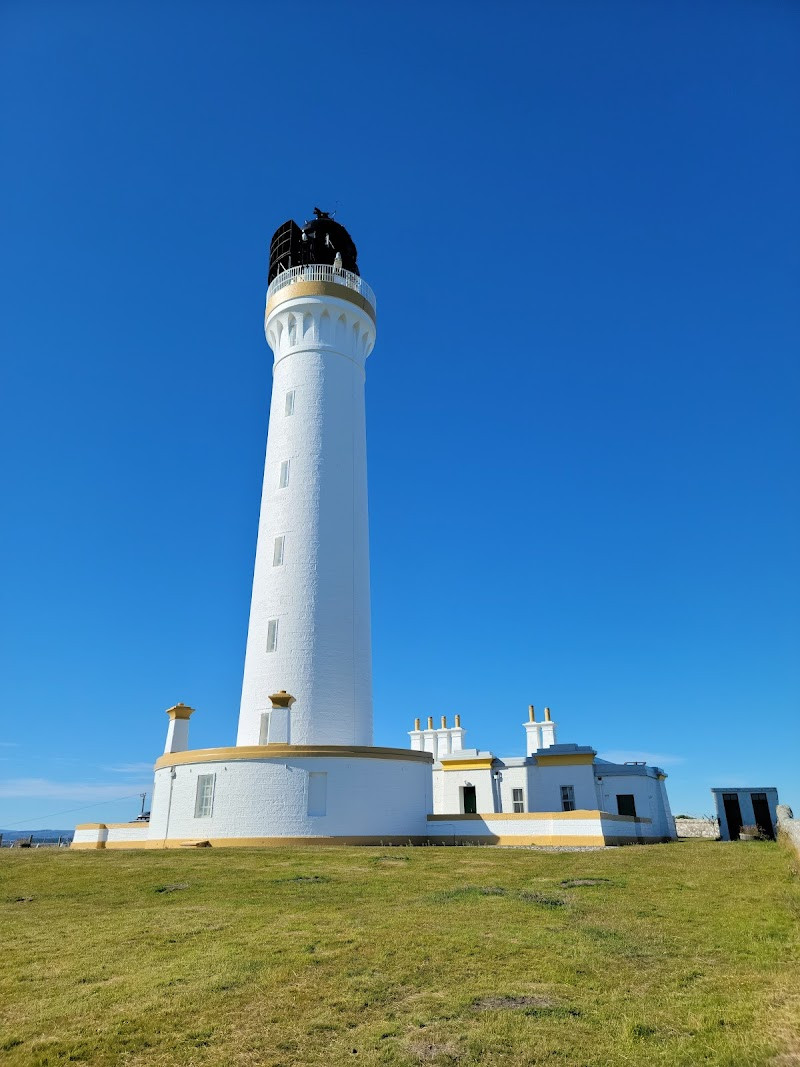
You’ll need to park near Covesea lighthouse and walk about 20 minutes along the shoreline. Take care — the rocks can be slick, and the tide comes in fast. Don’t attempt it in poor weather. But if conditions are right, this is where the trail feels closest to the world the Picts knew — raw, quiet, and half-shadowed.
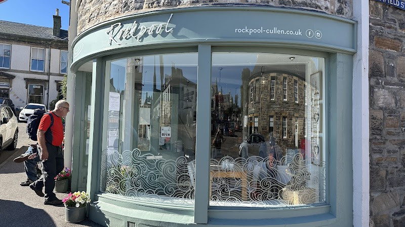
Lunch at Rockpool Café
From Covesea, the route leaves the Lossie coastline behind and swings east through Buckie and along the quiet B roads that skirt the edge of Cullen Bay. Cullen itself feels like a natural midpoint — not just geographically, but in pace. The town has long been shaped by the sea: once a fishing hub, later a resort, now a mix of locals, walkers, and visitors moving between the coast and the hills inland.
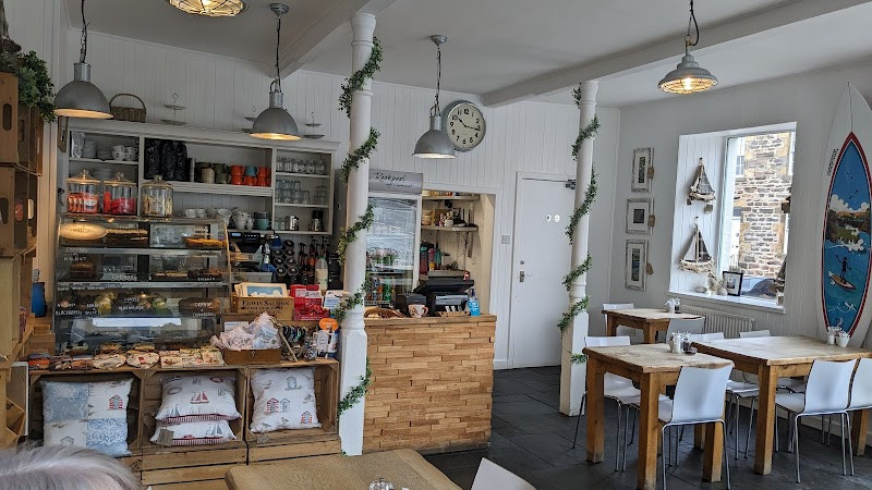
Tucked just off the main square is the Rockpool Café — a bright, unassuming stop with a reputation for Cullen Skink done properly: thick, smoky, and served with a warm roll. The menu’s short and straightforward — soups, sandwiches, daily specials — and the service moves without fuss. If the weather’s good, sit outside and watch the mix of dog walkers, families, and hillwalkers pass by, all arriving from different corners of Moray but ending up in the same queue for coffee.
This is also a good point in the day to reset. The drive from here begins to follow the edge of the land more closely — ruined castles, headlands, old harbours. If you’ve timed the day well, you won’t need to rush. Have a pot of tea. Take twenty minutes to walk the old railway viaduct that spans the town. It’s not part of the Pictish trail, but it tells its own story about how people have moved through this place — from fishermen and steam trains to heritage walkers and local schoolkids.
When you’re ready, the road continues along the cliffs to one of the best-known geological landmarks in the area — Bow Fiddle Rock.

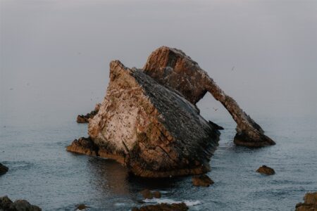
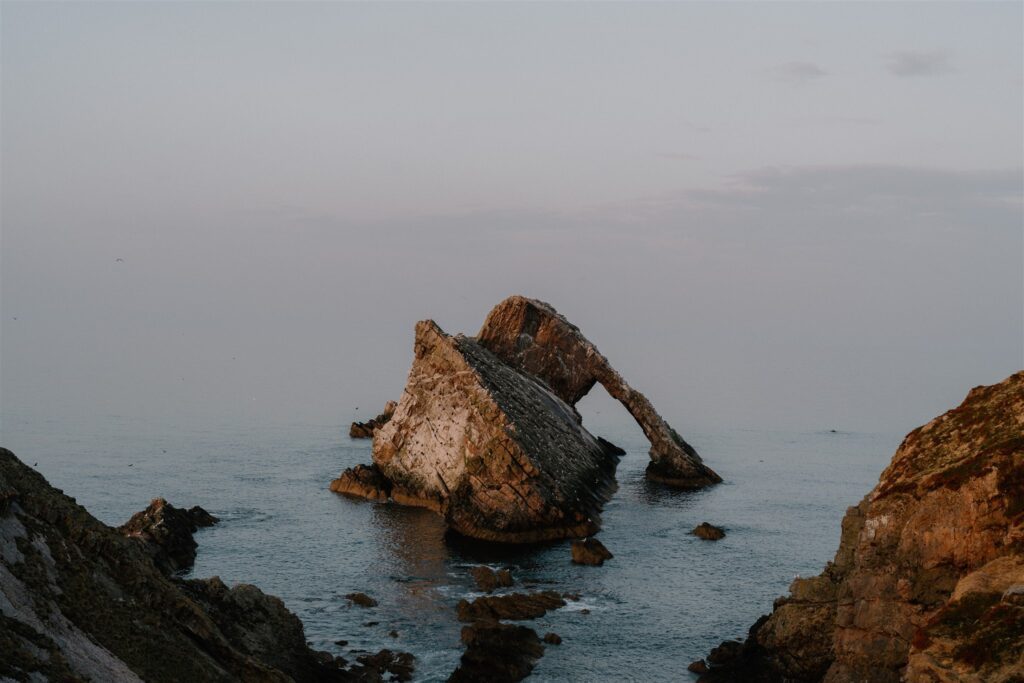
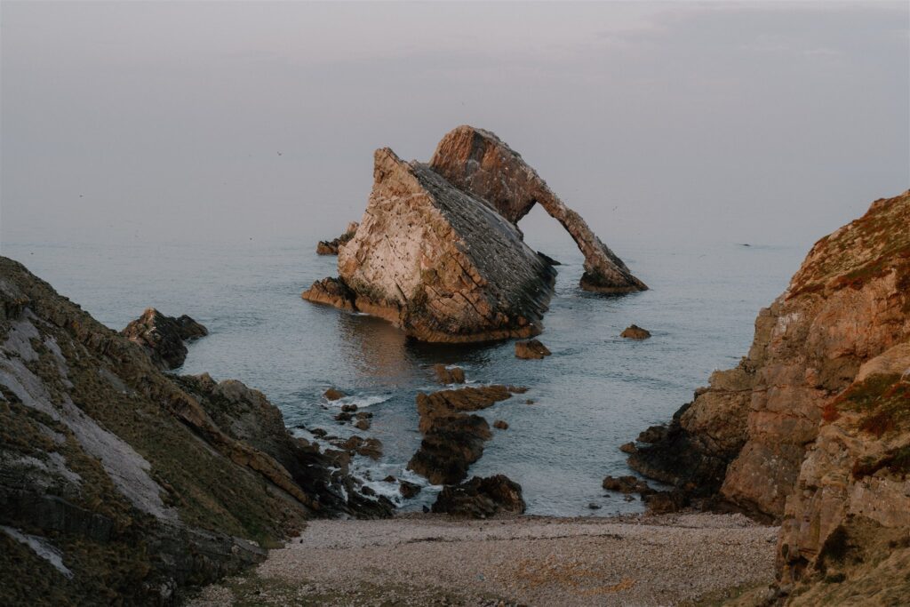
Bow Fiddle Rock
The road from Cullen to Portknockie takes minutes. The walking route between them — along the old railway line above the sea — takes longer, but rewards you with uninterrupted views over Cullen Bay, cliffs, and salt-stained outcrops. Just beyond the village edge, a short turn leads to a small car park on Admiralty Street. From there, it’s a few steps to the headland — and Bow Fiddle Rock.
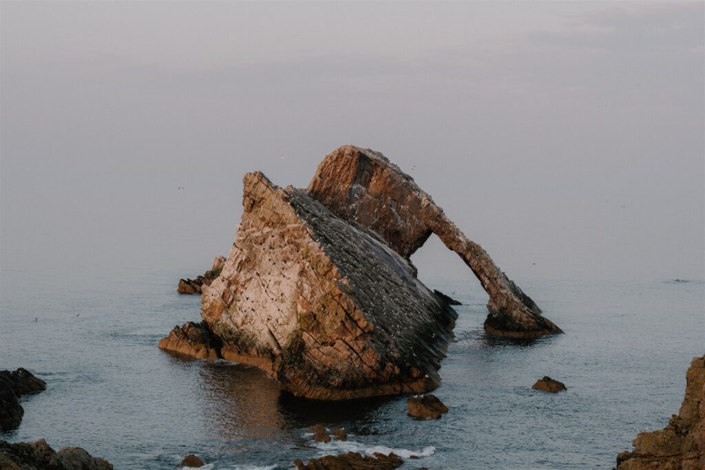
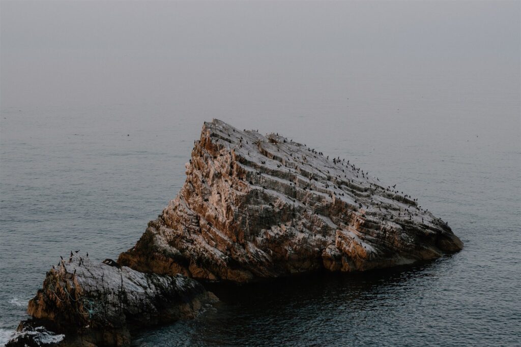
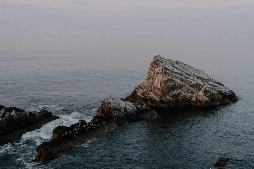
This quartzite sea arch rises just offshore, its angled shape said to resemble the tip of a fiddle bow. Formed by millennia of wind and surf carving through the coastal strata, it’s a geological landmark rather than a historical one. But it earns its place in the trail as a pause — a moment to look outward before the final stretch east.
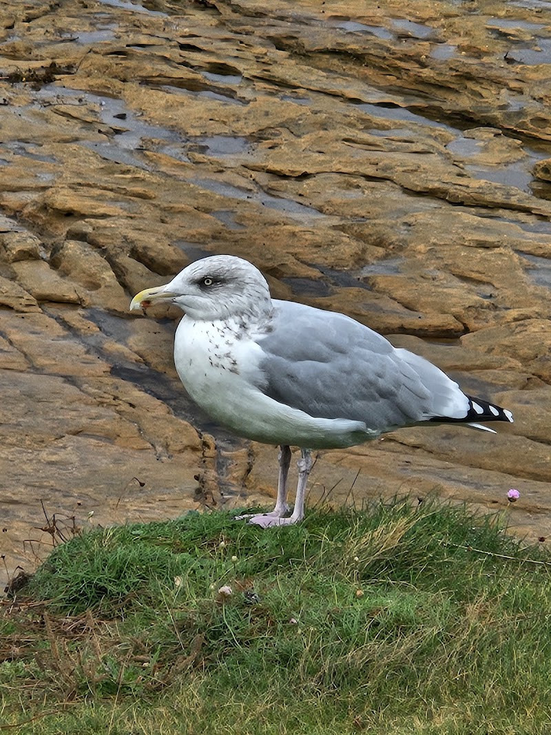
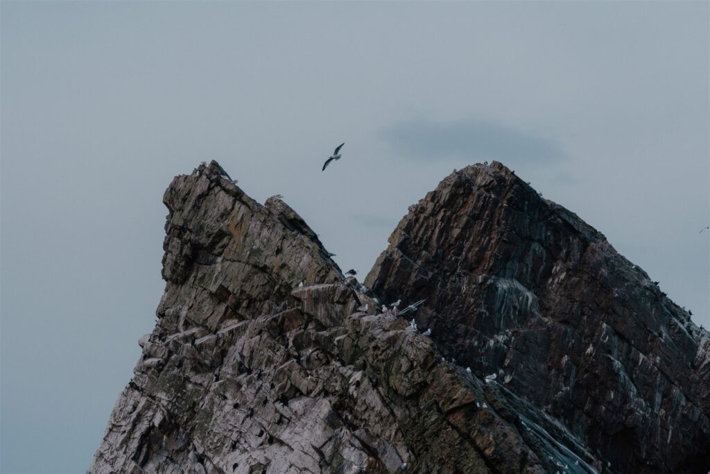
There’s no ancient carving here, but you’re standing above a coastline the Picts would have known well. This bay sits between major points on the Moray coast: Burghead behind you, the mouth of the Deveron ahead. Monks, traders, and seafarers would have crossed these waters long before towns like Portknockie existed in their present form. And the sea’s presence is constant — gulls overhead, spray drifting inland, the hollow sound of waves striking stone from underneath.
You can descend to the shingle beach below if the tide’s out, or stick to the upper path and take in the arch from above. Either way, it’s not a long stop. But it’s the right kind of intermission: elemental, unpeopled, and open-ended.
From here, the coast begins to harden again — cliffs turning to headlands, the houses thinning. The next stop is the shattered outline of Findlater Castle.

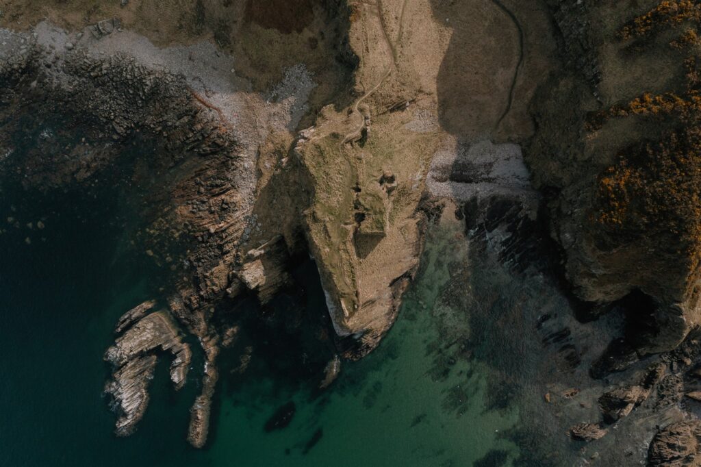
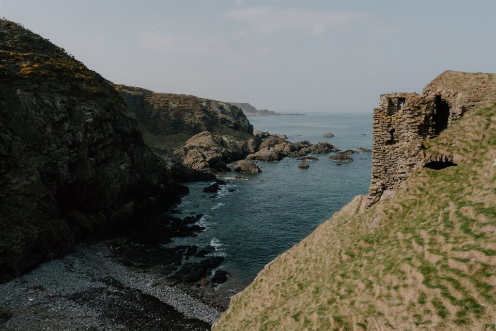
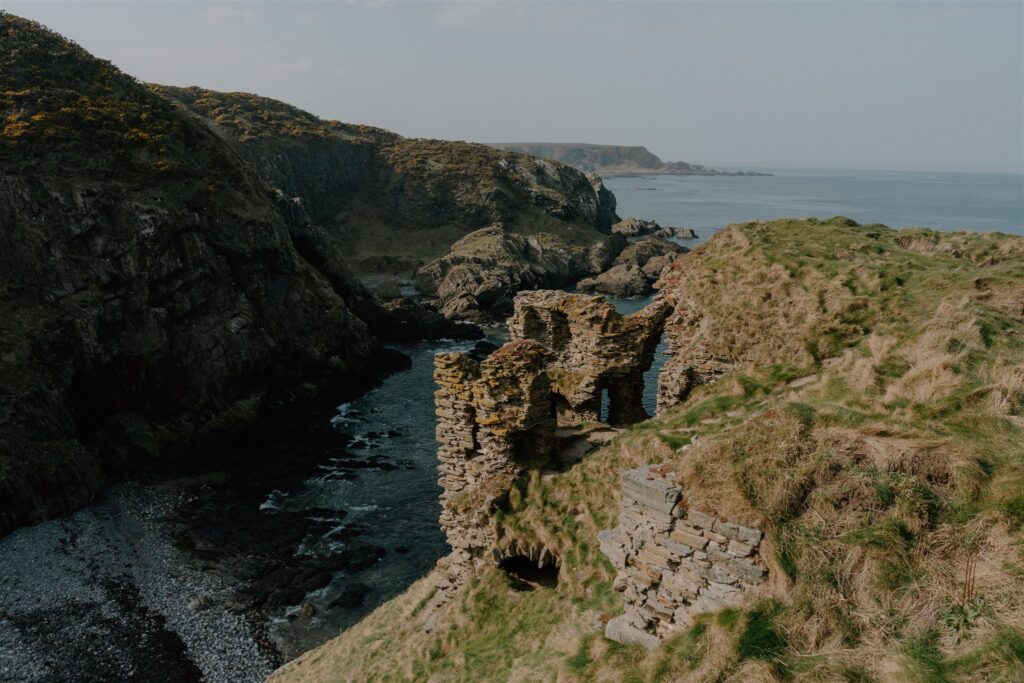
Findlater Castle
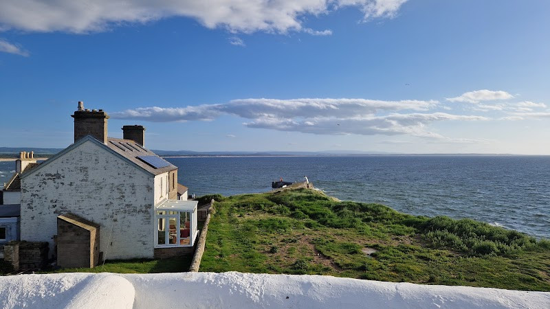
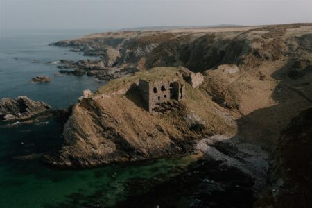
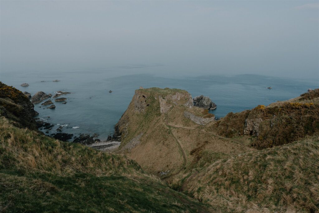
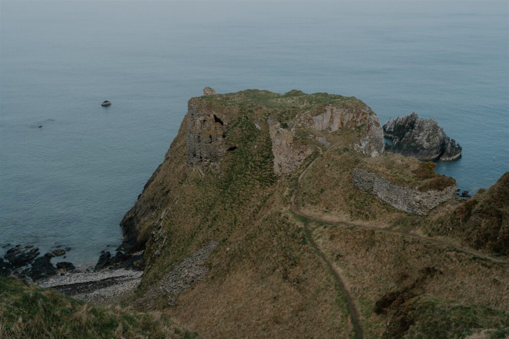
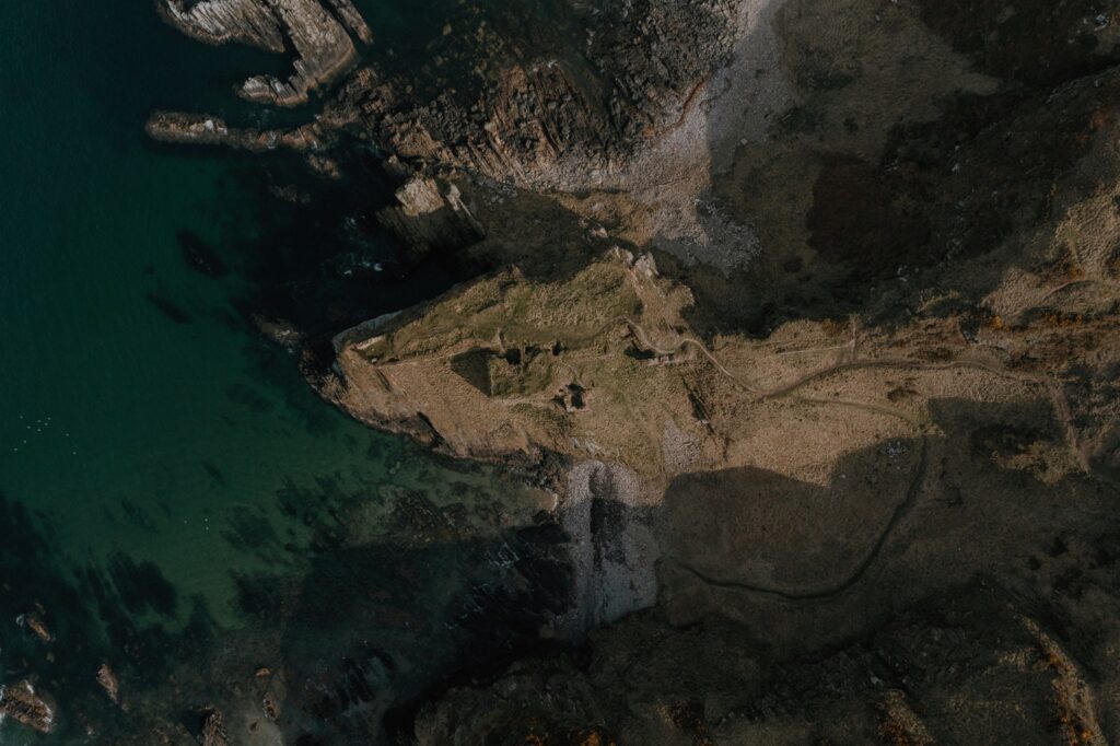
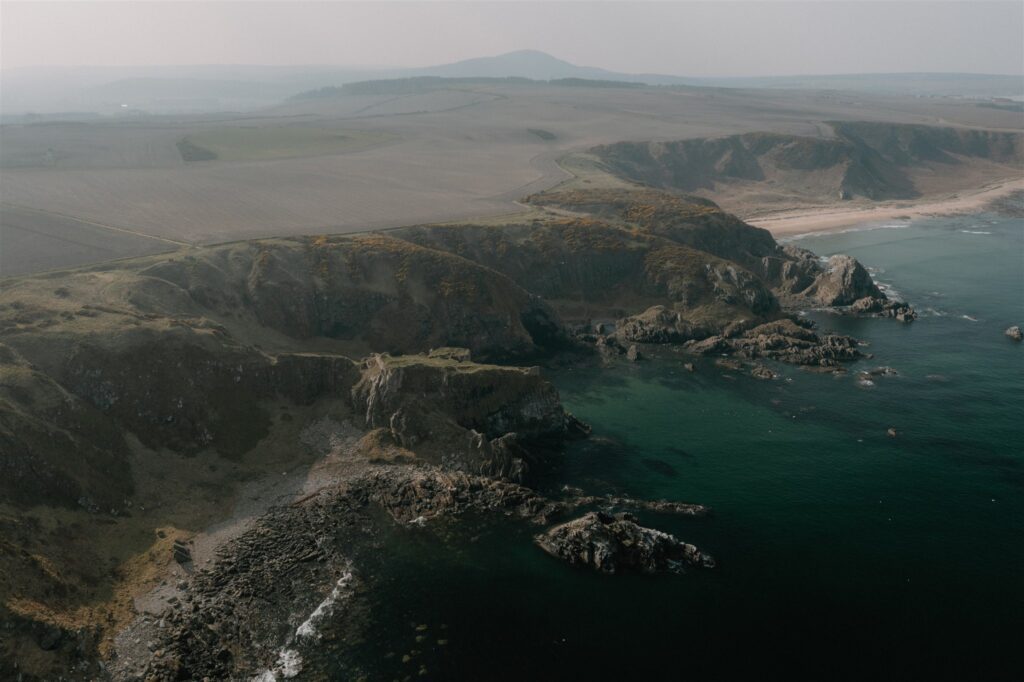
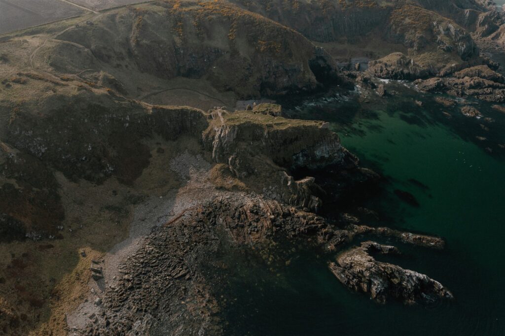
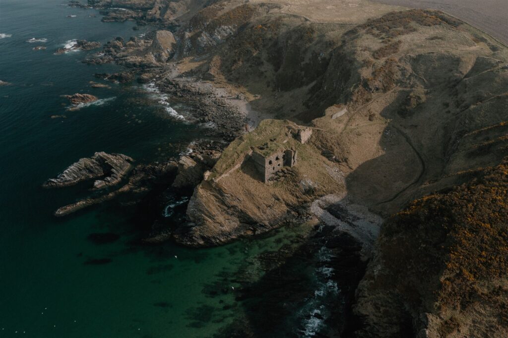
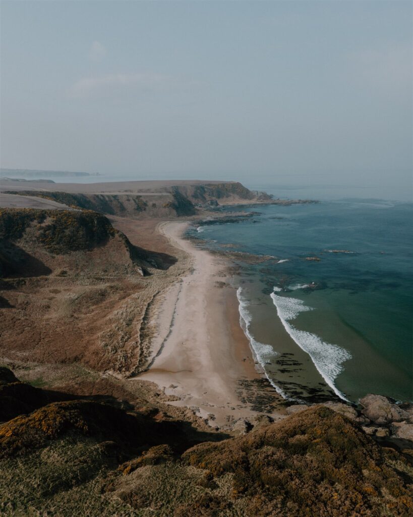
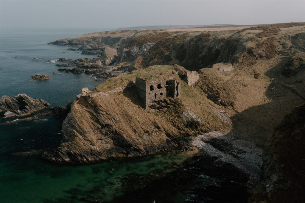
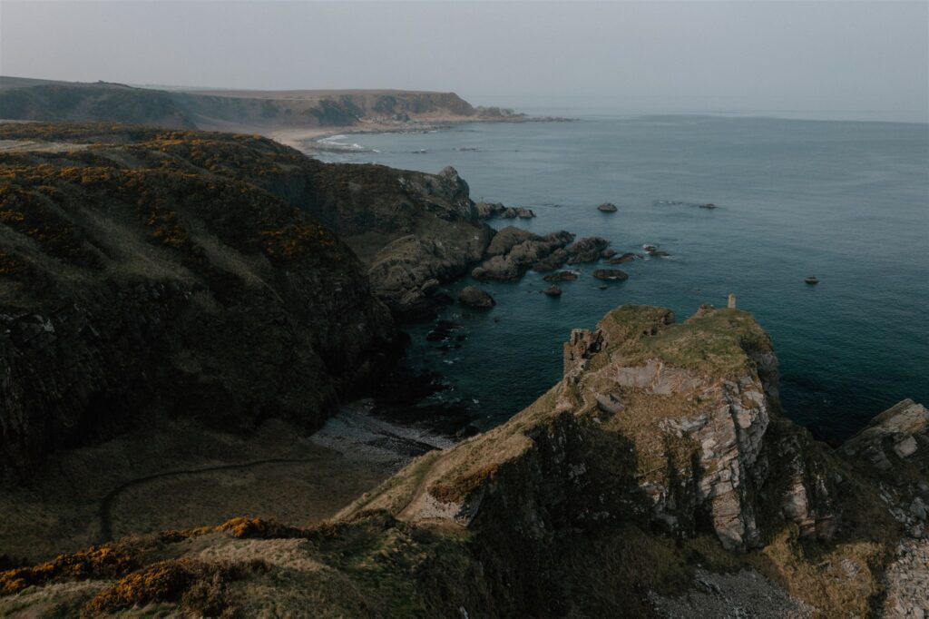
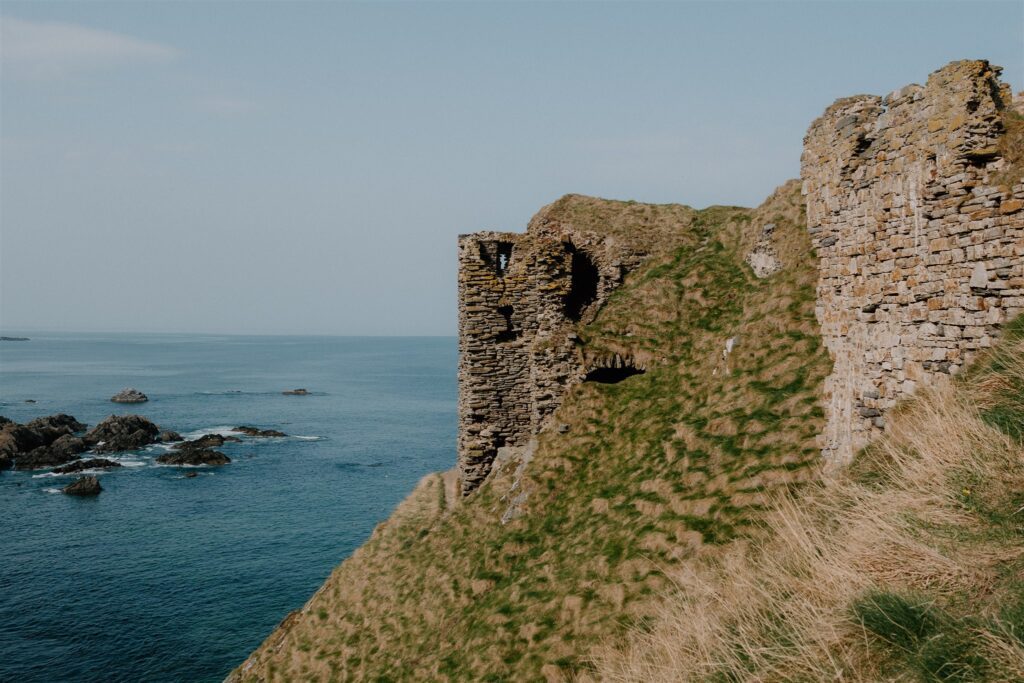
Perched on a narrow clifftop west of Sandend, the ruins of Findlater Castle seem stitched into the rock itself — grey stone rising from grey cliff, barely separated from the sea below. Little remains beyond broken walls and half-buried vaults, but the approach alone is worth the stop: a short walk along a farm track, through a gate, then onto a grassy slope that narrows to a spine above the waves.
The site itself dates mostly to the 14th and 15th centuries — a stronghold of the Ogilvies and once the scene of betrayal, siege, and family bloodshed. One laird was supposedly left to starve in his own dungeon by his son, who then took the title. It’s the kind of place that invites half-remembered stories, and much of what survives is fragmentary. But the location tells you more than the stone does.
This was a defensible place long before the medieval castle rose. Earlier promontory forts dotted this stretch of coastline — simple enclosures, sometimes nothing more than banks and ditches guarding the headland. Many were reused over centuries, changing shape with each wave of power that passed through. While no clear Pictish occupation has been confirmed here, the choice of site echoes theirs: control the high ground, face the sea, and watch who comes and goes.
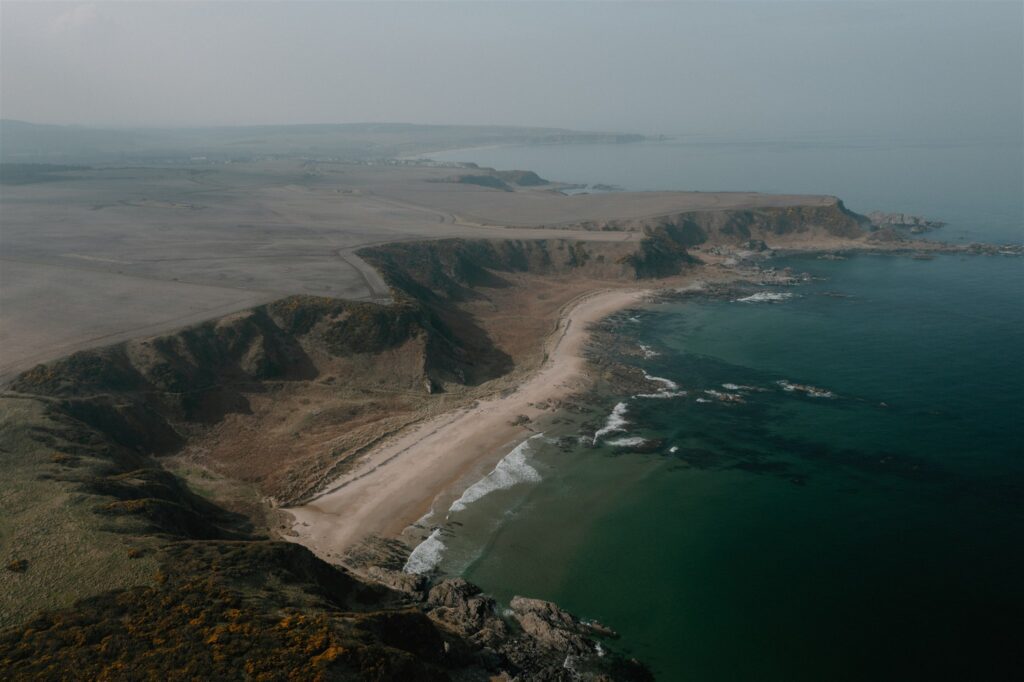
The cliffs here are steep, and care is needed near the edge. There are no railings, no markers, and nothing to stop you walking straight into the North Sea. But for those steady on their feet, the view back along the coast — Cullen, Portknockie, the curve of Bow Fiddle Rock behind you — is sharp and clear.
From here, it’s an easy drive east to Portsoy, where the trail ends by the harbour.
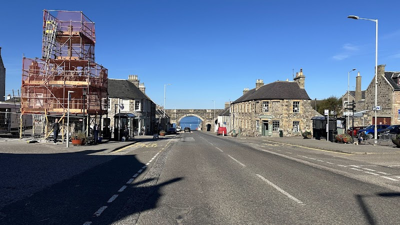
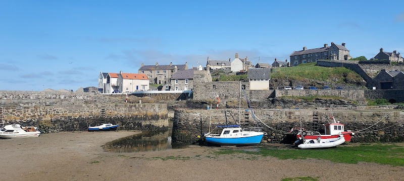
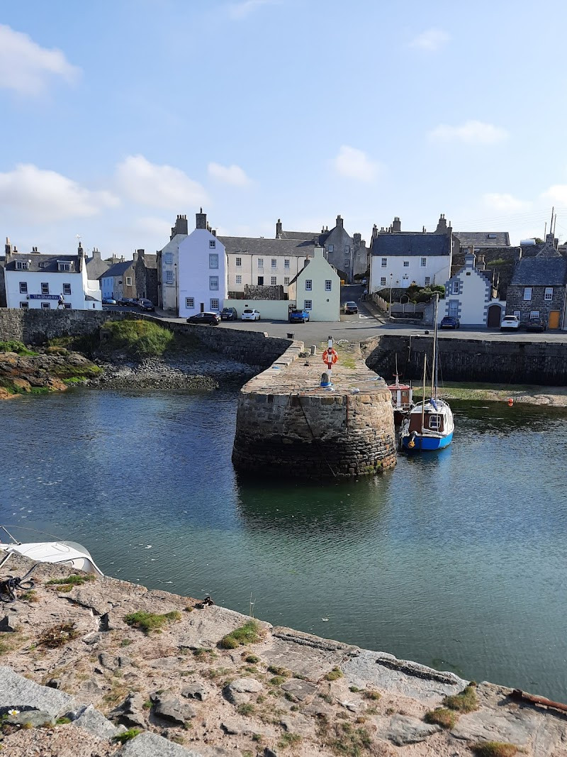
Portsoy
The road ends at the harbour — not just any harbour, but one of the oldest in Scotland still in working use. Built in the late 1600s, Portsoy’s curved stone basin has weathered centuries of North Sea wind, trade, and repair. The original stonework remains in place, patched in places, but largely intact — a rare survivor along a coast that has changed in almost every other way.
It’s a fitting place to end. There’s no plaque or monument marking the completion of your trail, just the quiet activity of a harbour town getting on with things. Small boats rise and fall on their moorings. Locals walk the breakwater. Visitors order haddock and chips from the nearby takeaway and sit facing the tide. You’re no longer in the symbolic world of carved stones and ritual sites — but you haven’t left it far behind, either.
In recent years, Portsoy has appeared on screen. The harbour featured in Peaky Blinders, and parts of the live-action remake of The Little Mermaid were also filmed here — drawn by the period stonework and the town’s ability to pass, convincingly, for a different time. You can see why. The place holds a stillness and texture that doesn’t feel staged.
The Salmon Bothy — just above the harbour — is worth a stop if open. Inside, local exhibitions tell the story of Portsoy’s past in fishing, quarrying, and seafaring, including its polished serpentine stone, often mistakenly called Portsoy marble.
There’s no rush now. Walk the headland. Order a pint. Watch the gulls. After fifty miles across Moray — from carved stones and coastal ruins to sea arches and cliff forts — Portsoy gives you time to sit still and let it all settle.
 Sign in with Google
 Sign in with Email