
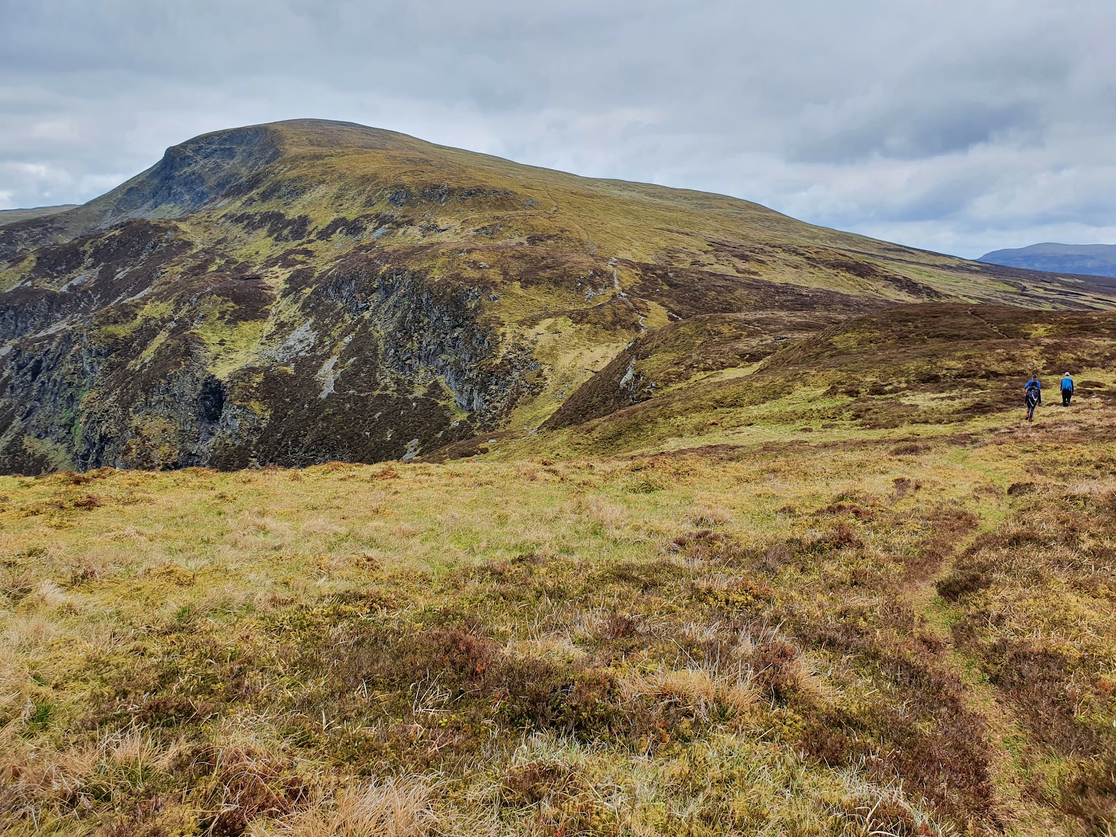
Ben Chonzie – Up the Invergeldie Glen to the Fence Line
8 miles · 4 to 5 hours · a hill · there and back
free parking
Ben Chonzie stands between Glen Lednock, above Comrie, and Glen Almond to the north, and rises to 930 metres.
Most people climb it from Invergeldie in Glen Lednock, up a glen track and a boggy hill path to an old fence line and the top, and back the same way. By our map it is about 12.7 km there and back with about 700 metres of climb, and it takes about 4 to 5 hours. The top is broad and featureless, a day for walkers who can find their way with a map and compass.
Where it starts
Start at the grass verge beside the Glen Lednock road at Coishavachan, just south of Invergeldie and about 4½ miles up the glen from Comrie, where the track to the hill leaves the road.
Is it for me?
Tap who is coming, or the day you have, for the answer on this walk.
Before you go
Getting there
No owner publishes a car park; by our map the verge is free to park on. It is small and busy on summer weekends and holidays: leave the track and the gates clear. From the western end of Comrie on the A85, follow the sign for Glen Lednock up the single-track road for about 4½ miles to Coishavachan, just before Invergeldie. No source read names a bus to the start.
On the path
About 4 to 5 hours there and back: about 12.7 km (8 miles) and 700 metres of climb by our map, from Coishavachan by Invergeldie in Glen Lednock to the 930 metre summit and back the same way. A stony track up the glen of the Invergeldie Burn, crossing small burns on stepping stones, then a boggy hill path that climbs steeply to an old fence line and along the broad ridge to the summit. A long moorland Munro of 930 metres with a featureless top: for older children used to hill days, with an adult who can navigate. The map to carry is OS Landranger 51, Loch Tay & Glen Dochart (1:50,000); OS Landranger 52, Pitlochry & Crieff (1:50,000) shows the country round it.
Good to know
All year in daylight, on a clear day with a good forecast. A dog that chases wildlife, birds or livestock must stay on the lead at all times, Mountaineering Scotland says; ground-nesting birds are most at risk from April to July. On the north side Auchnafree asks for dogs under strict control in lambing time, April and May. Under snow it is a winter mountain, and no avalanche forecast covers Ben Chonzie (the Scottish Avalanche Information Service forecasts six other areas). Deer may be stalked at any time of year, busiest in the first three weeks of October, Mountaineering Scotland says.
The walk
The usual way up Ben Chonzie starts in Glen Lednock above Comrie, at Coishavachan by Invergeldie, and comes back the same way. By our map it is about 12.7 km (8 miles) there and back, with about 700 metres of climb. Allow about 4 to 5 hours, more with stops, in poor weather or under snow, and leave plenty of daylight for the way down. A track climbs the glen of the Invergeldie Burn onto the moor. Then a boggy hill path climbs to an old fence line and follows it to the summit, 930 metres up. No public body publishes this way, a distance or a time for it. Other ways up come from Loch Turret to the east and from Glen Almond to the north; this walk keeps to Glen Lednock.
By car, turn off the A85 at the western end of Comrie, following the sign for Glen Lednock, and follow the narrow road up the glen for about 4½ miles. By our map the walk starts where a track leaves the road at Coishavachan, just south of Invergeldie. There is free parking on a grass verge beside the road there, by our map. It is small and can be busy on summer weekends and holidays, so arrive early and leave the track and the gates clear. The road is single-track all the way up the glen. No source read names a bus to the start, or toilets at it, so plan for none: Comrie is the village below the glen.
Before you set off, check the mountain forecast, and under snow the snow and avalanche conditions too, as Mountaineering Scotland advises for every trip. The weather can change quickly, and the hills are often much colder and windier than lower ground, Forestry and Land Scotland warns. Wear good walking boots and carry warm, waterproof clothing, plenty of food and drink, and a torch in case the day runs long. Carry a map and compass and know how to use them, and do not rely only on a phone or GPS. Mobile signal on the hill is not to be relied on. Mountaineering Scotland advises registering for the emergency text service before you go: text 'register' to 999 and follow the reply. Leave word with someone of where you are going and when you will be back.
The track runs north past the white houses of Coishavachan and through a gate, then up the glen of the Invergeldie Burn. It crosses the burn by a bridge and climbs more steeply through more gates. Higher up it drops to cross back over the burn below a small dam, then climbs the other side. Keep on the main track where it forks, and it climbs out onto heather moorland. By our map a small burn crosses it here with no bridge, on stepping stones. Soon after, a track goes off to the left, to the north: keep on up the broad southern slopes. A dog that chases wildlife, birds or livestock must stay on the lead at all times, Mountaineering Scotland says. Ground-nesting birds are most at risk from dogs from April to July.
About 4½ km up, by our map, before the top of the ridge, the hill path leaves the track on the left at a right-hand bend, by a small cairn. Keep to it: the track goes on east across the moor, not to the top. The path is boggy, crosses a small burn with no bridge and climbs steeply. Higher up it passes old stone grouse butts and a line of old metal fence posts. Then it turns sharply right along the broad ridge to the summit.
The top of Ben Chonzie is a broad, featureless plateau, and in low cloud walkers lose their way on it. Out on Scotland's hills there are no waymarks or signposts and paths can be hard to follow, Forestry and Land Scotland warns. This is where a map and compass count. If the cloud is coming down, the wind is rising or anyone is tiring, turn back: Forestry and Land Scotland asks walkers to turn back if they get tired, or if anything looks unsafe. Under snow it is a winter mountain, for walkers with winter skills, an ice axe and crampons. No avalanche forecast covers Ben Chonzie. The Scottish Avalanche Information Service forecasts six other areas, from Lochaber and Glencoe to the Cairngorms and Torridon. That is no sign there is no risk here.
The summit is 930 metres, by the Database of British and Irish Hills, with a large stone shelter on the top. Ben Chonzie has its part of Perth and Kinross to itself: the nearest Munro, Meall Greigh, is about sixteen kilometres to the north-west. Loch Turret and its dam lie on the Glen Turret side of the hill. The north side, in Glen Almond, is Auchnafree Estate, a working sheep farm and managed moorland. It asks for dogs under strict control in lambing time, April and May, and as little disturbance as possible to ground-nesting birds in May.
Deer are stalked on Scotland's hills, and stag stalking may now take place at any time of year, Mountaineering Scotland says. The first three weeks of October are the busiest, and hinds are stalked from 21 October to 15 February. Most stalking is on weekdays, and often there is none on a Sunday. In the busiest weeks, keep to well-known routes and ridges. No owner of the Glen Lednock side publishes its stalking dates. Auchnafree says its own deer management is busiest from September to February.
The way down is the way you came, back along the fence posts, down the hill path to the track and down the glen to the road. In cloud, check the line with your map and compass before you leave the top. In an emergency call 999 or 112 and ask for Police and then Mountain Rescue, Mountaineering Scotland advises. Give your location, ideally a six-figure grid reference and a named feature.
If it rains
None on this walk: in rain, low cloud or a high wind, leave the summit for another day. The top is broad and featureless, there are no waymarks on the hill, and Forestry and Land Scotland asks walkers to turn back if they get tired.
After the walk
Something to do with the rest of the day, nearest the end of the walk first.
With the rest of the day
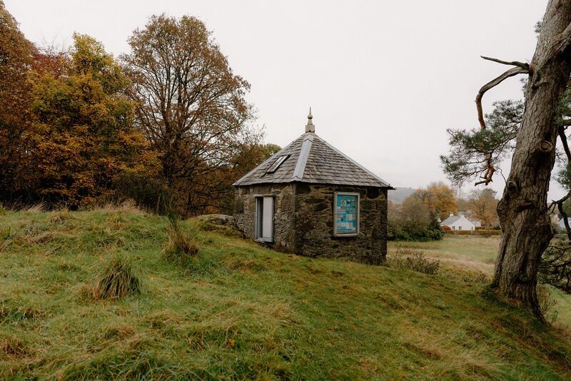 7 min by roadThings to doThe Earthquake HouseA tiny stone house of 1874 on a rock outside Comrie, the world's first building made to record earthquakes, with its old wooden seismometer still to be seen through the door.
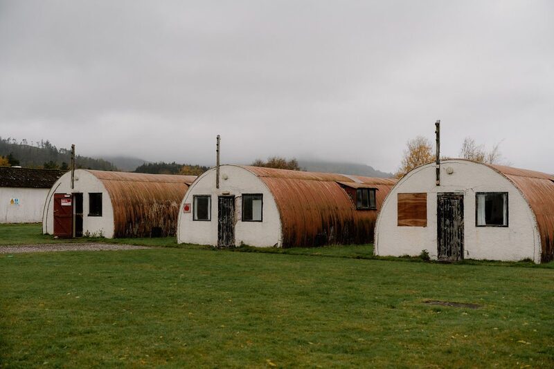 10 min by roadThings to doCultybraggan CampA Second World War prisoner of war camp at Comrie, one of the best preserved in Britain, its rows of Nissen huts bought by the village in 2007.
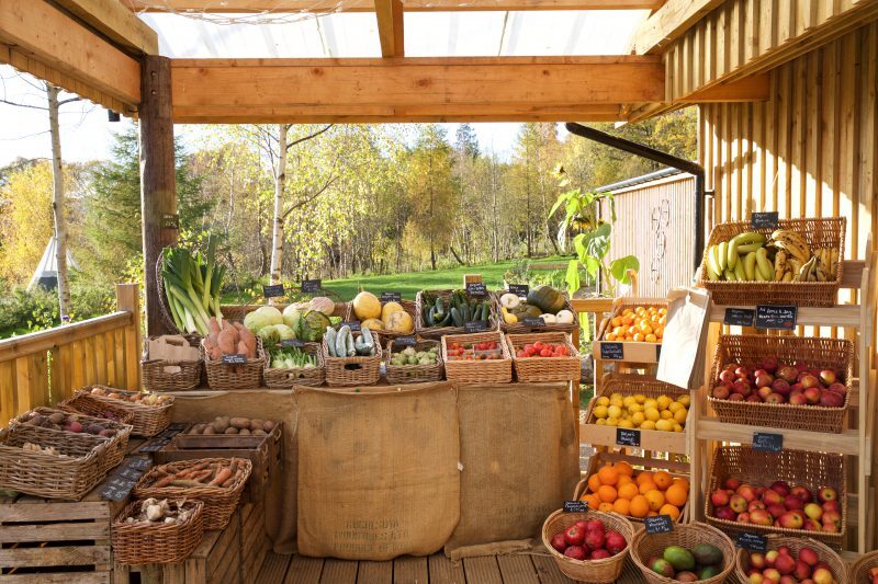 11 min by roadA shopComrie Croft Farm ShopA reimagined 231-acre farm between Comrie and Crieff, home to a farm shop, the Gorse Cafe, mountain bike trails, eco camping and a sauna.
Places to stay near the walk
Our places to stay nearest the start, by road.
An advert · Auchterarder
Whitehill Farm House
A 19th-century shepherd's farmhouse for eight on its own hill on the Colquhalzie Estate, three miles from Auchterarder and Gleneagles, looking south to the Ochil Hills.
Sleeps 8 · 29 minutes by road
See Whitehill Farm House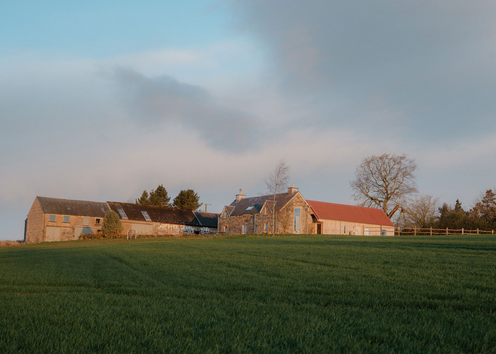
More walks near here
Within a short drive of the start.
Did this walk?
Tell the next person how it went. The best go on this page, with your name.
Find out more
For further reading, before you go.
- Safety and skills, Mountaineering Scotlandmountaineering.scot↗
- Calling for help, Mountaineering Scotlandmountaineering.scot↗
- Deer stalking and hill access, Mountaineering Scotlandmountaineering.scot↗
- Mountain access and safe hillwalking, Forestry and Land Scotlandforestryandland.gov.scot↗
- Public access on the north side, Auchnafree Estateauchnafree.com↗
- The Southeastern Highlands mountain forecast, the Mountain Weather Information Servicemwis.org.uk↗
- Avalanche forecasts, Scottish Avalanche Information Servicesais.gov.uk↗
Photograph by Arthur Marris via Google
Maps from OpenFreeMap © OpenMapTiles, data © OpenStreetMap contributors; heights from Mapzen's terrain tiles.