
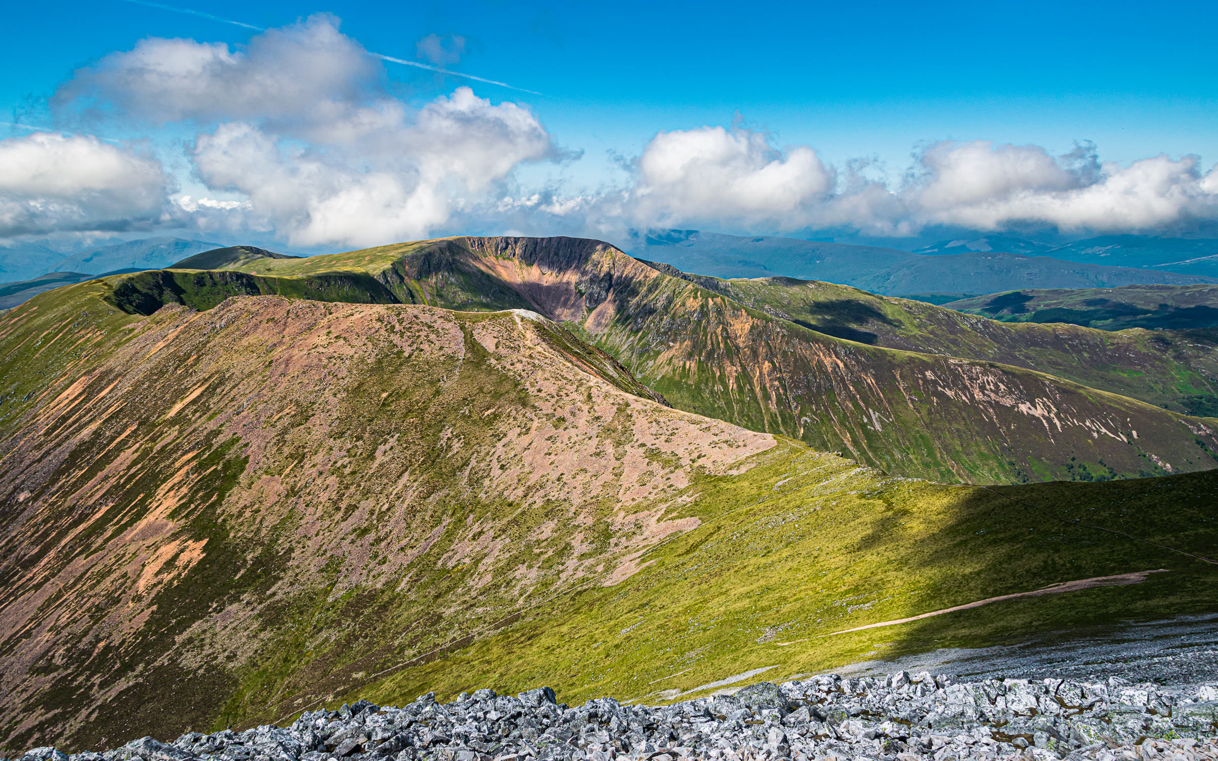
Mullach nan Coirean – By the Forest and the North-East Ridge
About 5½ miles on foot.
Mullach nan Coirean, 939 metres, is the westernmost Munro of the Mamores, above Glen Nevis.
The usual way up on its own starts at the Lower Falls, climbs through the Nevis Forest to the north-east ridge and follows the ridge to the summit. It comes back the same way. By our map it is about 9¼ km there and back with about 910 metres of climb, and it takes about 4½ to 5½ hours there and back, by our map's distance and climb. The ground is boggy by the fence and rough and bouldery high up, with crags near the summit. It is a day for experienced hillwalkers who can find their way with a map and compass.
- Time
- About 4½ to 5½ hours there and back, by our map's distance and climb: about 9¼ km (5¾ miles) and about 910 metres of climb by our map. From the Lower Falls car park in Glen Nevis through the Nevis Forest to the stile, then up beside the fence and the north-east ridge to the summit, 939 metres, and back the same way.
- The path
- A short way along the glen road, a path up the side of the forest, a forest road and a path through felled forest, hard going in stretches. Then a stile over the deer fence, a wet, boggy path beside the fence and a steep ridge, rocky and bouldery high up, with scree and crags near the summit.
- Where to start
- The Highland Council's Lower Falls car park, about 7 km up the Glen Nevis road from Fort William, just before the bridges over the Water of Nevis. Steven Fallon says there is a charge to park. OpenStreetMap marks a two-hour limit, and this walk takes 4½ to 5½ hours: check the signs.
- Set off
- By the Glen Nevis road from the roundabout at the north end of Fort William. Shiel Buses' route 41 is a limited summer service up the glen, and Scotland Off the Beaten Track says a seasonal bus stops at the Lower Falls: check the times and stops with the operator.
- When to go
- All year in daylight, on a clear day with a good forecast.
- Dogs
- A stile over the deer fence at the top of the forest. Keep dogs under close control on the hill, on a lead near livestock, and above all in the stalking season.
- Children
- About 9¼ km of rough walking with about 910 metres of climb, a boggy path by the fence, a steep, bouldery ridge and crags near the summit. The weather can close in fast. For children used to big hill days, with an adult who can navigate.
- Toilets
- The Highland Council lists composting toilets at the Lower Falls car park, open through the winter, with no disabled access. None on the hill.
- Before you set out
- Under snow it is a winter mountain, with crags near the summit; the Lochaber avalanche forecast does not name the Mamores, but the risk is here all the same. Stags may be stalked at any time of year, busiest in the first three weeks of October, and hinds from 21 October to 15 February, Mountaineering Scotland says.
The walk
The usual way up Mullach nan Coirean on its own starts at the Lower Falls car park in Glen Nevis and comes back the same way. It climbs through the Nevis Forest to the hill's north-east ridge and follows the ridge to the summit. By our map it is about 9.2 km (5¾ miles) there and back, with about 910 metres of climb. Allow about 4½ to 5½ hours there and back, by our map's distance and climb, more with stops, in poor weather or under snow. The summit is 939 metres up, and the car park only about 60 metres. No public body publishes this way, a distance or a time for it.
Mullach nan Coirean is the westernmost Munro of the Mamores, the range above Glen Nevis. Its granite gives it a red shade, Wikipedia says, against the pale quartzite of Stob Ban to the east. Many walkers join the two in a round, up Coire a' Mhusgain to Stob Ban and along the ridge to Mullach nan Coirean, or the other way. This walk takes the direct way up through the forest and the north-east ridge to the summit and back, and no further.
The Lower Falls car park is the Highland Council's, about 7 km up the Glen Nevis road from Fort William, just before the bridges over the Water of Nevis, Steven Fallon says. He says there is a charge to park. OpenStreetMap marks a two-hour limit, and this walk takes 4½ to 5½ hours: check the signs before you set off. Get Lost Mountaineering mentions some limited free parking nearby. The Highland Council lists composting toilets at the car park, open through the winter. A seasonal bus stops at the Lower Falls, Scotland Off the Beaten Track says: check the times with the operator.
Before you set off, check the mountain forecast: the Mountain Weather Information Service's West Highlands forecast covers the hills round Ben Nevis. It grows colder as you climb, about 1°C for every 100 metres, and the wind usually rises with height, MunroMagic says. Visibility can change markedly with the cloud level, it warns, and burns can rise markedly in a day. Carry a map and compass and know how to use them: MunroMagic says the way needs map reading and the ability to navigate with a compass. The Lochaber Mountain Rescue Team answers more than 150 call-outs a year.
From the car park walk back down the glen road about 300 metres, over a bridge, to a forest track opposite the cottages at Achriabhach. Just inside it a path leaves on the left and climbs the side of the forest to meet the upper forest road at a hairpin. Turn right along the forest road for about 750 metres by our map. A sign and a small cairn mark where a path leaves it on the left, Steven Fallon says.
The path climbs through felled forest. Forestry work over the years, with felling and regrowth, can make stretches below the stile hard going, Steven Fallon warns. Get Lost Mountaineering says felling closed the way in 2015 until it opened again in 2018: follow any forestry signs or diversions. At the top of the forest, about 2 km from the car park and about 310 metres up by our map, a stile crosses the high deer fence onto the open hill.
Above the stile the path follows the fence, wet and boggy, Steven Fallon says, and faint in places, another guide says. It is steep: by our map its steepest part, soon after the stile, rises about 55 metres in every 100. At about 640 metres the fence turns sharply away. Leave it and keep on up the north-east ridge, south-west. Higher up the ridge narrows and steepens and the ground turns rocky and bouldery, with the path picking a way round the roughest of it. If the cloud is coming down, the wind is rising or anyone is tiring, turn back here.
The ridge reaches the summit plateau at a small cairn. The path goes on round the rim of Coire Dearg, on your left, to the big summit cairn, 939 metres, about 250 metres further on, Get Lost Mountaineering says. Steep, stony slopes of red scree fall into the corrie: keep back from the edge. MunroMagic warns of crags near the summit, and of steep, stony and rocky slopes on or near the ways up.
In mist, mind the way off the summit. Four ridges leave it, Wikipedia says: east to Stob Ban, south-west to Meall a' Chaorainn, the long north ridge and the north-east ridge you came up. Check your line with your map and compass before you leave the cairn, and again where the path leaves the plateau for the ridge. If the cloud comes down, the wind rises or anyone is tiring, turn back by the way you came.
Under snow Mullach nan Coirean is a winter mountain, for walkers with winter skills, an ice axe and crampons. MunroMagic asks winter walkers to check the snow conditions with the avalanche service. The Scottish Avalanche Information Service's Lochaber forecast centres on Ben Nevis and the Aonach Mor range and does not name the Mamores. Its own reports have recorded large avalanches in the Mamores after a thaw: snow brings the risk here all the same.
Stags may be stalked at any time of year, busiest in the first three weeks of October, and hinds from 21 October to 15 February, Mountaineering Scotland says. Most stalking takes place on weekdays, and often none on a Sunday. The Heading for the Scottish Hills tables give no stalking information for Mullach nan Coirean, and MunroMagic points walkers to the Hillphones service for the area. Follow any signs, and if in doubt keep to the well-known way.
The way down is the way you came: down the north-east ridge and beside the fence to the stile, through the felled forest to the forest road, and down the path by the forest to the glen road. In an emergency call 999 or 112 and ask for Police and Mountain Rescue, Mountaineering Scotland says. Give a six-figure grid reference and a named feature if you can. Phone signal in the Highlands is often patchy: to be able to text 999, register first by texting the word register to 999.
If it rains
None on this walk: in rain, low cloud or a high wind, leave the summit for another day. The path is wet and boggy beside the fence and rough and bouldery high up, with crags near the summit.
Before you go
Book accommodation nearby
If you are staying over: here are ours nearest where the day starts and ends.
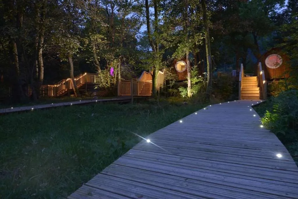
The nearest of ours is RiverBeds at Woodlands Glencoe, 8 miles away. Sleeps 2.
Find out more
For further reading, before you go.
- Mullach nan Coirean, the Munro page, Hidden Scotland↗
- Heading for the Scottish Hills: stalking in the Central Highlands, Outdoor Access Scotlandoutdooraccess-scotland.scot↗
- Deer stalking, Mountaineering Scotlandmountaineering.scot↗
- Calling for help, Mountaineering Scotlandmountaineering.scot↗
- The West Highlands forecast, the Mountain Weather Information Servicemwis.org.uk↗
- The Met Office's forecast for the summit of Mullach nan Coireanweather.metoffice.gov.uk↗
- The Lochaber avalanche forecast, Scottish Avalanche Information Servicesais.gov.uk↗
Maps from OpenFreeMap © OpenMapTiles, data © OpenStreetMap contributors; heights from Mapzen's terrain tiles.