
Meall Corranaich – Up the Old Fence Posts to the Top
4 miles · 2½ to 3½ hours · a hill · there and back
Meall Corranaich, 1,067 metres, stands at the western end of the Ben Lawers range, above Lochan na Lairige.
The usual way from the hill road goes up from the north end of the lochan, across the slope and up the hill's broad south-west shoulder to the summit, and back the same way. By our map it is about 6.7 km there and back with about 540 metres of climb, and it takes about 2.5 to 3.5 hours. The lower ground is boggy, the last climb is steep and the broad top is confusing in mist: it is for hillwalkers who can find their way with a map and compass.
Where it starts
A small parking place at the side of the hill road between Loch Tay and Glen Lyon, by a big cairn at the north end of Lochan na Lairige, grid reference NN 593 415 by our map.
Is it for me?
Tap who is coming, or the day you have, for the answer on this walk.
Before you go
Getting there
The parking place has room for only a few cars; Steven Fallon names more parking just above the north end of the lochan, about 400 metres back by our map. Never park in a passing place. The start is reached by the hill road from the A827 by Loch Tay, east of Killin, or from Bridge of Balgie in Glen Lyon, about 7 km to the north by our map. The road is one lane wide with few places to pass, unsuitable for caravans and other large vehicles, and not kept open in winter.
On the path
About 2½ to 3½ hours there and back: about 6.7 km (4 miles) and 540 metres of climb by our map. From the hill road at the north end of Lochan na Lairige across the slope and up the south-west shoulder to the summit, 1,067 metres, and back the same way. A gravel path through heather with bog beside it, then a rough hill path across boggy ground, fainter in places, and a steep climb on grass and stones up a broad shoulder, by the line of old fence posts, to a summit cairn that is easy to pass, with crags near the top. A short Munro of about 6.7 km, but still a mountain over 1,000 metres, with bog, a steep last climb and a broad top where mist comes in fast: for children used to hill days, with an adult who can navigate. The map to carry is OS Explorer OL48, Ben Lawers & Glen Lyon (1:25,000); OS Landranger 51, Loch Tay & Glen Dochart (1:50,000) shows the country round it.
Good to know
Summer and early autumn in daylight, on a clear day with a good forecast, and after a dry spell, when the bog is at its firmest. The National Trust for Scotland asks walkers to keep dogs under control on the hill, which much of the path crosses inside its nature reserve. There are no toilets at the parking place by our map, and none on the hill. Under snow it is a winter mountain: no avalanche forecast covers it, a cornice can form on the east side of the ridge and escape to the east is inadvisable, most incidents in the area come from slipping on hard snow without crampons. The broad top is confusing in mist. Deer stalking can take place at any time of year, busiest in the first three weeks of October, with hinds from 21 October to 15 February.
The walk
The usual way up Meall Corranaich from the hill road between Loch Tay and Glen Lyon starts at the north end of Lochan na Lairige. A path climbs through the heather, crosses the slope above the lochan and goes up the hill's broad south-west shoulder to the summit. By our map it is about 6.7 km (4 miles) there and back, with about 540 metres of climb. Allow about 2.5 to 3.5 hours, more with stops, in poor weather or under snow. The summit is 1,067 metres up, and the walk starts about 550 metres up. Much of the lower ground is boggy, the last 500 metres or so are steep, and the broad top is confusing in mist. No public body publishes this way up, a distance or a time for it. Others climb the hill from the National Trust for Scotland's car park further down the road, by Coire Odhar and a steep shoulder: Munro Magic and Steven Fallon give that way. Many walkers add Meall a' Choire Leith, a Munro of its own about 3 km to the north: this walk keeps to Meall Corranaich.
The start is a small parking place at the side of the hill road, by a big cairn, at the north end of Lochan na Lairige. By our map it is at grid reference NN 593 415, about 7 km up the road from Bridge of Balgie in Glen Lyon. One of Munro Magic's readers calls it the start the Scottish Mountaineering Club's guide recommends. It has room for only a few cars: he found space for just two. Steven Fallon says there is more parking just above the north end of the lochan, where a track leaves the road for the water's edge. Never park in a passing place. The road is one lane wide with few places to pass, and Steven Fallon calls it unsuitable for caravans and other large vehicles. It is ungritted in winter, he says, and Undiscovered Scotland says it is not kept open in winter conditions. Our map shows no toilets at the start.
Before you set off, check the mountain forecast: the Mountain Weather Information Service's Southeastern Highlands and West Highlands forecasts both reach this far. Conditions on the hills are often much colder and windier than down by the loch, Forestry and Land Scotland warns. Wear good walking boots, waterproof ones for the bog, and carry warm, waterproof clothing, plenty of food and drink, and a torch. Carry a map and compass and know how to use them, and do not rely only on a phone or GPS. If you have not been trained to use them in poor visibility, plan to turn back early by a safe route, Killin Mountain Rescue Team advises. Leave word with someone of where you are going and when you will be back. Deer stalking can take place at any time of year, Mountaineering Scotland says, busiest in the first three weeks of October, with hinds from 21 October to 15 February. Find out before you go.
From the parking place walk a few metres back along the road towards the lochan, where a gravel path leaves it on the left. It climbs north through the heather, and by our map bog lies close beside it. Walkers who cut straight up behind the cairn have found a rough trudge through boggy tussocks before they met the path, so keep to it from the road. About 500 metres out, about 610 metres up, the path forks. The path straight on, north-east into Gleann Da-Eig, is the way to Meall a' Choire Leith. For Meall Corranaich bear right, south-east.
The path runs south-east and then south across the slope above Lochan na Lairige, between about 600 and 700 metres up. By our map it crosses patches of bog, and it is fainter on the ground here than above and below. Much of the way lies in the Ben Lawers National Nature Reserve, and the hill's fragile mountain plants are easily damaged. The National Trust for Scotland, which owns the hill, asks walkers to keep to the path as far as possible and to keep dogs under control.
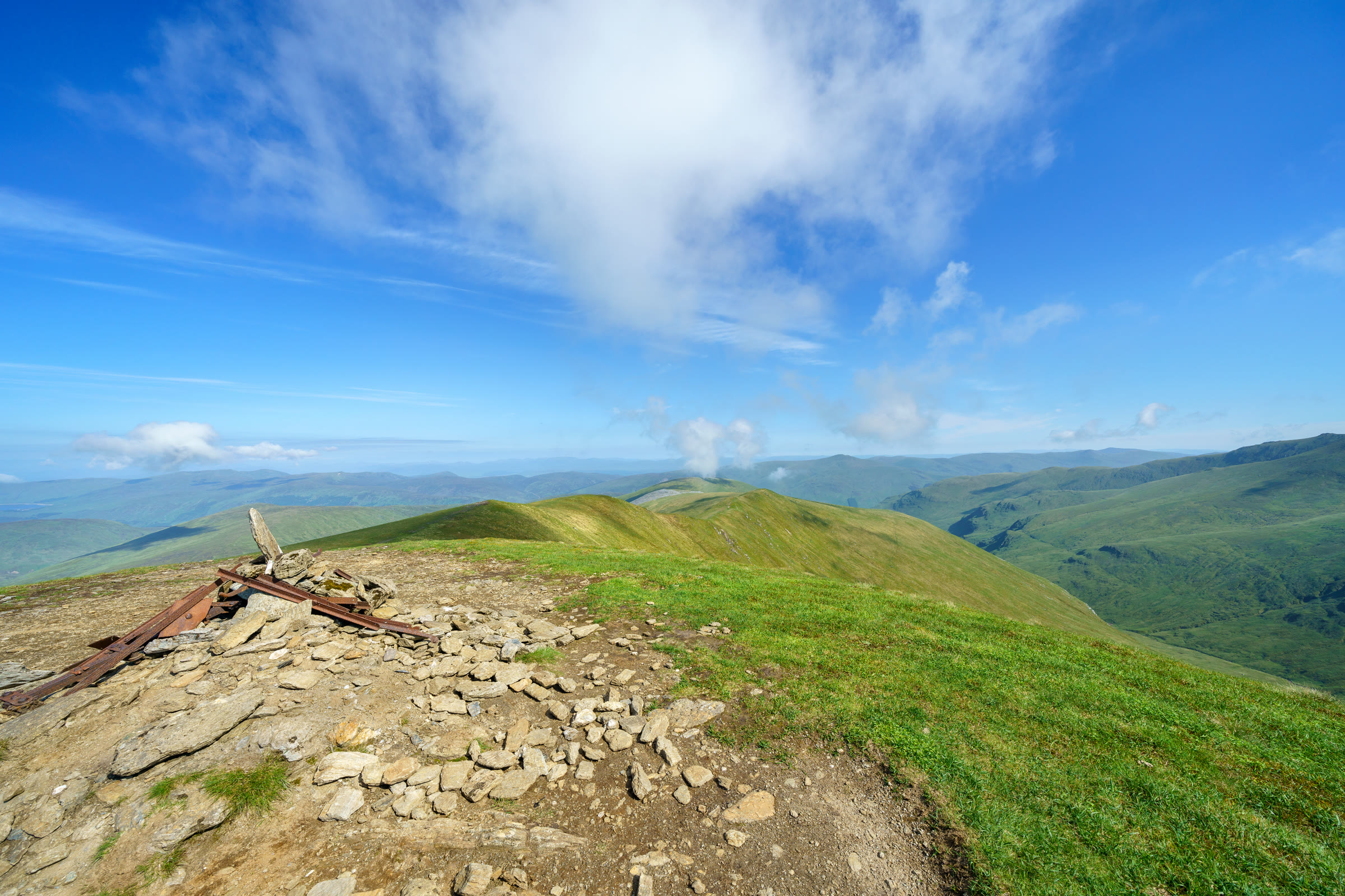
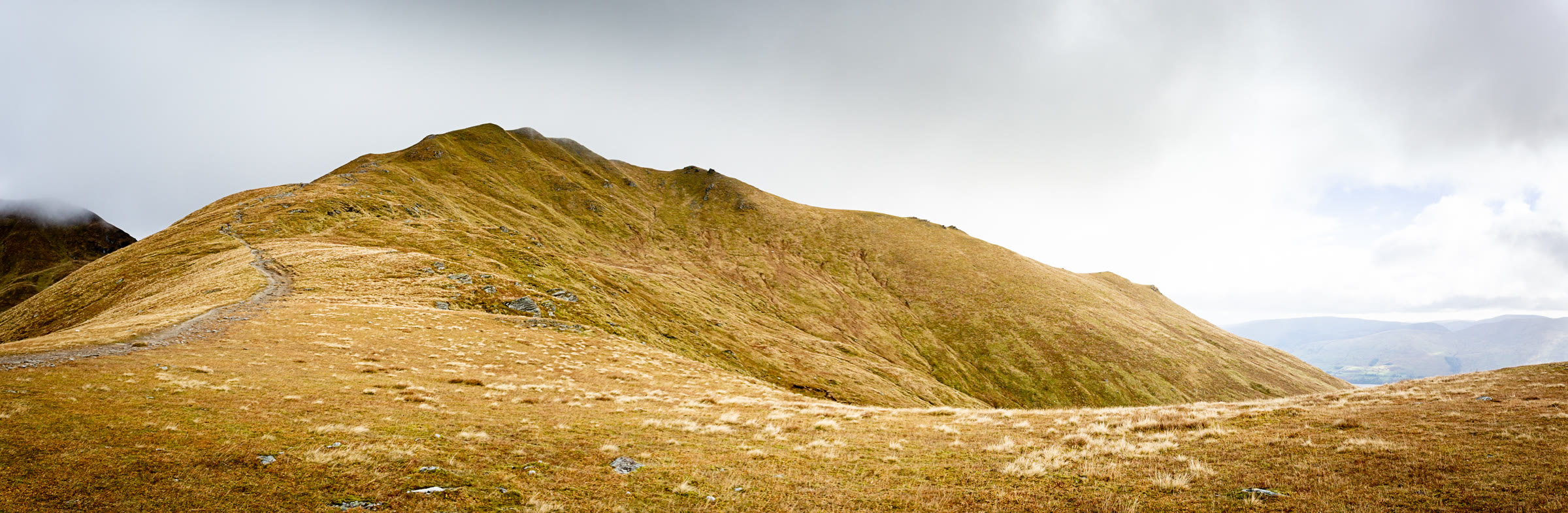
About 1.9 km out, about 710 metres up by our map, the path bends east and begins to climb the broad south-west shoulder of the hill. Munro Magic's readers follow a line of old fence posts on the hill to the summit; one calls it a sure way up, if a roundabout one. The climb steepens as it goes: by our map the last 500 metres or so rise more than 30 metres in every 100, on grass and stones. Another reader found the ascent steep but the path well defined.
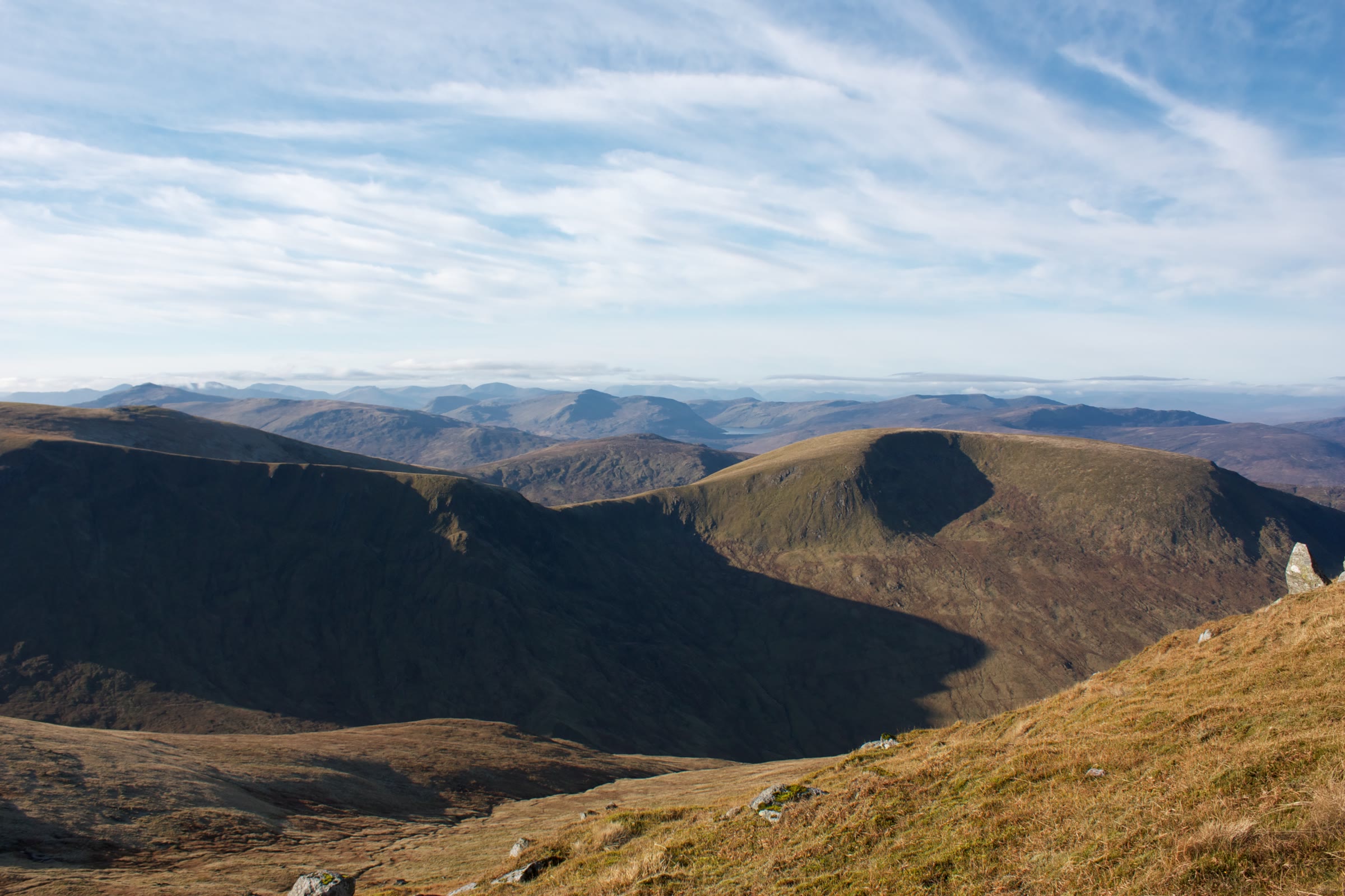
The summit, 1,067 metres up and about 3.3 km out by our map, is a small cairn beside the line of old iron fence posts on a broad, grassy crest. It is easy to miss: one walker went right past it, taking it for a marker cairn. Munro Magic warns of crags near the summit, and by our map small crags lie about 250 metres to the east, on the steep ground falling to Coire Odhar. In winter a cornice can form on the east side of the ridge, In Callander warns. Keep well back from that edge, and never try to come off the hill to the east. On a clear day the views run along the Ben Lawers range, to Beinn Ghlas and Ben Lawers, and north to Meall a' Choire Leith and the hills above Glen Lyon.
In winter or thick mist, navigation on these hills can be quite testing, Steven Fallon says, and the path south-west off the summit, the way home, is the fainter one. The broad, rounded tops are disorienting in cloud, one guide warns, and Munro Magic's readers tell of walkers taking the wrong ridge in mist. Before you leave the summit, take a bearing south-west for the path. If the cloud comes down, the wind rises or anyone is tiring, turn back by the way you came: Forestry and Land Scotland asks walkers to turn back if they get tired.
Under snow it is a winter mountain. Most incidents in its area, Killin Mountain Rescue Team says, come from people slipping on hard snow without crampons or losing their way in mist. Crampons may be needed on icy slopes, one guide says. No avalanche forecast covers the hill. The Scottish Avalanche Information Service forecasts six other areas, from Lochaber and Glencoe to the Cairngorms and Torridon, which is no sign there is no risk here. In snow the hill road itself may be impassable, as it is not gritted or kept open.
The way down is the way you came: south-west off the summit and down the shoulder, then north across the slope to the fork, where the path from Gleann Da-Eig joins from the right. Then it runs down through the heather to the road, and a few metres along it to the parking place. If someone is hurt, call 999 or 112 and ask for Police and Mountain Rescue, Mountaineering Scotland says. Give a six-figure grid reference and a named feature if you can. To be able to text 999 where a call will not connect, register first by texting the word register to 999.
If it rains
None on this walk: in rain, low cloud or a high wind, leave the summit for another day. After rain the lower path is boggier still. The top is broad and the path off it south-west is faint: if the cloud comes down, turn back by the way you came.
After the walk
Something to do with the rest of the day, nearest the end of the walk first.
Places to stay near the walk
Our places to stay nearest the start, by road.
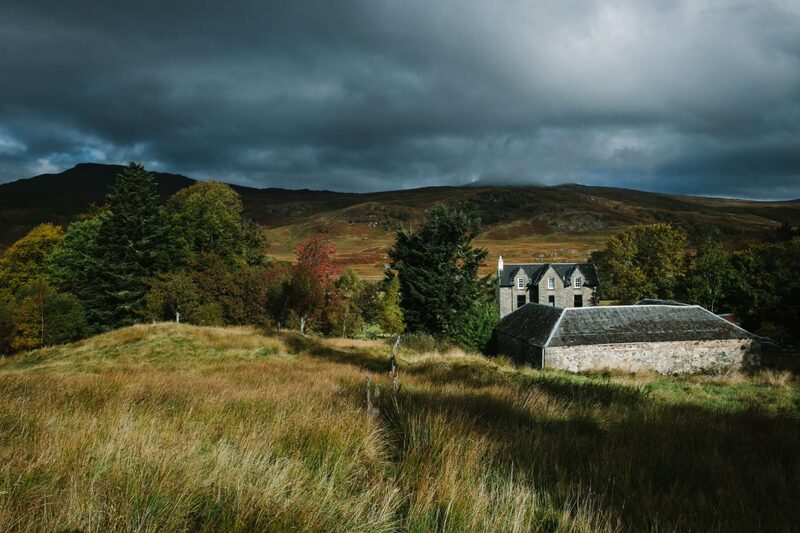
None of ours is close to the start. The nearest is Suie Hunting Lodge in Luib, 16 miles from the start. An advert.
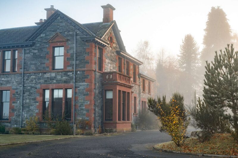
Then The House at Dun Aluinn in Aberfeldy, 23 miles from the start. Sleeps 18.
More walks near here
Within a short drive of the start.
Did this walk?
Tell the next person how it went. The best go on this page, with your name.
For further reading, before you go.
- Meall Corranaich, the Munro page, Hidden Scotland↗
- Mountain access and safe hillwalking, Forestry and Land Scotlandforestryandland.gov.scot↗
- Southeastern Highlands forecast, Mountain Weather Information Servicemwis.org.uk↗
- West Highlands forecast, Mountain Weather Information Servicemwis.org.uk↗
- Avalanche forecasts, Scottish Avalanche Information Servicesais.gov.uk↗
- Deer stalking, Mountaineering Scotlandmountaineering.scot↗
- Road closures in Perth and Kinross, Perth and Kinross Councilpkc.gov.uk↗
- Killin Mountain Rescue Teamkillinmountainrescue.scot↗
- Calling for help, Mountaineering Scotlandmountaineering.scot↗
Maps from OpenFreeMap © OpenMapTiles, data © OpenStreetMap contributors; heights from Mapzen's terrain tiles.