
Before you go to RaasayPart 3 of 4
Areas
2 minute read
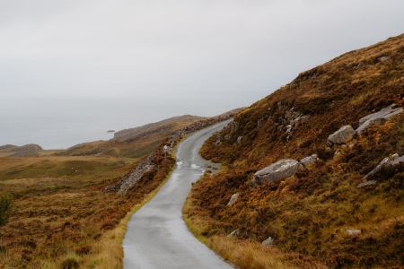
Raasay’s long, narrow geography creates three distinct areas, each offering a different facet of the island’s character.
The South: Inverarish & The Distillery The southern end of the island is its most populated and accessible part. The ferry from Skye arrives at Churchton Bay, a short walk from Inverarish, the main village built in the early 20th century to house miners. This area is the island's hub, home to Raasay House, the community-owned village store, and the magnificent Isle of Raasay Distillery. The distillery runs tours and tastings, and looks across to the Cuillin.
The Centre: Dùn Caan The heart of Raasay is dominated by its highest and most distinctive peak, Dùn Caan. At 443 metres, its flat-topped summit is visible from all over the island and from Skye. The challenging walk to the top is the island's main hill route. From the top, the 360-degree view takes in the serrated peaks of the Cuillin, the Torridon mountains on the mainland, and the Hebridean islands.
The North: Calum's Road & Brochel To travel north on Raasay is to go back in time and into a wilder landscape. The journey is defined by Calum's Road, the legendary stretch of single-track road built by Calum Macleod. Driving or cycling this road is a poignant experience, a tribute to one man's incredible resolve. The road leads past the atmospheric ruins of Brochel Castle, a 15th-century stronghold perched dramatically on a rock pinnacle, and onwards to the now-uninhabited township of Arnish, offering a profound sense of remoteness and peace.