Glen Affric and Strathfarrar

Sgurr Fhuar-thuill

A Munro of 1,049 metres, number 81 of the 282.

The hill

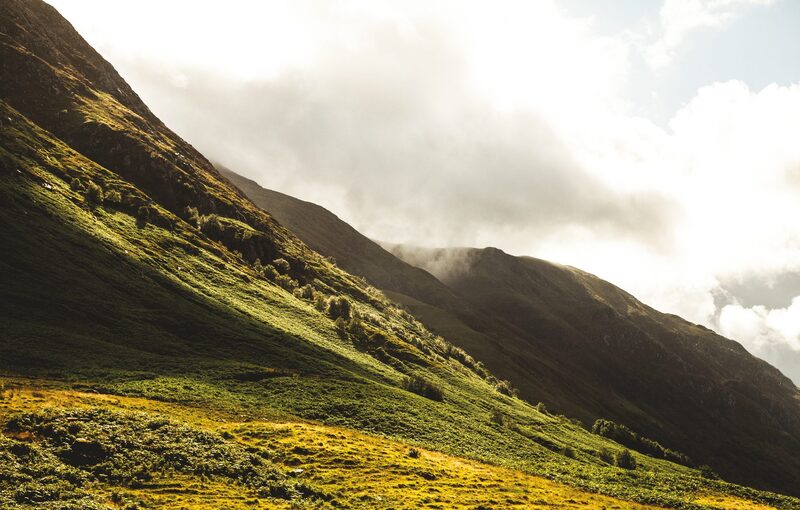
Sgurr Fhuar-thuill is the westernmost of the four Strathfarrar Munros, which stand in a line above Glen Strathfarrar, and the second highest of them.

Sgurr a' Choire Ghlais, the highest, is about two and a half kilometres to the east, with Carn nan Gobhar and Sgurr na Ruaidhe beyond it.

Further west the glen reaches Loch Monar, whose dam is part of SSE's Affric-Beauly hydro scheme. Harvey, the mapmakers, call it "the remote Loch Monar area", and Dundonnell Mountain Rescue Team names Strathfarrar among the remote ranges it covers.

Starts from
Glen Strathfarrar, up a private road behind a locked gate near Struy.
On foot or by bike
Walking or cycling up the glen, you do not need to register your visit with Mountaineering Scotland.
Winter
The private road is not gritted or cleared of snow. Last winter's arrangement for cars ran from 1 November 2025 to 31 March 2026 and is under review, so read Mountaineering Scotland's page before planning a winter day.
Stalking
Mountaineering Scotland names Braulen Estate and East Monar Estate on the glen road, and asks walkers to follow the estates' signs and notices about deer stalking. Its deer stalking page says how to find out more.
Under snow
There is no avalanche forecast for Strathfarrar, but that does not mean there is no risk under snow. The Scottish Avalanche Information Service's full forecasts for its six areas begin on 17 December 2026.
The gate
In 2026, from about 1 April to the end of October, anyone may drive up the glen without booking, through a gate kept by a gatekeeper and on a number of conditions. The glen is closed to vehicles all day on Tuesdays and until 1.30pm on Wednesdays. Otherwise the gate opens at 9am and closes at 6pm in April and October, 7pm in May and September and 8pm in June, July and August, and the last car goes in one hour before closing. No more than 25 vehicles are allowed in the glen in a day. The arrangement changes, so read Mountaineering Scotland's page on it before you travel.
Parking
Park at Mhullie Greens, just past Deanie power station, at NH283386. Overnight parking is not allowed anywhere in Strathfarrar. When Mountaineering Scotland last wrote, in October 2024, there was limited or no mobile phone signal in the glen.
Bus
In 2026 buses stop at Struy: the 48 between Tomich and Inverness on Fridays only, and the 44, 44A and 44B between Tomich and Dingwall on Tuesdays, Wednesdays and Saturdays. Timetables change, so check with Highland Council.
On the hill today
0° to 3°Drizzle on the summit, 1,049 m. Feels like −4° in the wind.

West wind to 13 mph, gusting 28
Rain, about 5 mm
Light from 7.55am to 6.15pm, ten hours

Sat 17Cloudy−1° to 3° on top · 8 mph, gusts 19
Sun 18Cloudy−4° to 4° on top · 10 mph, gusts 20
Mon 19Cloudy−5° to 5° on top · 3 mph, gusts 6

A weather model's forecast for the height of the summit, not a report from the hill. Read the mountain forecast the evening before: Northwest Highlands forecast, Sgurr Fhuar-thuill.

October2026

MTWTFSS

Going another day?

Choose the day you mean to climb.Near or far: the light you will have, and what the summit is likely to be doing.

Before you go

Carry

  • A paper map and a compass, and the skill to use them
  • Waterproofs, warm layers, hat and gloves
  • Food and drink
  • A head torch, a whistle and a first aid kit
  • A survival bag
  • Boots with a good grip

Under snow and ice this is a different day, with short light and the risk of avalanche. It needs an ice axe, crampons, winter boots and the skill to use them.

If something goes wrong

  • Dial 999, ask for the police, then mountain rescue
  • Give a six-figure grid reference: the summit is NH 235 437
  • Say how many are hurt, how many are with you, and your number
  • Register to text 999 before the day: text the word register to 999

The summit is optional. Turning back is the right decision whenever the cloud, the wind or the light say so.

How to call for help in the hills · Safety and skills for the hills · ThinkWINTER

From our readers

Nobody has written from Sgurr Fhuar-thuill yet. If you were up, yours would be the first.

Tell the next person

Were you up? Three words is enough.A free account, a word for the weather and a line if you like.

Read more elsewhere

For the route itself, take the map and read these.

Next along: Sgurr a' Choire Ghlais, Carn nan Gobhar, Sgurr na Ruaidhe, Maoile Lunndaidh. Checked on 10 October 2026. The facts on this page are Mountaineering Scotland's, Highland Council's and Dundonnell Mountain Rescue Team's; the forecasts are the Mountain Weather Information Service's, the Met Office's and the Scottish Avalanche Information Service's. Height and position from The Database of British and Irish Hills, v18.3, adapted, CC BY 4.0. This page is not a route description and does not replace a map.