The Road That Winds Through Time
The Bealach na Bà, rising through Wester Ross to 626 metres, is one of Scotland’s steepest and most storied roads. Ben Lerwill traces its origins, challenges, and lasting allure—unpacking how a centuries-old cattle route became a modern-day rite of passage for adventurous drivers and travellers seeking dramatic Highland scenery.
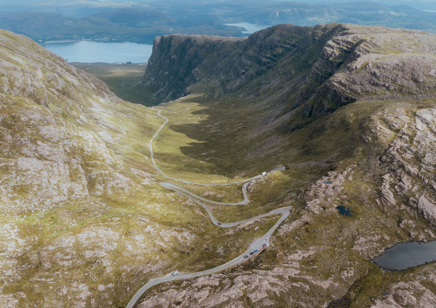
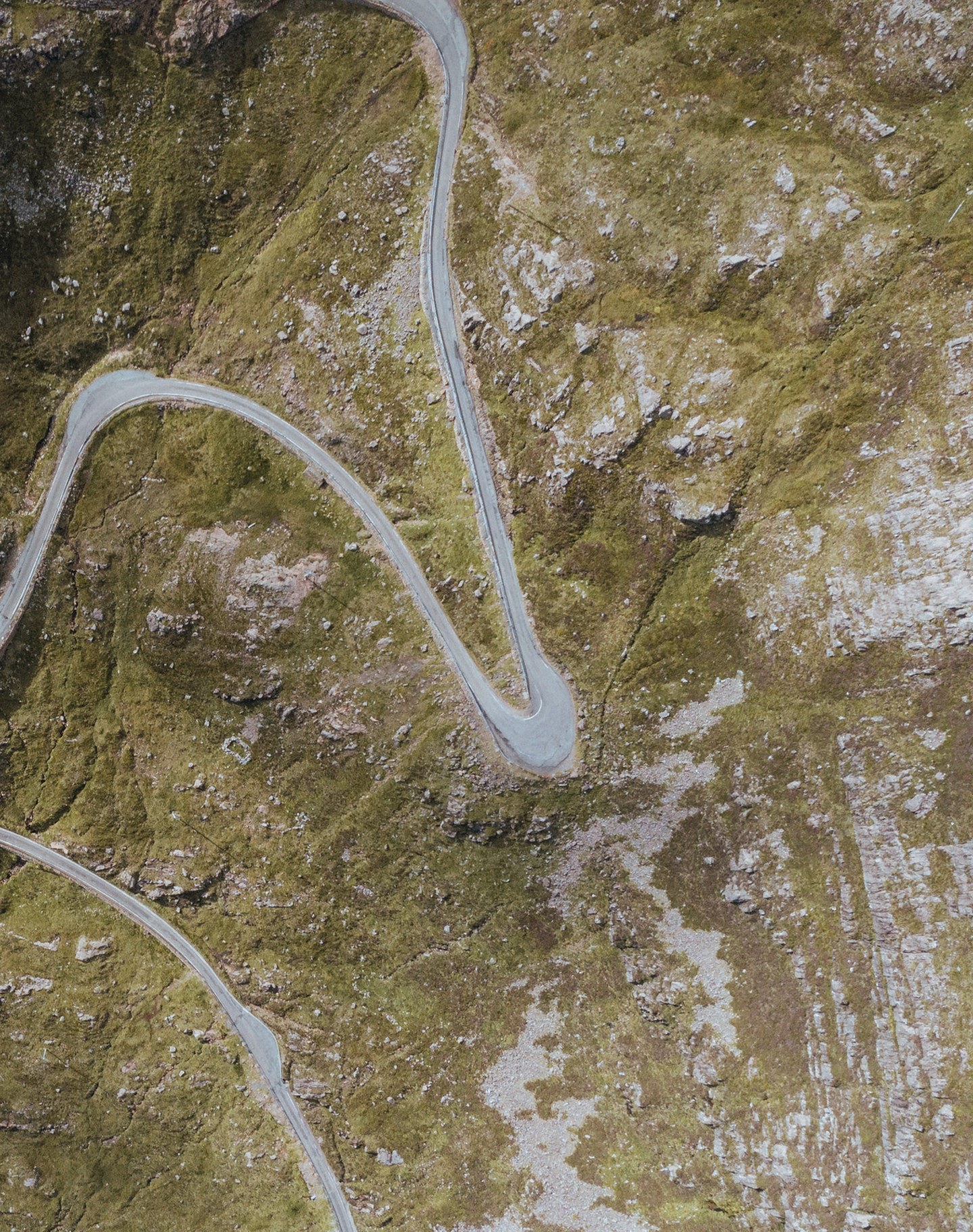
Not all country roads are created equal. Some glide between pancakeflat fields. Others curve easily across rolling farmland. Others have to buck, twist and swivel their way through the mountains, contorting themselves in spaghetti twirls and presenting drivers with a challenge that’s not so much a highway as a kind of asphaltcovered bobsleigh run. Bealach na Bà, as you may be aware, falls into this last category.
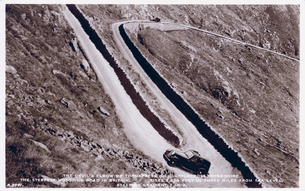
The road is a legendary one. Wriggling up from sea level to an altitude of 626m, it stands as the third highest road in Scotland and arguably the most eulogised stretch of carriageway in the country. It’s around 9km long and is still considered to be Britain’s steepest road. You’ll find it on the savagely beautiful Applecross peninsula, amid the romping highlands of Wester Ross, and if you’re in any doubt as to its reputation, consider the sign at the top, which includes the following words: “Gradients of 1 in 5 and hairpin bends. Not advised for learner drivers, very large vehicles or caravans.”
Next year will officially mark two centuries since the road’s construction, although the history of this winding, precipitous route dates back much longer. Hardy locals are thought to have forged a footpath up and over the hills as long as 2,000 years ago. Early Christian missionaries followed the same route on their way to and from a monastic settlement at Applecross, and the track later became a droving path for farmers herding their livestock to market at Muir of Ord. Indeed, the name Bealach na Bà translates as ‘Pass of the Cattle’, and we can only speculate as to the number of beasts that had to haul their bovine backsides up these energy-sapping slopes.
It was in the early years of the 19th century, however, when the road took proper shape. At the time, local landowners the Mackenzies were among those helping to push forward a road-building programme in the Highlands, in a bid to make the region more readily accessible. For obvious reasons, Bealach na Bà presented a headache, but having searched high and low to find a contractor willing to embark on what was a mammoth engineering conundrum – and splitting the cost with the government – a deal to begin work was finally signed on 4th May, 1818.
It’s said that the first contractor lasted only three months before being sent insane by the challenge of the task, not to mention the peril of falling rocks and boulders. The job was completed by John Reid & Son, an Edinburgh firm who took on the project at a cost of £4,000 (around half a million pounds in today’s money). Their labourers were on a shilling a day, and the landowners provided not only oatmeal – carbheavy fuel being essential on a job like this – but rock-blasting materials and a horse and cart.
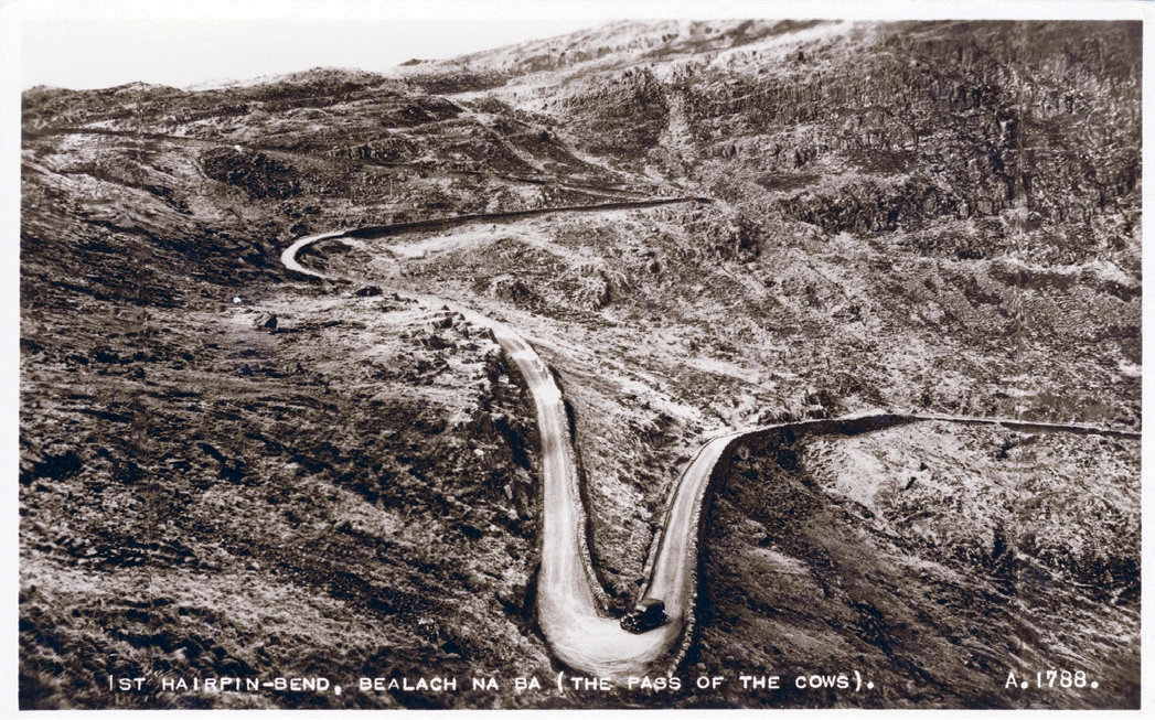
The road was completed by April 1822. Originally covered in rough gravel, it incorporated several hairpin bends and seemed to meander madly across the map, but it also proved a practical way of connecting the residents of Applecross to the wider world. It was not, however, without its flaws. After snow – and remember the word takes on a special potency in this part of the UK – it could leave the road impassable for weeks, buried under head-high drifts. When this happened, access to and from the peninsula was limited to the steamer service that puffed across to Kyle of Lochalsh and the Isle of Lewis.
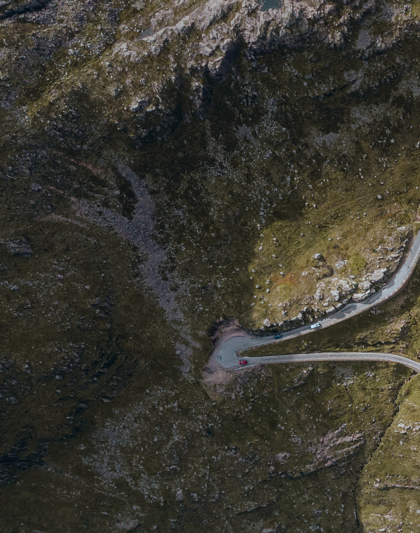
Only in the 1950s did the road receive a serious upgrade. Between 1956 and 1958, its surface was levelled, tarmac was applied and its switchback bends were widened. To ease matters further – and no doubt to the jubilation of regular drivers – a series of passing places for cars were installed at semi-regular intervals. The mind boggles when imagining the kind of manoeuvres that would previously have had to be employed when vehicles met each other head-on.
There’s one thing, however, that every incarnation of this snaking singletrack road has had in common: the view. Stretching east towards Raasay and west towards Loch Kishorn, the panorama in both directions is an exquisite one: high-sided and summitstrewn, blending the wild greens of the land with the steely blues of the coast. It’s even been named one of the most picturesque drives on the planet, drawing comparison with the great mountain passes of the Alps.
Little wonder that so many see the road, which sits along the North Coast 500 circuit, as a rite of passage. Fleets of high-spec cars – not to mention motorcyclists and generously thighed road-bikers – regularly wind up and down its curves. If you’re tempted to join them, be aware that this is a memorable but genuinely challenging drive. Reversing along narrow, steep inclines may well be required, and the route becomes extra-hazardous in snowy, foggy or icy conditions. It would be deeply unwise to attempt it at any time in a campervan or motorhome, while novice drivers would always be best to steer clear. Literally.
On which note, you might be relieved to hear it’s not the only way onto this ravishing peninsula. The singletrack coastal road coming in from the north offers a more sedate, but no less scenic, way to reach Applecross, with glorious views out towards Torridon and Skye. Once you’ve arrived, meanwhile, you could do far worse than call in at the waterside Applecross Inn, a fixture here since the 1950s and rightly extolled in the Good Pub Guide for its “particularly friendly welcome, real ales and good seafood.” Which is precisely what you’d hope for in this neck of the woods – no matter which road you’ve come in on.
Promoted Post
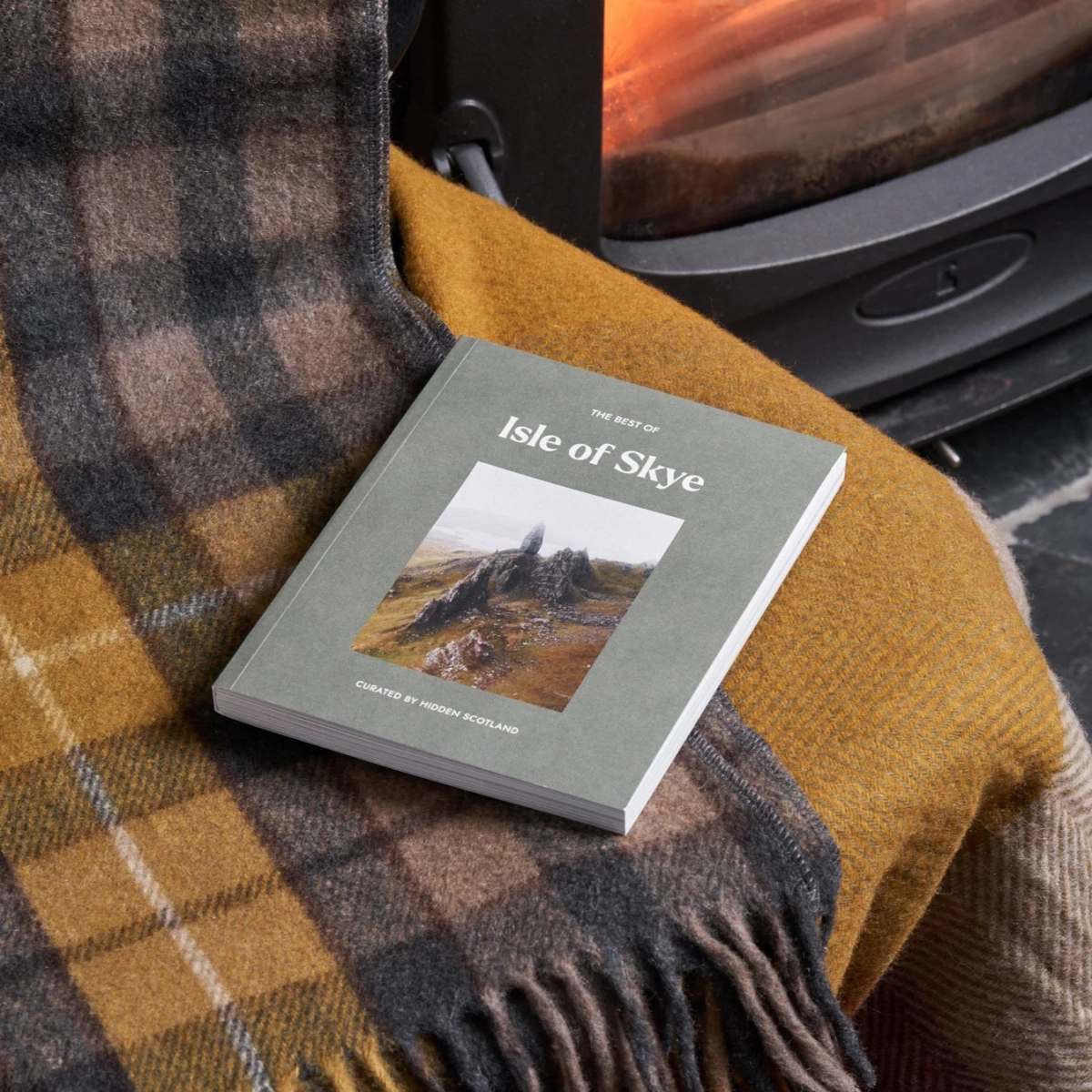
The Best of Skye Guidebook
The Isle of Skye is a place of rare wonder, a wildlife-rich spread of bays, peaks, cliffs and ridges. The views are big, but the prospect of adventure is even bigger. We hope this curated Hidden Scotland guide – which takes in everything from the best walks to the finest restaurants – helps you to have your own unforgettable island escape.
 Sign in with Google
 Sign in with Email