10 of Scotland’s Most Peaceful Beaches
Scotland has no shortage of beaches, but it’s the quieter ones that leave a lasting impression. This list brings together ten peaceful spots where you’re more likely to meet seabirds than people — remote, low-key, and worth the effort to reach.

Written by Jack Cairney
Scotland’s quietest beaches are rarely found on signposts. They appear at the end of long tracks, behind low hills, or beneath the remains of an old castle wall. Often, there’s no path at all — just a faint line across bracken or dune grass, and then a sudden openness: sand, stone, water, light.
This collection focuses on those understated stretches of coastline that still feel unknown. Each beach on the list offers a degree of solitude — not by design, but by geography. Their remoteness keeps them untroubled by volume. Some lie on far northern headlands, others on small islands or inlets without through-roads. A few are reached only on foot or at low tide.
There’s no one type here. Some are pale, wide and open; others dark with volcanic rock, or scalloped beneath sea cliffs. What links them is the absence of distraction — no cafés, no surf schools, no nearby hotels. Just the rhythm of the tide and a sense of place that lingers longer than expected.
These are beaches where time behaves differently. You don’t go for the afternoon. You stay as long as the weather allows, then you leave without saying much. Their presence stays with you later — in salt on your boots or grit in a jacket pocket. They are hard to find, and quietly difficult to forget.
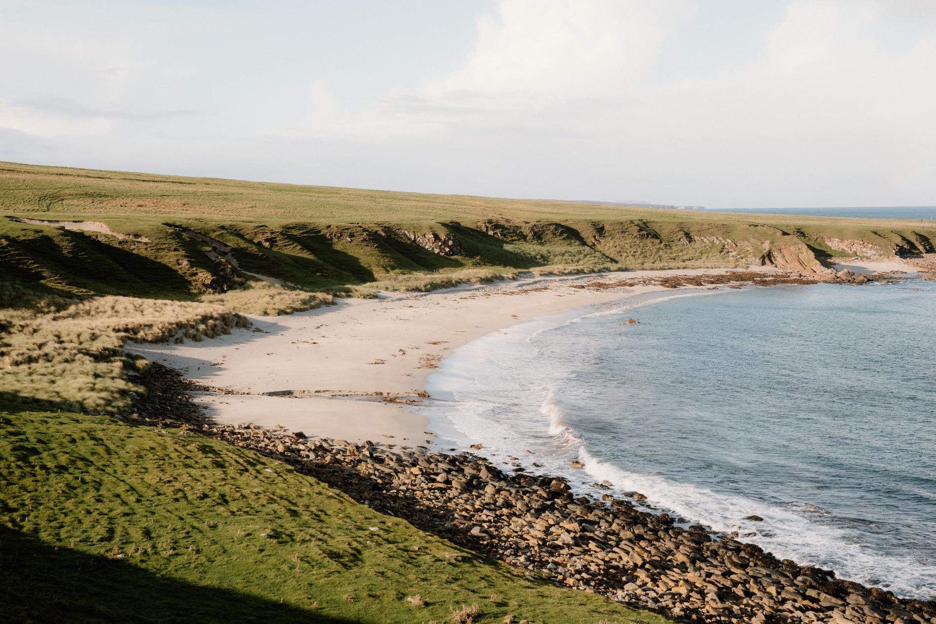
Sandwood Bay, Sutherland
The four-mile walk to Sandwood Bay is part of what keeps it quiet. The trail begins at Blairmore and crosses open moorland, passing small lochans and sections of raised peat, with the sea held out of view until the final descent. Then the bay appears all at once — a long, empty stretch of sand with high dunes behind it, a freshwater loch inland, and the sea stack of Am Buachaille standing sentinel at its southern end.
There are no buildings here, no signposts, and no mobile signal. The only human mark is the worn shell of a former croft tucked behind the dunes. The light shifts quickly, especially in late afternoon, and the wind often arrives without warning. It is a beach that asks for time and patience — not a brief visit, but a deliberate journey. On still days, the sound of the sea reaches far inland. On others, the sky and the Atlantic can shift tone in minutes.
Despite its reputation as one of Scotland’s finest beaches, Sandwood rarely feels busy. The distance, exposure, and absence of facilities all help preserve its atmosphere. Most people arrive quietly, stay longer than expected, and leave without rushing.
What’s Nearby
Kinlochbervie is the closest village, with a small shop, fuel station, and accommodation options. From there, the road to Blairmore marks the start of the Sandwood path. Other nearby beaches include Oldshoremore and Polin — smaller, more accessible, and usually just as quiet.
Need to Know
Access: 4-mile footpath (one way) from Blairmore
Parking: Free parking available at Blairmore
Facilities: None — no toilets, bins, or water
Best time to visit: Morning or early evening for the clearest light and quietest conditions
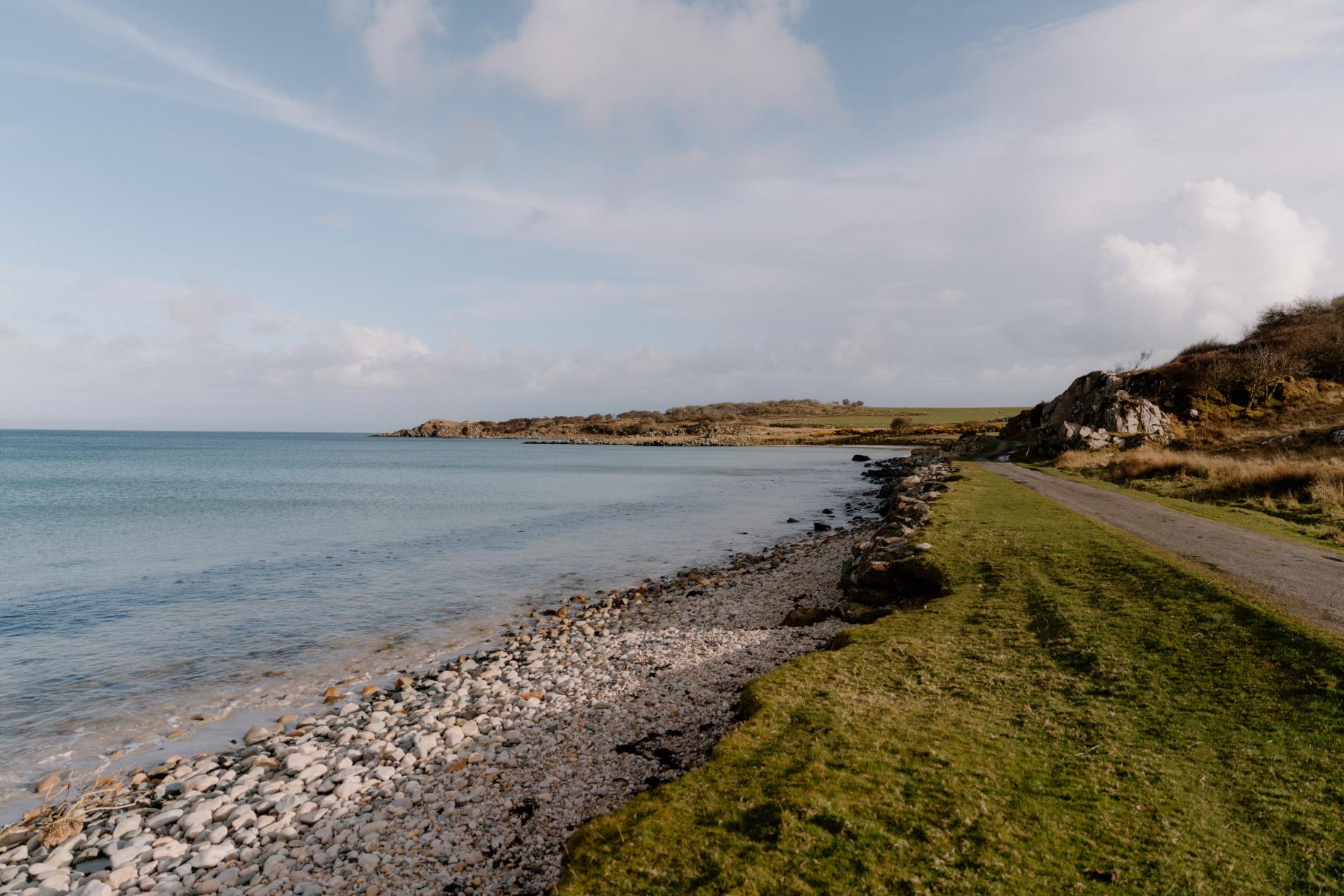
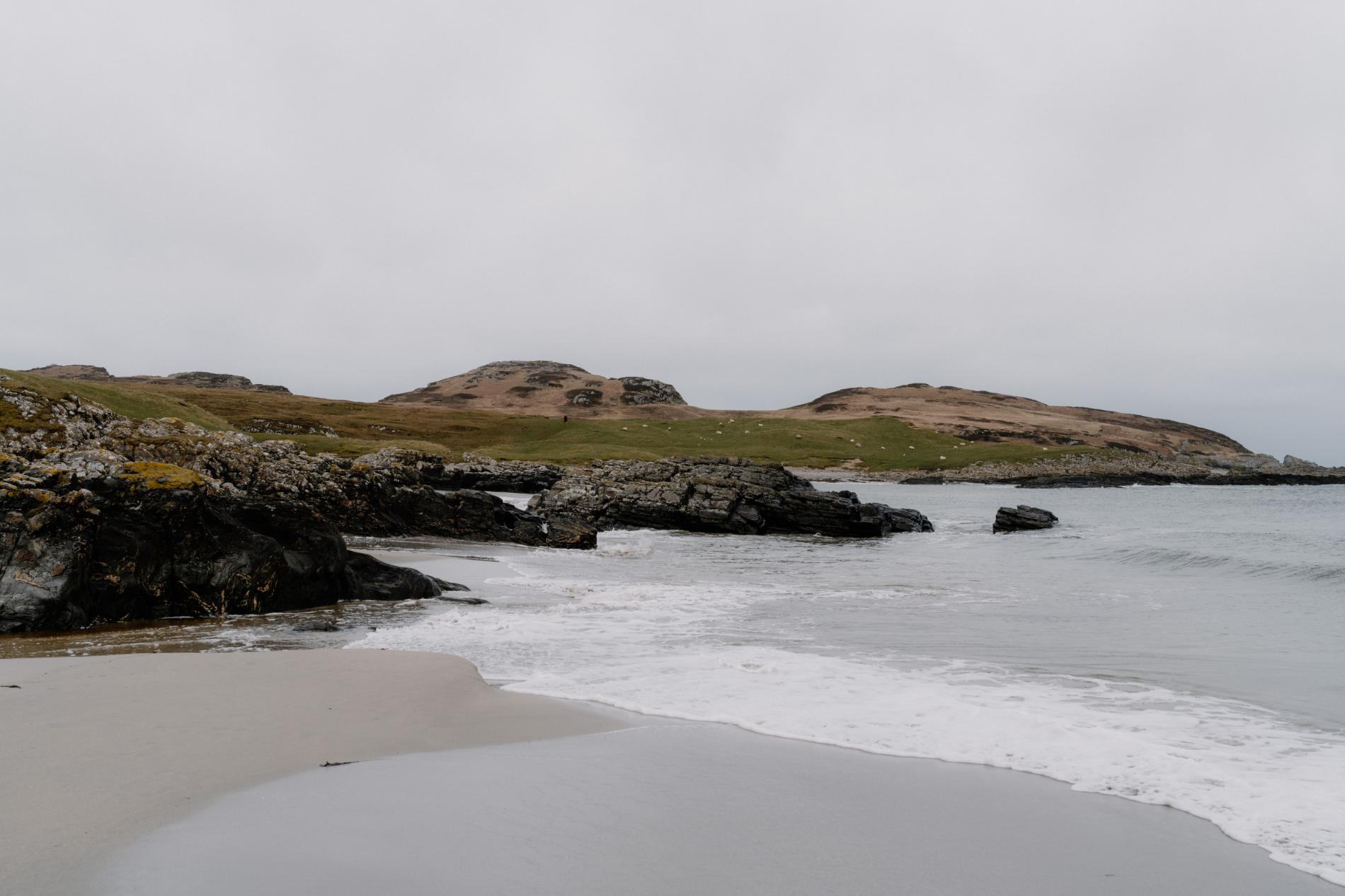
Claggain Bay, Islay
Claggain Bay curves gently at the southern edge of Islay, at the end of a quiet single-track road that continues past Ardbeg and disappears into farmland and open coast. The beach is a mix of pale sand and rounded pebbles, with driftwood scattered along the tideline. Behind it, low hills and grassy slopes rise gradually, offering a sense of quiet enclosure without ever feeling closed in.
Despite being relatively easy to reach, Claggain remains quiet. There’s no signage, no formal parking, and little to suggest it’s a destination. The approach feels like it leads to nowhere in particular — which is part of what makes it worth following. Once there, you’re likely to find still water, low sky, and little else. The sea is shallow and often calm, with the faint outline of Jura visible on a clear day. The only sounds are the occasional gull, wind through the grass, or the slow rhythm of the tide.
In summer, wildflowers line the verges on the road in. In winter, the bay feels pared back — exposed, spare, but not bleak. It’s the kind of place where you stop for a few minutes and end up staying longer than you planned, without really knowing why.
What’s Nearby
Port Ellen is around ten minutes away, with shops, cafés, and the ferry terminal. Kilnaughton Bay is nearby if you’re looking to explore another quiet stretch of sand. Further south, the road leads toward Ardtalla and more rugged coastline.
Need to Know
Access: Reached via a narrow road; no signage
Parking: Roadside verge at the edge of the beach
Facilities: None — bring anything you need with you
Best time to visit: Late afternoon, when the light is soft and the beach is at its quietest
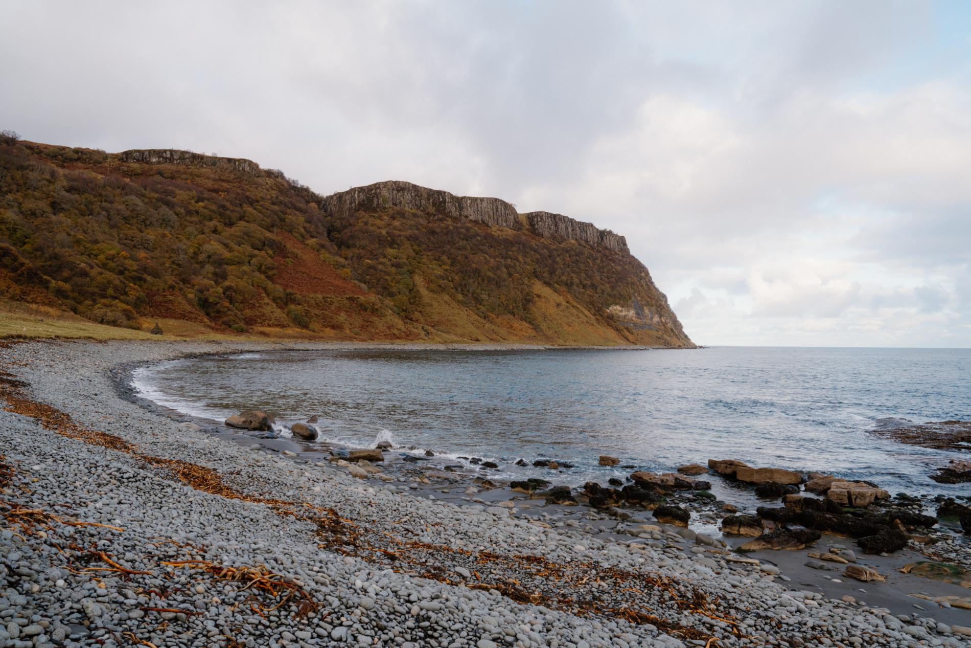
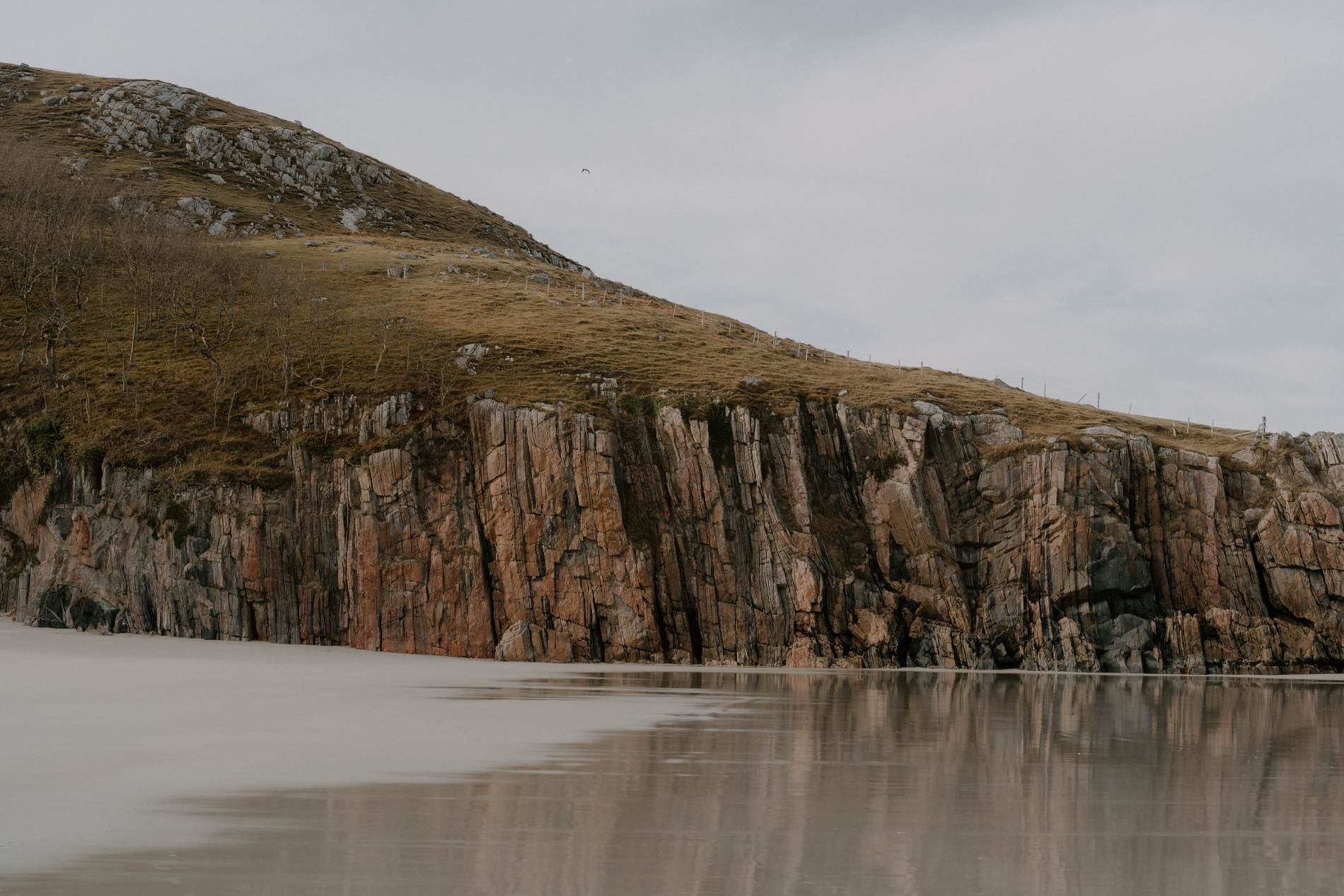
Bearreraig Bay, Skye
Bearreraig Bay sits beneath high basalt cliffs on the east coast of Skye, just south of the Old Man of Storr. It’s not well-marked and not easily reached, but for those who make the steep descent, it offers a rare and elemental kind of stillness. The path follows a disused hydroelectric line, dropping sharply from the roadside down to a stony inlet framed by cliffs and open sea. On days without wind, the only sound is the movement of water over stone.
The beach itself is made of large pebbles, scattered driftwood, and slabs of rock slick from the tide. Fossil hunters have long visited the site, and occasionally the remains of Jurassic life can still be found embedded in the shale. Most visitors come and go without seeing another person. The scale of the place — the vertical drop behind, the open expanse in front — lends it a slightly surreal calm, as though the space has been left undisturbed for too long.
There’s little flat ground and nowhere obvious to sit for long, but it doesn’t matter. The point of Bearreraig isn’t comfort. It’s quiet. And the walk back up is just as sharp as the way down, which keeps it that way.
What’s Nearby
The bay lies directly below the Old Man of Storr car park, though it’s rarely noticed by those heading to the summit. Staffin is a 10-minute drive north and Portree sits 15 minutes to the south. Kilt Rock and Lealt Falls are nearby, though far busier.
Need to Know
Access: Steep, unmaintained path descending from a layby near Storr car park
Parking: Limited roadside space
Facilities: None — no bins or toilets
Coldbackie Beach, Sutherland
Coldbackie sits just north of the Kyle of Tongue, on one of the quietest stretches of Scotland’s northern coast. The beach runs beneath low dunes and grassy banks, opening out into a pale, shallow bay that looks west toward the Rabbit Islands and the long rise of Ben Loyal inland. The curve of sand here is wide and soft underfoot, with tidal pools and seaweed ribbons stretching along the waterline. At low tide, it’s possible to walk a long way out before the water deepens.
The nearby village shares the beach’s name but remains tucked back from the shore. Most people pass through the area without realising this beach exists. There’s no obvious signage, and the beach isn’t visible from the main road. That, paired with its size and the depth of the bay, means you’re unlikely to find more than a handful of footprints — if that.
Even in summer, it feels undisturbed. The light here can be remarkable, especially toward evening when clouds shift over the ridge and shadows move quickly across the sand. The sea is often calm, its surface broken only by the movement of birds or the slow lap of incoming tide. It’s the kind of place that encourages stillness without demanding it. You simply arrive, and everything else slows down.
What’s Nearby
The village of Tongue is around five minutes away by car, with a hotel, café and local shop. The Kyle of Tongue causeway provides access to excellent views inland toward Ben Loyal, and further north the beaches at Talmine and Achininver offer similarly quiet coastal walking.
Need to Know
Access: Short walk from a layby on the A838, just past Coldbackie
Parking: Informal verge parking — limited space
Facilities: None — no toilets, no bins
Best time to visit: Evening or early morning for soft light and low tide
Bay of Sannick, Caithness
Just beyond the turning for Duncansby Head, where the road begins to narrow and the cliffs draw higher, the Bay of Sannick curves out quietly from the land. It’s a short, grassy descent from a roadside pull-in, leading to a crescent of pale sand and flat stones that face east into the North Sea. The bay is modest in scale but rarely busy, even in peak months. Most visitors continue toward the nearby sea stacks without stopping, which leaves this patch of coast largely untouched.
The setting feels more open than enclosed — sea to the front, low turf-covered hills behind, and the constant presence of wind. On calmer days, seals haul out on the rocks near the far end of the bay. The light can be sharp and clear, especially in the early morning, when the sun lifts across the water and throws long shadows behind the dunes.
This is not a place for long beach walks or busy afternoons. It suits those looking for quiet observation — the sound of seabirds, the shape of a distant lighthouse, or the rhythm of waves as they draw steadily across the bay’s curve. It’s easy to miss, and that’s part of what keeps it still.
What’s Nearby
Duncansby Head is just a few minutes further on, known for its dramatic sea stacks and coastal walks. John o’ Groats is nearby with a café, seasonal ferry services, and car park. Despite its proximity to these better-known sites, Sannick remains quiet and undeveloped.
Need to Know
Access: Short walk from roadside pull-in on route to Duncansby Head
Parking: Limited verge space near the access point
Facilities: None at the beach; nearest public toilets in John o’ Groats
Best time to visit: Morning, particularly in spring or early autumn when wildlife activity is high and light is clear

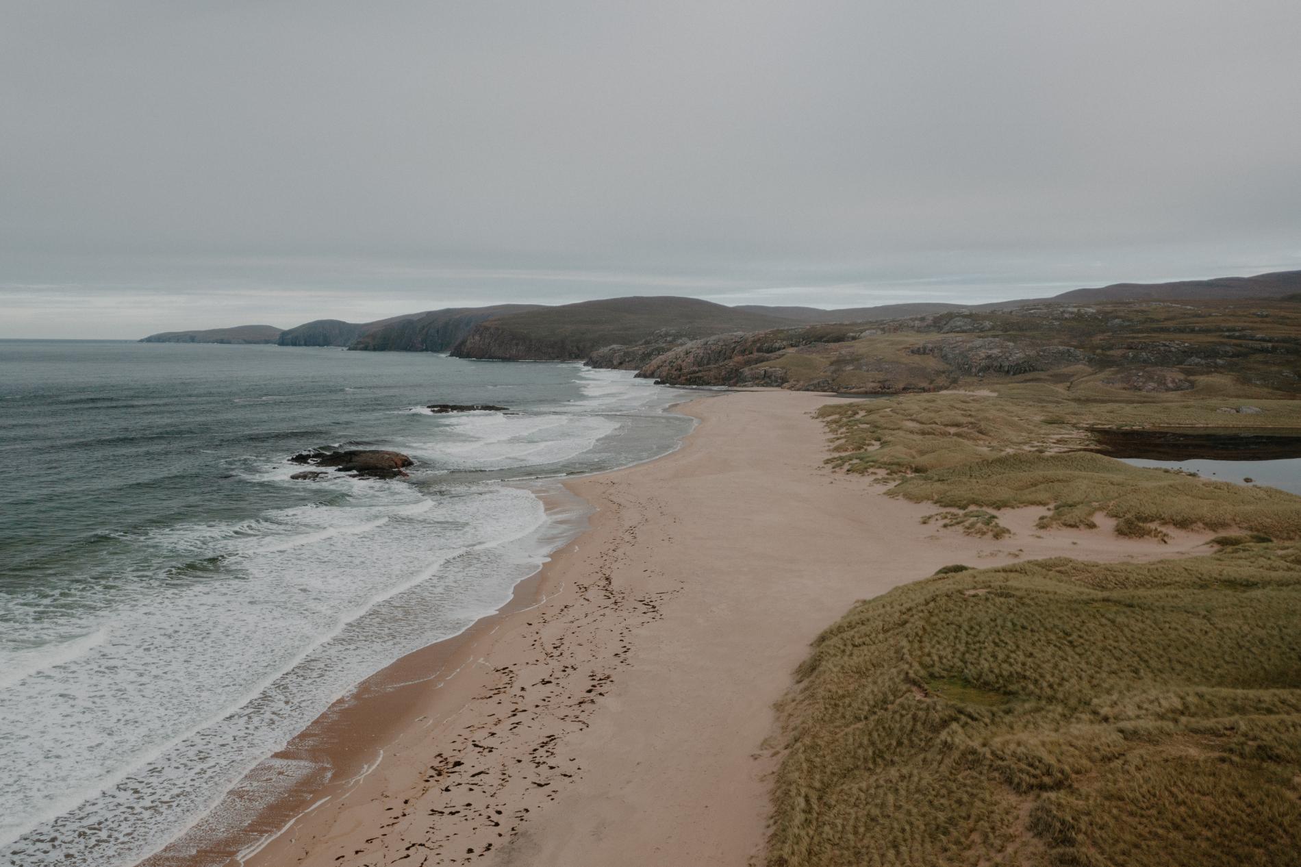
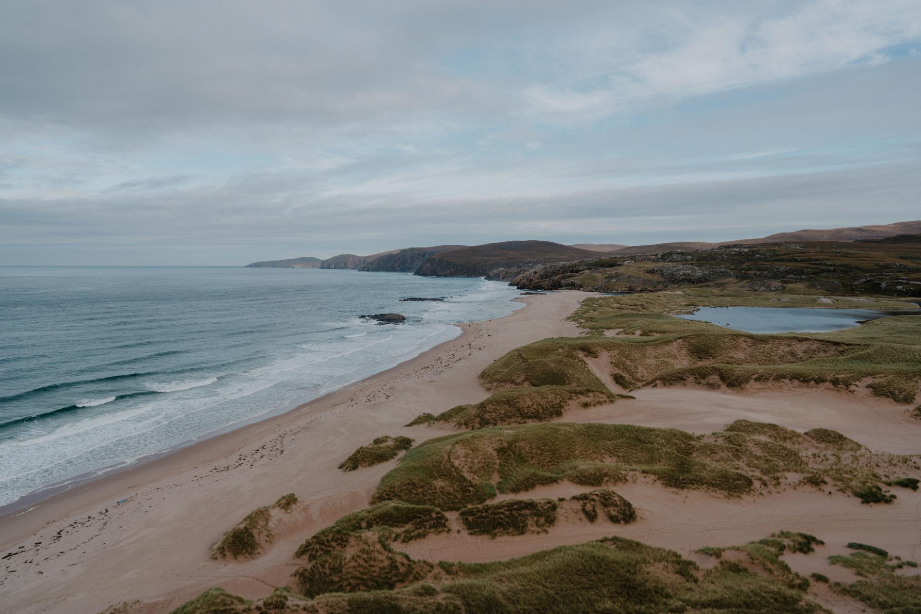
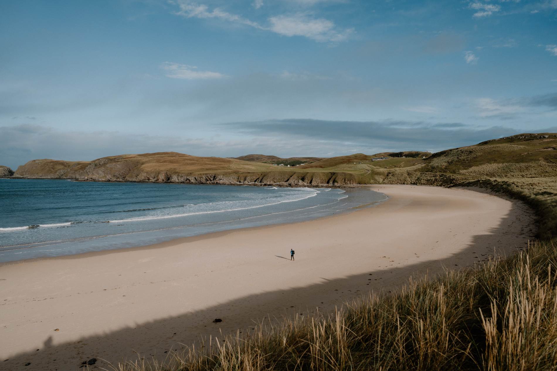
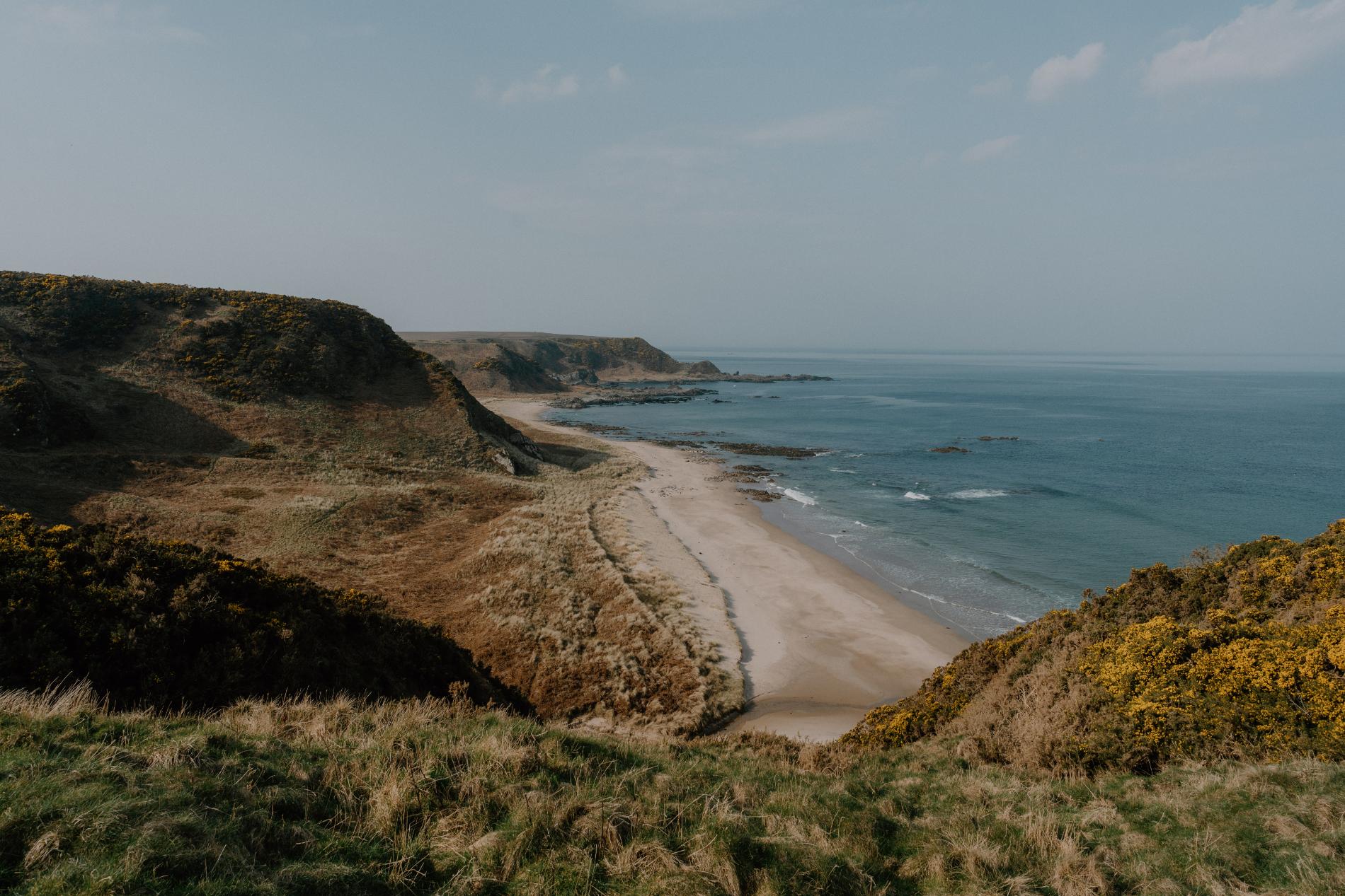
Farr Beach, Sutherland
Farr Beach stretches out below low cliffs and grassy dunes on the far north coast of Sutherland, facing directly onto the Atlantic. Wide and clean, with fine sand underfoot and no visible development, it feels like a place that could easily be overlooked — and often is. There’s no signage from the road, and even from the small parking area the sea isn’t visible until you walk over the rise. Then it opens out completely.
The beach itself runs long and level, flanked by scattered stones and backed by flat machair where wildflowers grow in summer. The water here is often clear, with a steady shore break and the occasional presence of seabirds working the edge of the tide. On quiet days, it’s easy to walk the full length without seeing another person. Even in high season, it tends to remain still — the access road is narrow, the parking minimal, and the location just far enough from busier routes to be left alone.
The atmosphere is open and unaffected. It isn’t dramatic, but it doesn’t need to be. You arrive, walk out, and the sense of space takes over. For those looking to sit quietly, swim without distraction, or walk slowly without talking, it’s exactly right.
What’s Nearby
The small hamlet of Farr lies just inland. Bettyhill is ten minutes west by car, with a village store and a café. Strathy Point is nearby for longer coastal walks and lighthouse views. The beach sits well outside the NC500’s main pull-in stops, which helps preserve its quiet.
Need to Know
Access: Short walk from a narrow road; beach revealed just beyond the dunes
Parking: Limited space near the end of the track
Facilities: None — nearest toilets in Bettyhill
Best time to visit: Mid-morning or evening, particularly in spring and early autumn
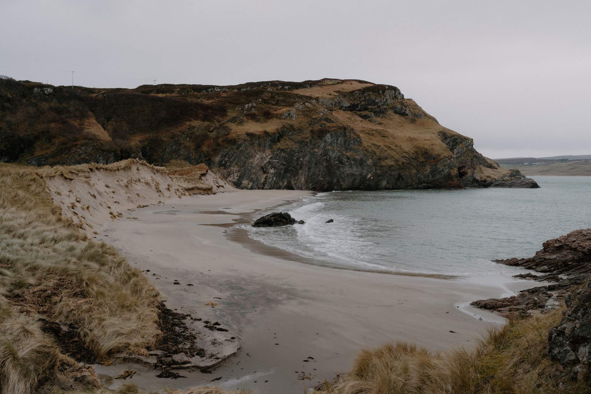
Ceannabeinne Beach, Sutherland
Ceannabeinne lies just east of Durness, where the coast begins to fold into steep headlands and the road follows the curve of the land. The beach sits below the old Ceannabeinne township, tucked behind a low rise, hidden from view until the final turn. What appears is a broad, pale sweep of sand, broken by outcrops of dark rock and the occasional flash of turquoise water when the sun is out. The approach is easy enough, but the atmosphere remains quiet — the bay’s shape and the absence of through traffic give it a kind of natural privacy.
The beach is larger than it first seems. At low tide, long patterns appear in the sand, and the water draws far back, leaving shallow pools and clean arcs of shell and stone. The cliffs to the east are soft and grass-covered, rising steadily behind the bay. On most days, the wind moves in from the west and keeps the air clear. Even in summer, when nearby beaches are busy, Ceannabeinne feels open and calm.
There are no cafés, shops, or buildings in sight. Just the road, a small layby, and the sound of the tide. It’s a place to bring a book, or nothing at all.
What’s Nearby
Durness is a short drive west, with a small shop, fuel, and Sango Sands for those looking to stay. The ruined Ceannabeinne township lies just uphill from the beach, with signs marking its history. Balnakeil Craft Village and the cave at Smoo are close by — both worth visiting, though often far livelier than the bay itself.
Need to Know
Access: Short path from roadside layby just off the A838
Parking: Limited; arrives early for best chance of space
Facilities: None — no bins or toilets
Best time to visit: Mid-morning for soft light or evening for long low sun
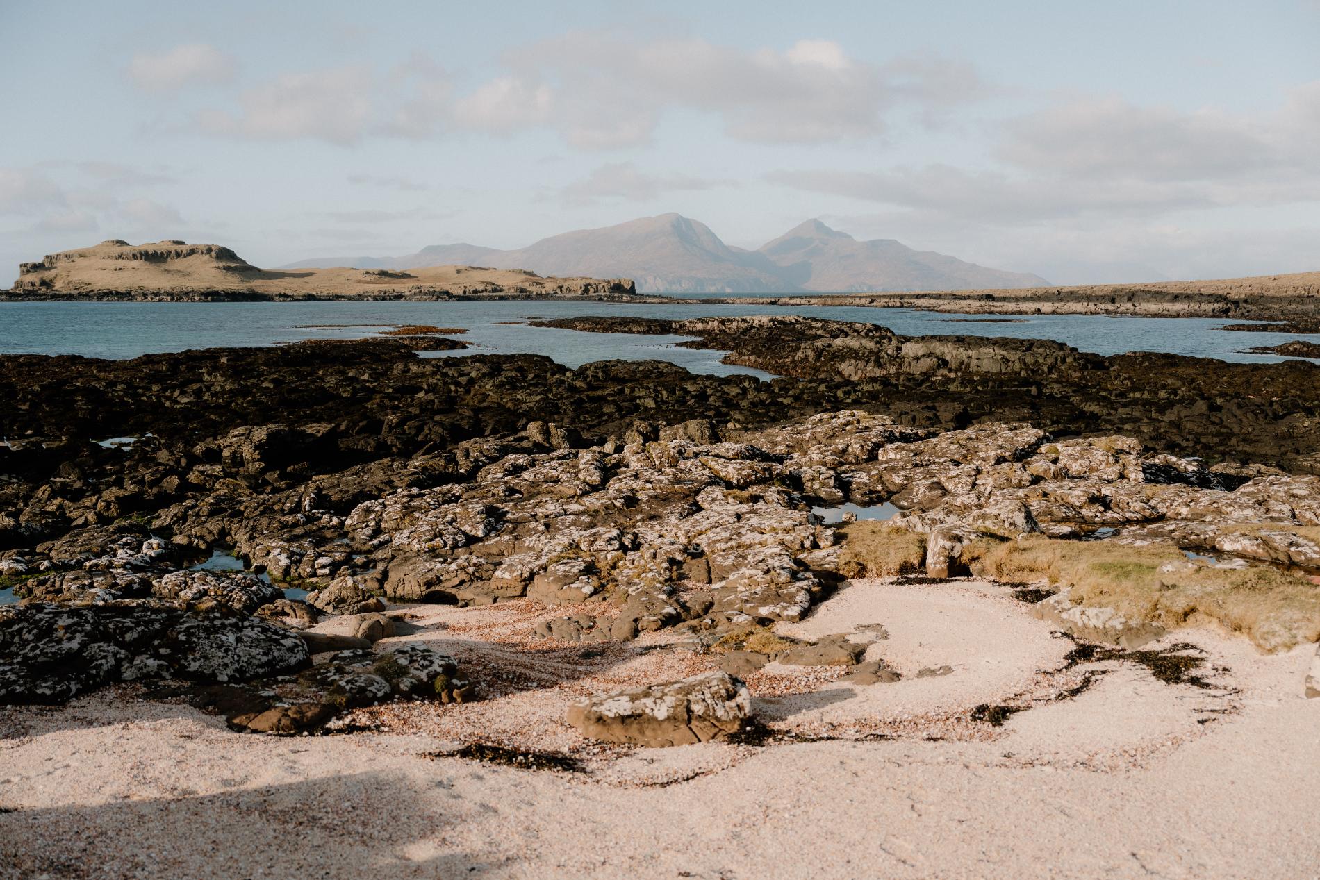
Sanaigmore Beach, Islay
Sanaigmore sits at the end of a long, single-track road on Islay’s northern coast — a stretch of shoreline that feels cut off from the rest of the island. The beach itself is framed by low cliffs and gentle headlands, forming a soft horseshoe of pale sand and smooth stone. The approach gives little away. For much of the drive, the sea stays out of view, hidden behind rough grazing land and dry-stone walls. Then, suddenly, it’s there — open water, a curve of beach, and little else.
This isn’t a beach built for passing traffic. The road ends here. There’s nowhere further to go. And perhaps that’s part of the appeal. Visitors tend to arrive deliberately, then linger quietly. The sand gives way to larger rocks at the edges, and in summer, the water here can appear unexpectedly clear, reflecting the changing sky above the bay. There’s a stillness to the place that stays with you, even after you leave.
Behind the beach, a grassy bank leads up toward the ruins of an old building, and inland there’s a quiet art gallery — open part of the year, and often missed entirely. But the beach is the main reason to come. Remote, quiet, and rarely busy, it offers a kind of calm that’s difficult to explain until you’ve stood there.
What’s Nearby
The road to Sanaigmore branches off north of Bridgend, with few signs and little traffic. The closest services are back in Port Charlotte or Bowmore. The nearby Outback Art Gallery sometimes opens seasonally and sits just behind the beach, but otherwise the area remains quiet.
Need to Know
Access: Reached by single-track road; last few bends can be rough
Parking: Small informal area near the beach — limited space
Facilities: None — bring food and water if you plan to stay
Best time to visit: Early afternoon when the sun reaches across the full curve of the bay
Shell Bay, Isle of Muck
On an island as small and lightly inhabited as Muck, Shell Bay feels even more remote than it already is. The beach sits on the island’s eastern edge, looking back toward the Scottish mainland, and is named, plainly and accurately, for the mix of crushed shells that make up much of its shoreline. The bay is small and curved, more cove than coast, but it holds its own character — wind-shaped grass above the tideline, shallow water below, and a slow rhythm that matches the rest of the island.
There’s nothing showy about Shell Bay. Its beauty lies in its quiet: no road noise, no buildings, no signage. Only a short path leads there, threading down from the track near the main settlement. The walk is short, but the moment you reach the water, it feels distant from everything else. The beach narrows at high tide and opens out at low, revealing a pale, uneven stretch with scattered seaweed, driftwood, and small pools where waders pick through the sand.
What stays with you isn’t the view — though it is striking — but the silence. It’s a place you sit in without needing to do much at all. Most visitors walk there without passing anyone, and often leave without speaking a word.
What’s Nearby
The Isle of Muck is only a few miles across, so everything is nearby — the ferry landing, a small café, and the island’s handful of cottages. Shell Bay sits just east of Port Mòr and can be reached on foot in about ten minutes. The track is rough but clear.
Need to Know
Access: Walkable from the ferry pier at Port Mòr — around 10–15 minutes
Parking: No vehicles — Muck is car-free
Facilities: Limited — check ferry timings and bring essentials
Best time to visit: Low tide, especially on calm days when the water is clear and the bay opens out
Sunnyside Beach, Moray
Sunnyside Beach lies tucked beneath the ruins of Findlater Castle, just west of Sandend on the Moray coast. It isn’t obvious from the road, and there’s no direct signage — only a rough track leading through fields and along the edge of a cliff before the path drops sharply toward the water. What waits below is a shallow, sheltered bay of smooth pebbles and pale sand, enclosed by rocky outcrops and backed by steep grass banks. The castle remains above — broken, windworn, and watching.
The beach is small, but it rarely feels hemmed in. The sea stretches east toward the firth, and the sound carries easily along the cliffs. Driftwood often gathers along the edges, and seabirds move constantly above. On a still day, the beach can feel completely cut off. The only sounds are waves over stone, the rustle of long grass on the cliffs, and the occasional cry of gulls overhead.
Despite its beauty, Sunnyside sees few visitors. The descent can be slippery after rain, and the route in isn’t well maintained — which is likely what keeps it so quiet. But that’s also what makes it worth the effort. Once you reach the bottom, you’re somewhere most people won’t. And it feels like it.
What’s Nearby
Sandend is the closest village, with a car park, small beach, and direct access to the Moray Coast Trail. Cullen is a short drive east, offering cafés and shops. Findlater Castle itself, though in ruins, can be viewed from above on the walk in.
Need to Know
Access: Rough coastal path from field track near Findlater Castle; uneven and steep in parts
Parking: Informal roadside parking near the castle path
Facilities: None — nearest toilets in Cullen or Portsoy
Best time to visit: Midweek and mid-tide, when the beach is at its widest and least visited
Promoted Post
ferryman
 Sign in with Google
 Sign in with Email