
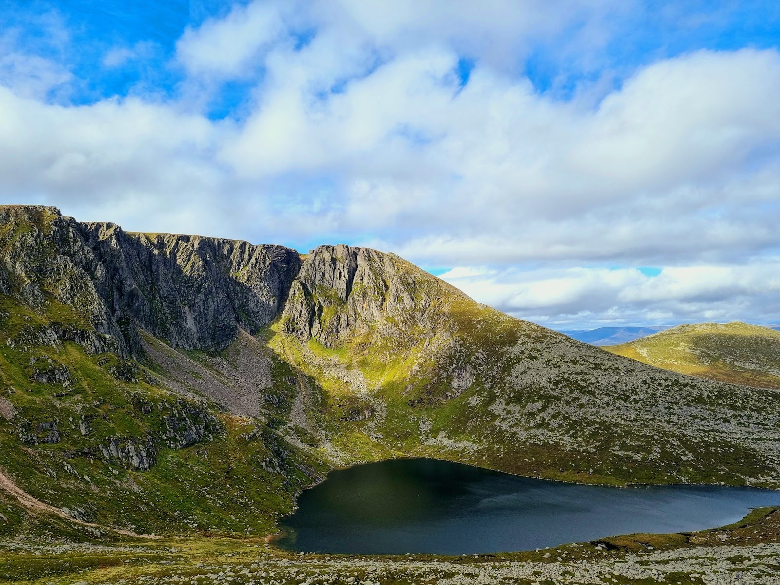
Lochnagar – Up the Ladder to Cac Carn Beag
11 miles · 6 to 7 hours · a hill · there and back
Lochnagar is the great hill of Royal Deeside, rising to 1,155 metres above Balmoral in the Cairngorms National Park.
Most people climb it from the Spittal of Glen Muick, across the glen and up a track and a hill path to the col below Meikle Pap. Then the Ladder climbs through granite boulders onto the plateau, and the ridge leads on to Cac Carn Beag; back the same way. By our map it is about 17.6 km there and back with about 900 metres of climb, and it takes about 6 to 7 hours. The last few metres to the top are a short scramble over boulders. It is a day for experienced hillwalkers who can find their way with a map and compass.
Where it starts
Start at the car park at the Spittal of Glen Muick, where the public road up the glen ends, some ten miles from Ballater.
Is it for me?
Tap who is coming, or the day you have, for the answer on this walk.
Before you go
Getting there
The car park charges a fee and fills early on summer weekends, so arrive early. The Balmoral Ranger Service's visitor centre is beside it. From Ballater, cross the River Dee and turn right, then take the signed road into Glen Muick and follow the single-track road with passing places to its end. There is no public transport to the Spittal, the Balmoral Estate says.
On the path
About 6 to 7 hours there and back: about 17.6 km (11 miles) and 900 metres of climb by our map, from the car park at the Spittal of Glen Muick to Cac Carn Beag, 1,155 metres, and back the same way. A gravel track across the glen and a rough, stony hill track with a burn crossed on stepping stones. Then a path over a field of boulders and up the Ladder, a steep staircase of stone slabs through big granite boulders, and a rocky ridge path. The last few metres to the summit are a short scramble over boulders. A long, rough Munro of 1,155 metres with a bouldery climb, cliffs beside the path and a scramble at the top: for older children used to big hill days, with an adult who can navigate. The map to carry is OS Explorer OL53, Lochnagar, Glen Muick & Glen Clova (1:25,000); OS Landranger 44, Ballater & Glen Clova (1:50,000) shows the country round it.
Good to know
All year in daylight, on a clear day with a good forecast. Keep a dog on a short lead or close at heel, the national park authority asks, above all from April to August where birds nest on the ground or livestock graze. A dog that chases wildlife or livestock stays on the lead at all times, Mountaineering Scotland says. Under snow it is a winter mountain, with cornices on the corrie edge; it lies in the core of the Scottish Avalanche Information Service's Southern Cairngorms area. Deer may be stalked at any time of year, busiest in the first three weeks of October, Mountaineering Scotland says.
The walk
The usual way up Lochnagar starts at the Spittal of Glen Muick, where the public road up the glen from Ballater ends, and comes back the same way. By our map it is about 17.6 km (11 miles) there and back, with about 900 metres of climb. Allow about 6 to 7 hours, more with stops, in poor weather or under snow, and leave plenty of daylight for the way down. A track crosses the glen, passes the pines at Allt-na-giubhsaich and climbs the moor towards Conachcraig. Then a path leads to the col below Meikle Pap and up the Ladder, a steep staircase through granite boulders, onto the plateau. It runs along the ridge to the summit, Cac Carn Beag, 1,155 metres up, where the last few metres are a scramble over boulders. No public body publishes this way, a distance or a time for it. Many walkers come down another way, by the Glas Allt path past its waterfall and along Loch Muick. This walk returns the way it came.
By car, cross the River Dee at Ballater and turn right, then take the signed road into Glen Muick and follow it to the car park where the public road ends. The road is single-track with passing places. The Spittal is some ten miles from Ballater, and there is no public transport to it, the Balmoral Estate says. The car park charges a fee and fills early on summer weekends, so arrive early. The estate publishes no current price. The Balmoral Ranger Service opens a visitor centre at the Spittal all year, the national park authority says, usually with a ranger on hand early in the morning and late in the afternoon. The day's weather forecast is on display there, and the avalanche forecast in winter. The nearest shops are in Ballater.
Before you set off, check the mountain forecast, and under snow the snow and avalanche conditions too, as Mountaineering Scotland advises for every trip. On the hills it is often much colder and windier than in the glen, Forestry and Land Scotland warns. Wear good walking boots and carry warm, waterproof clothing, plenty of food and drink, and a torch in case the day runs long. Carry a map and compass and know how to use them, and do not rely only on a phone or GPS. Mobile signal on the hill is patchy at best, so do not count on it. Leave word with someone of where you are going and when you will be back. Fires and barbecues are banned across the national park, its authority says.
From the end of the road the track runs south-west past the visitor centre, then turns north-west across the flat floor of the glen and over the River Muick by a bridge. At Allt-na-giubhsaich, a house among the pines, the way is signed for Lochnagar. A path through the trees leads to the hill track beyond. The track climbs west beside the Allt na Giubhsaich and crosses it on stepping stones, by our map. After heavy rain the burn can run high: if the crossing looks unsafe, turn back. Above it the track is rough and stony as it climbs the moor towards the col below Conachcraig. Keep a dog on a short lead or close at heel, the national park authority asks, above all from April to August where birds nest on the ground or livestock graze.
About 4.4 km up, by our map, a large cairn below the col marks where the Lochnagar path leaves the track on the left. Keep to the path: the track goes on over the col. The path dips, crosses a field of boulders and climbs in zig-zags to the col between Meikle Pap and Lochnagar. Here the corrie opens up ahead, its cliffs ringing a dark loch far below. Then comes the Ladder, a steep, rough staircase of stone slabs up a slope of big granite boulders. By our map it climbs within 10 to 30 metres of the corrie's cliffs. Take it slowly, watch every step and keep to the path, well back from the drop.
At the top of the Ladder the path reaches the plateau. It dips to a saddle, then climbs to where the Glas Allt path comes up from Loch Muick on the left: keep right, on up the ridge. The path passes the big cairn on Cac Carn Mor, dips and climbs again to Cac Carn Beag. Near Cac Carn Mor it comes within about 30 metres of the cliffs again, by our map. In cloud the plateau is featureless and the corrie edge is hard to see. Keep to the path and well away from the edge. If the cloud is coming down, the wind is rising or anyone is tiring, turn back: Forestry and Land Scotland asks walkers to turn back if they get tired, or if anything looks unsafe.
Under snow Lochnagar is a winter mountain, for walkers with winter skills and the equipment for them. Wherever snow lies on the Scottish hills there will be cornices, Mountaineering Scotland warns: overhanging masses of snow on the edge of corries, not solid ground. The Scottish Avalanche Information Service has recorded cornice collapses on Lochnagar, which lies in the core of its Southern Cairngorms forecast area. Outside its winter season the service issues no hazard category, and that is no sign there is no risk under snow.
The summit, Cac Carn Beag, is 1,155 metres up, with a toposcope among its rocks. The highest point is a granite tor, and the last few metres to it are a short scramble over boulders, hands on the rock. In wind, wet or ice, leave the tor alone. On a clear day the view reaches across Royal Deeside and deep into the Cairngorms.
The Balmoral Estate, which manages access to Glen Muick and the Lochnagar area, is a working estate with deer forest and grouse moors. Stags may be stalked at any time of year, busiest in the first three weeks of October, and hinds from 21 October to 15 February, Mountaineering Scotland says. Stalking does not usually take place on a Sunday, the national park authority says, though that is not so on every estate. The estate's rangers post where stalking is taking place on Heading for the Scottish Hills and their Hillphone service, its head ranger has written. Keep to the main path.
The way down is the way you came, back past Cac Carn Mor and down the ridge. Where the Glas Allt path goes off to the right, keep left for the top of the Ladder. Go down it with care, then back by the col, the track and the glen to the car park. In cloud, check the line with your map and compass before you leave the top. In an emergency call 999 and ask for the service you need, mountain rescue among them, the national park authority says. Give a six-figure grid reference if you can, who is hurt and how, and your phone number.
If it rains
None on this walk: in rain, low cloud or a high wind, leave the summit for another day. The plateau is featureless in cloud, the path runs close to the corrie's cliffs, and Forestry and Land Scotland asks walkers to turn back if they get tired.
Places to stay near the walk
Our places to stay nearest the start, by road.
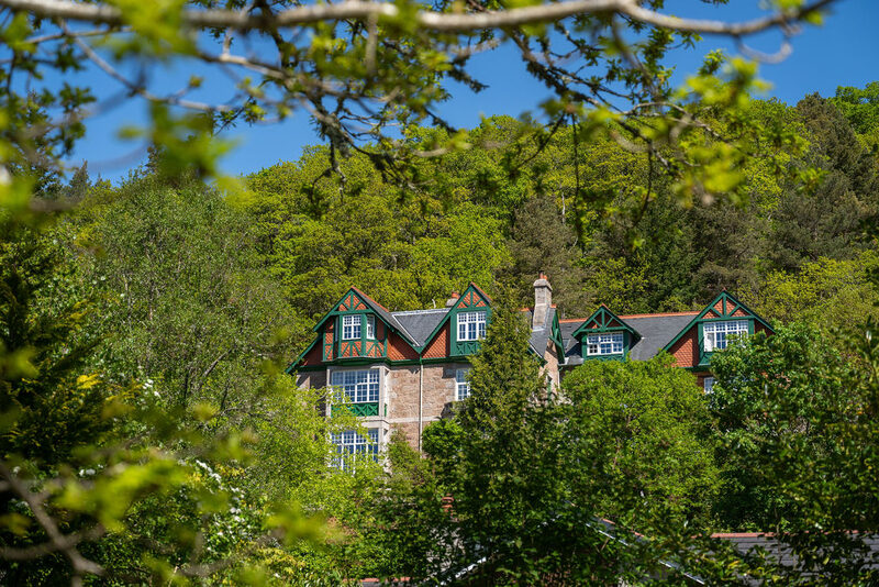
None of ours is close to the start. The nearest is Darroch Learg in Ballater, 9 miles from the start. An advert.

Then Inverenzie Cottage in Ballater, 13 miles from the start. Sleeps 4. An advert.
More walks near here
Within a short drive of the start.
Did this walk?
Tell the next person how it went. The best go on this page, with your name.
Find out more
For further reading, before you go.
- The Spittal of Glen Muick visitor centre, the Cairngorms National Park Authoritycairngorms.co.uk↗
- Path closures in the national park, the Cairngorms National Park Authoritycairngorms.co.uk↗
- Deer stalking, the Cairngorms National Park Authoritycairngorms.co.uk↗
- In an emergency, the Cairngorms National Park Authoritycairngorms.co.uk↗
- Safety and skills, Mountaineering Scotlandmountaineering.scot↗
- Cornices, Mountaineering Scotlandmountaineering.scot↗
- Mountain access and safe hillwalking, Forestry and Land Scotlandforestryandland.gov.scot↗
- The Cairngorms National Park and Monadhliath mountain forecast, the Mountain Weather Information Servicemwis.org.uk↗
- The Southern Cairngorms avalanche forecast, Scottish Avalanche Information Servicesais.gov.uk↗
Photograph by Chris Bryson via Google
Maps from OpenFreeMap © OpenMapTiles, data © OpenStreetMap contributors; heights from Mapzen's terrain tiles.