
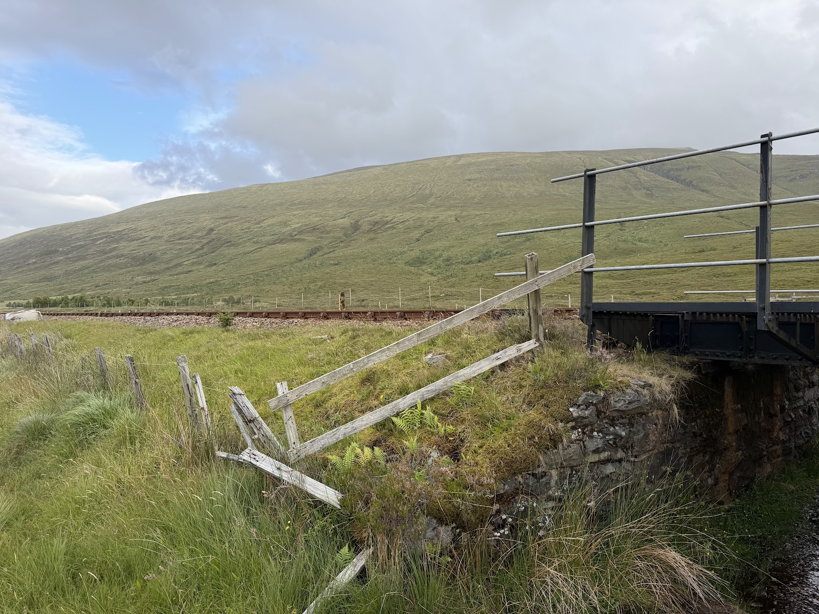
Moruisg – Over the River Carron and up the north-west slopes
4½ miles · 3½ to 5 hours · a hill · there and back
Moruisg, 926 metres, rises above Glen Carron, about 10 km south-west of Achnasheen.
The usual way up on its own starts from a lay-by on the A890 near Loch Sgamhain. It crosses the River Carron by a footbridge, goes under the railway and climbs the long north-west slopes to a broad, flat top, and back the same way. By our map it is about 7.2 km there and back with about 780 metres of climb, and it takes about 3½ to 5 hours. The ground is boggy and the climb steep, on a faint path: for hillwalkers who can find their way with a map and compass.
Where it starts
A lay-by beside the A890 near Loch Sgamhain, about 10 km south-west of Achnasheen, at grid reference NH 080 520, Steven Fallon says.
Is it for me?
Tap who is coming, or the day you have, for the answer on this walk.
Before you go
Getting there
One walker calls it a little lay-by. The A890 is part of the NC500, where traffic is fast, 60 mph and unlit by our map: pull in and out with care. The start is reached by the A890 between Achnasheen and Lochcarron. Forestry and Land Scotland says there is a limited bus service: check the times with Traveline Scotland.
On the path
About 3½ to 5 hours there and back: about 7.2 km (4½ miles) and 780 metres of climb by our map. From the A890 near Loch Sgamhain over the River Carron by a footbridge, under the railway and up the north-west slopes to the summit, 926 metres, and back the same way. A path across a field, a footbridge over the River Carron and an underpass under the railway, where the ground below is likely to be soggy and the iron girders are low enough to duck. Then a damp path through boggy ground and two gates in deer fences, and a faint path up long, steep grass slopes to a broad top. Two small burns to ford, with no bridge. About 7.2 km of boggy, steep walking with 780 metres of climb on a faint path, and a broad top that is hard to read in mist: for children used to big hill days, with an adult who can navigate. The map to carry is OS Explorer 429, Glen Carron & West Monar (1:25,000); OS Landranger 25, Glen Carron & Glen Affric (1:50,000) shows the country round it.
Good to know
Summer and early autumn in daylight, on a clear, dry day with a good forecast, after a dry spell if you can: the hill is boggy. Keep dogs under close control: the field by the road sometimes has cattle in it, and the A890 is fast. Mind the deer fences. None at the lay-by or on the hill. For toilets and places to eat, Forestry and Land Scotland points to Achnasheen and Lochcarron. Heading for the Scottish Hills lists stalking on the northern slopes from August to 20 October, never on Sundays, with access by the main paths and ridges always fine: follow any stalking signs. Under snow it is a winter hill: there is no avalanche forecast for it, but the risk is here all the same.
The walk
The usual way up Moruisg on its own starts from a lay-by on the A890 in Glen Carron, near Loch Sgamhain. It crosses the River Carron by a footbridge, goes under the railway and climbs the long north-west slopes to the top. By our map it is about 7.2 km (4½ miles) there and back, with about 780 metres of climb. Allow about 3½ to 5 hours, more with stops, in poor weather or under snow. The summit is 926 metres up, and the walk starts about 150 metres up, by the road. No public body publishes a route, a distance or a time for it. Most people climb Moruisg from the A890 and come back down the same way, Steven Fallon says. Wikipedia says almost every ascent goes on to Sgurr nan Ceannaichean, the neighbour to the south-west, now a Corbett: this walk keeps to Moruisg. Forestry and Land Scotland names its Craig car park, further down the glen, as the start for these hills. Wikipedia and Steven Fallon also name ways up from the south, on stalkers' paths from Glenuaig Lodge and the Allt a' Chonais.
The lay-by is beside the A890 about 10 km south-west of Achnasheen, Steven Fallon says, at grid reference NH 080 520. One walker calls it a little lay-by. By our map it is on the river's side of the road, and the path leaves it through a gate a few metres from the road. No source read gives a charge. For toilets and places to eat, Forestry and Land Scotland points to Achnasheen and Lochcarron, so plan for none at the start. It says there is a limited bus service, and Traveline Scotland has the times.
The A890 here is part of the North Coast 500. The lay-by sits beside a straight stretch of it, and traffic is known to travel quite fast, Steven Fallon warns. By our map the road has a 60 mph limit and no lighting. Pull in and out with care, and keep children and dogs close by the road.
Before you set off, check the mountain forecast. The Mountain Weather Information Service's Northwest Highlands forecast covers the hill, and the Met Office gives a forecast for the summit itself. Carry a map and compass and know how to use them: MunroMagic says the way needs map reading and the skill to navigate with a compass. Heading for the Scottish Hills lists the Glencarron and Glenuaig Estate on the northern slopes, stalking from August to 20 October, never on Sundays. Access by the main paths and ridges is always fine, it says. In the stalking season follow any signs on the ground.
From the lay-by go through the gate into a field, sometimes with cattle in it, Steven Fallon says, and down to a wooden footbridge over the River Carron, about 180 metres out. By our map the path then runs east along the river's south bank, over a short bridge on a small stream, to the Kyle of Lochalsh railway. It goes under the line by an underpass about 380 metres out, beside a burn. Use the underpass, never the line itself. The ground below it is likely to be soggy, Steven Fallon warns, and you will need to duck to miss its iron girders. Just beyond it, by our map, the path fords the burn with no bridge and goes through a gate in a deer fence.
Beyond the gate the moor is fenced off to let the forest grow back, Steven Fallon says, and one walker found young pine and birch planted across the glen. A damp path crosses it through marshy patches to a second gate in the fence, about 1.2 km out and about 285 metres up by our map. Steven Fallon puts it at around 300 metres. Through it you are on the open hillside. By our map a second line of path leaves and rejoins the first just above the gate.
Moruisg is boggy, and every account read says so. Some of these hills are rather boggy, as their names suggest, Forestry and Land Scotland says. One walker found the ground waterlogged on many sections, except perhaps after a very dry spell. Another found the whole north-western flank boggy, with the path vanishing where people had stepped round the wettest parts. Wear boots that keep the water out, and expect wet feet.
Above the gate a faint path climbs a grassy bank through heather beside a small burn, Steven Fallon says. Higher up the heather gives way to grass, and the path is only vaguely traceable to the top. The accounts differ on how clear it is: one walker found an obvious path or trod all the way, and others a faint path that comes and goes. One called the climb pathless, up knee-high grass. Get Lost Mountaineering keeps to the left of two wide gullies, with a stream further to the left. By our map the path crosses that burn high up, about 2.5 km out and about 680 metres up, with no bridge. The climb is steep and long, about 800 metres in about 3 km, one walker says. By our map the slope steepens all the way, and its steepest 100 metres, about 2.2 km out, climb about 60 metres. MunroMagic marks steep slopes and crags on or near the ways up, and warns that streams can rise markedly in a day. The steep, wet ground can be slippery underfoot, one walker warns. One party met a walker at about 500 metres who had given up on the steep slopes. If the climb is too much, come down the way you came, slowly.
The slope eases near the top, and the path comes out at the north end of a broad, flat plateau, about 3.3 km out by our map. A large cairn stands here, with a stone shelter beside it, one walker found. It is not the summit. The summit is about 300 metres on by our map, south-west along the plateau, past a smaller pile of stones, at a smaller cairn. Guides count two or three cairns on the top, and Steven Fallon thinks the small one in the middle marks the highest point. Wikipedia says the level top has many minor bumps and cairns, and the highest point can be hard to make out, especially in mist.
In mist the broad top is hard to read. Visibility can change markedly with the cloud level, MunroMagic warns. On open ground in poor visibility, following a path without your compass may get you lost, it says. Moruisg's craggy west slopes form the east wall of Coire Toll nam Bian, MunroMagic says, with crags near the summit. Its southern flanks fall precipitously to the glen of the Allt a' Chonais, Wikipedia says. North-east of the summit, MunroMagic says, steep slopes drop to a boggy plateau. Before you leave the summit, take a bearing for the large cairn, about 300 metres north-north-east by our map. From it the path goes down west-north-west. If the cloud comes down, the wind rises or anyone is tiring, turn back by the way you came.
From the summit a path follows the rim of Coire Toll nam Bian south-west to Sgurr nan Ceannaichean, 913 metres. Wikipedia calls that round a more interesting circular walk, and Steven Fallon finds Sgurr nan Ceannaichean the more interesting hill. It is a walk of its own, not this one.
Under snow Moruisg is a winter hill. There is no avalanche forecast for this hill, but that does not mean there is no risk under snow. One party climbing in February found the snow deeper and icy higher up, and needed crampons. On the plateau a strong wind and a windchill of minus 15 degrees sent them home without going on to the neighbour. A frozen waterfall hung in one of the gullies on the west face. Go then only with winter gear and the experience to use it.
The way down is the way you came. From the summit go back north-north-east to the large cairn, and down the path west-north-west, then north-west to the upper gate. Take the steep, wet ground slowly. Cross the fenced ground to the gate by the railway, ford the burn, go under the line by the underpass and back over the footbridge to the lay-by. In an emergency call 999 or 112 and ask for Police and Mountain Rescue, Mountaineering Scotland says. Give a six-figure grid reference and a named feature if you can. Mobile reception in the Highlands is often intermittent or non-existent, it warns. To be able to text 999 where a call will not connect, register first by texting the word register to 999.
If it rains
None on this walk: in rain, low cloud or a high wind, leave the summit for another day. The steep grass turns slippery, the bog deepens, the burns rise fast, and the broad top is hard to read in mist. If the cloud comes down, turn back by the way you came.
Places to stay near the walk
Our places to stay nearest the start, by road.
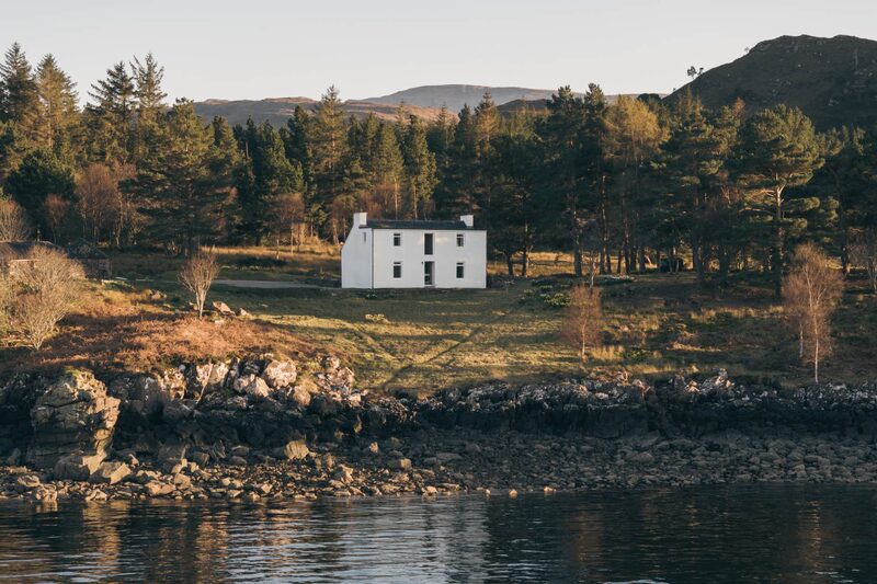
None of ours is close to the start. The nearest is Rhuroin in Shieldaig, 36 miles from the start. Sleeps 3. An advert.
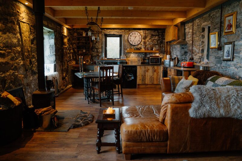
Then Lusa Bothy in Ashaig, 36 miles from the start. Sleeps 2.
Did this walk?
Tell the next person how it went. The best go on this page, with your name.
Find out more
For further reading, before you go.
- Moruisg, the Munro page, Hidden Scotland↗
- Northwest Highlands forecast, Mountain Weather Information Servicemwis.org.uk↗
- Moruisg summit forecast, Met Officeweather.metoffice.gov.uk↗
- Stalking tables for the Northern Highlands, Heading for the Scottish Hillsoutdooraccess-scotland.scot↗
- Craig, Forestry and Land Scotlandforestryandland.gov.scot↗
- Calling for help, Mountaineering Scotlandmountaineering.scot↗
Photograph by Scott Walmsley via Google
Maps from OpenFreeMap © OpenMapTiles, data © OpenStreetMap contributors; heights from Mapzen's terrain tiles.