
Where is Shetland?
Where Shetland sits on the map, at 60° North between Scotland, Norway and Faroe.
Words by Laurie Goodlad
Shetland is a small cluster of islands, 567 square miles in all. Flanked by the North Sea to the east and the North Atlantic on its western seaboard, Shetland’s position has long made it an important trading point which has helped to sculpt and carve both its past and present.
The combination of geographical location, geology and climate gives rise to an incredibly distinct, diverse and unique natural landscape. Shetland lies at 60° North, where Scotland meets Scandinavia. The latitude line passes through the sweeping South Mainland, metaphorically slicing Shetland in two. Being so far north means that the days of summer are very long and light – or, as in winter, are very short and dark. In summer, Shetland enjoys up to 19 hours of daylight but, in the winter, can expect to see only six hours of light. Put simply, Shetland is closer to the Arctic Circle to the north (400 miles/643 km) than it is to the UK’s urban powerhouse, London (600 miles/962 km), to the south.
Geographically, it is easiest to consider Shetland as a ‘stepping stone’; with Bergen, Norway 200 miles (320 km) to the east, Aberdeen, Scotland, 200 miles to the south and Faroe 200 miles to the north-west. Lying between Shetland and mainland Scotland is Fair Isle, 24 miles (39km) to the south and Orkney, 50 miles (80km) to the south-west. These islands provided the perfect route to Shetland for the first people to arrive here, some 6,000 years ago which marked the beginning of the islands’ human history.
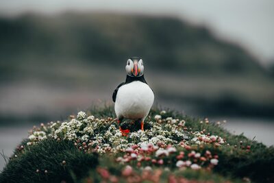
Shetland itself is made up of over 100 islands. Its rugged coastline of almost 1,000 miles (1,700km) has been carved and shaped by the unbridled power of the North Atlantic on the west while, on the east coast, the North Sea challenges the ever-changing coastline. Of these 100 or so islands, 16 are inhabited (one with a population of only two), and they are all connected to the Mainland (Shetland) either by inter-island ferry or, in the cases of Burra, Trondra and Muckle Roe, a road bridge.
Including Fair Isle to the south, and Out Stack in the north, Shetland is about 100 miles (160 kilometres) long and, at its widest, is 7 miles (11 km), but in places like Mavis Grind, it’s no more than about 70 metres wide. Mainland is the largest of the islands, at 55 miles (88 km) long, and it has links by inter-island ferry, plane and road bridge to those that are inhabited. Geographically, Shetland resembles a jigsaw puzzle formed by a range of ancient hills standing on the continental shelf and partly drowned when the last period of glaciation retreated 10,000 to 12,000 years ago.
 Out now
Twice a year, to your door
One hundred and sixty pages of Scotland, every photograph commissioned, every word written by someone who went. Members get both issues posted and everything on screen.
 The Last Stop Before Nowhere
 A Weekend Exploring the Isle of Mull
 What's On in Scotland: Autumn and Winter