
A day in the West Mainland
Day plans for Shetland’s West Mainland: one with children, one for knitters, one for history walks.
Words by Laurie Goodlad
The West Mainland is arguably the least explored of all Shetland’s regions, yet it has some of the most beautiful landscapes and walks. The area is rugged and exposed, yet gentle and rolling. It’s a place of intrigue and mystery where a significant Neolithic population lived thousands of years ago, settling the land and farming the soil.
Shaped by the mighty North Atlantic and the regular winter storms that assault Shetland’s western boundary, the coastline has been moulded, altered and scarred by the sheer power of the ocean, creating some incredible coastal walks.
Inland, the gently rolling hills of the West Mainland are thronged with some of the most notable and extensive archaeological remains on the islands, dating back to the Neolithic, some 4-5,000 years ago, including the Stanydale Temple, a megalithic structure, tucked into the landscape that continues to baffle archaeologists to this day.
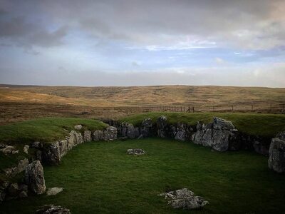
Referred to simply as the ‘Westside’, Shetland’s West Mainland begins as you pass over the Weisdale Hill towards Tresta and Bixter and is represented on the map as the ‘left-arm’ of the islands, bulging out from the long, narrow central spine into the North Atlantic.
Planning your day
Although you’re likely to want to spend more time exploring the extensive West Mainland, this one-day itinerary will give a few of the highlights and act as a springboard to explore more.
Shetland’s West Mainland is a relatively large area, encompassing the Mainland area, including the communities of Aith (Eid), Walls (Waas), Sandness and Skeld. It also includes the outlying islands of Foula, 25 miles west of Shetland, Papa Stour, a short hop from Sandness across the treacherous Papa Sound, and Vaila, a small island off Walls with a population of two.
We will explore the Mainland only for this itinerary – saving the islands for another itinerary and another day.
You may wish to base yourself in the West Mainland to enjoy the walking, wildlife and varied landscapes of this corner of Shetland. The West Mainland feels quieter, and it’s less densely populated and slightly off the main tourist trails of the north and south. There are also fewer ‘attractions’, meaning visitor centres and museums. This is a place for quiet contemplation, hiking, and just enjoying the glorious scenery.
Self-catering options
The Taing, Reawick, sits at the head of the beautiful Reawick Beach. Listen, from your bed, as the sea gently washes over the orange sands. The Taing is a beautifully curated self-catering cottage set in the rural idyll of Shetland’s West Mainland.
Westshore is set in the middle of the West Mainland. This unique architect-designed self-catering cottage ties old and new together perfectly, while the property itself enjoys spectacular sea views.
Eating Options
Despite being quite a large area, the West Mainland has few eating options. Thankfully, those that are available are excellent.
The Original Cake Fridge & Tearoom – near Aith, pick up a picnic at the Cake Fridge, or sit in the cafe inside the converted traditional crofthouse.
Cafe in the Church – held in the Walls kirk every Friday, serving delicious homemade soup and sweets.
Bonhoga Cafe – be sure to check out the exhibition space in the gallery upstairs in this converted watermill.
Honesty Boxes & Cake Fridges – including the Original Cake Fridge near Aith, you’ll find several roadside honesty boxes and fridges selling cakes and bakes, farm produce and eggs. Simply make your selection and leave the correct money in the tin provided. The Mussel box selling shellfish at Tresta and the Sand Honesty Box are a few to look out for.
Shops – you may want to pick up a picnic from Eid Community Coop, Walls Shop or Bixter Shop.
Top tip: If you’re planning to visit the West Mainland on a Sunday, be sure to check the What’s On guide in the weekly Shetland Times newspaper or check roadside signs advertising Sunday Teas in any one of the local public halls. Sunday Teas are quintessentially Shetland. Basically, a team of volunteers will open the hall for an afternoon selling tea, coffee, cakes, bakes, sandwiches, soup. For a nominal fee, visitors can tuck into an all you can eat buffet-style spread with the best local home-baking and hospitality.
Walking and hiking options
Planning is key to making the most of your time in the West Mainland – make sure you factor in where you’ll be stopping for lunch, or ensure you bring a picnic with you. There are some fantastic walking options in this area, and you’ll find that most of them are quiet – even at the height of the tourist season.
Top tip: If you’re setting off from Lerwick in the morning, The Peerie Shop Cafe make fantastic picnic lunches that you can pre-book and collect anytime after 8 am.
The following are a few suggestions for itineraries for your day, based on the activity level you expect and whether or not you are travelling with children.
Travelling with kids
The West Mainland is a fantastic place to explore with children, with lots of open spaces and the freedom to explore. The following is a suggested itinerary for the day.
Itinerary:
Sand Gairdins and Sand beach
Lunch – The Original Cake Fridge & Tearoom
Burn of Lunklet, Aith
Michaelswood, Aith
Sand: Begin the day in Sand with a visit to the Sand Gairdins. To get to Sand, follow the A971 towards Walls and turn off (21 miles from Lerwick) towards Skeld onto the B9071. A few miles along the B9071, follow the road signs towards Sand. A few miles in, the road forks – bearing left, you will reach Da Gairdins, and a right turn will take you to the Sand beach and ruined Chapel of St Mary’s.
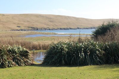
As you drive in the road towards Sand, you’ll pass the Sand Cake Fridge, an honesty box selling cakes and bakes. Stop here and pick up a picnic before heading towards the Sand Gairdins.
Da Gairdins in Sand is a 60-acre site with around one-third made up of maintained woodland, which is open to the public all year round. The woods and gardens were started in 1997, and its ambitious planting schemes benefit the environment and community alike. The gardens are free, but they welcome donations at the entrance gates. There are two sections to explore: the upper area has woodland walks and picnic benches, whereas the lower portion houses the large ponds, wildflower meadows and sunny lawns.
The gardens create a haven for wildlife with the planting, ponds and wildflower meadows encouraging a whole host of different species. With a variety of woodland walks, thousands of trees, picnic areas, and three large ponds that, in spring, are teeming with frogs and tadpoles, there is no shortage of things to catch your eye in this quiet coastal retreat.
From the Gairdins, visit the beach at Sand, a beautiful sandy expanse that is seldom busy. The beach has stunning uninterrupted views to the south.
Beside the beach is the remains of St Mary’s Chapel and, within the graveyard, get the children to search for the ‘Pirate’s Grave’, an unnamed grave depicting a skull and crossbones.
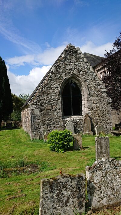
The area is dominated by the impressive Haa that overlooks the beach; this grand three-storey house was built by Sir Andrew Mitchell, a merchant from Scalloway. Haa houses can be seen around Shetland and were constructed by the landowning classes between the 17th and 19th centuries.
If time allows before lunch, or if you’ve brought a picnic lunch, check out the Reawick Beach, a beautiful orange, sandy beach that is set right beside the road and is the perfect place to don a wetsuit and make a splash.
Lunch: Either head to The Original Cake Fridge & Tearoom near Aith for lunch or head towards Aith after a picnic lunch on the beach. (Heading towards Sand, you will have passed the signs for Aith just after Bixter on the A971).
Burn of Lunklet: After lunch, grab a few cupcakes from the Cake Fridge and park half a mile down the road, where you’ll see signs for the Burn of Lunklet.
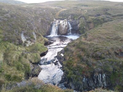
The Burn of Lunklet is perhaps Shetland’s best-known burn and waterfall. Shetland is not known for its extensive waterways – there are no rivers in Shetland, just small streams that trace through the hills like tiny veins.
There are a few reasons to do this walk – particularly if you have kids. Firstly, it’s only half a mile from the Original Cake Fridge & Tearoom, where you can pick up bribery snacks and refuel before you set off. Secondly, the access path is fantastic, meaning that it’s a relatively easy walk if you have mobility issues or small toddler legs. An off-road capable wheelchair can access the waterfall here. Lastly, the waterfall that plunges down the face of a sheer rock surrounded by the heathery hillsides is spectacular – particularly after a period of rain or when the heather is in purple flower at the end of summer.
Michaelswood: By this stage, small legs will likely protest, and tiredness will threaten to cloud the skies. Michaelswood is the perfect place to end the day, particularly if you travel with under 12s.
Michaelswood is about two miles from Lunklet within the village of Aith and is a community garden set up in memory of Michael Ferrie, a young musician from the community who died in 1996. The wooded area has a trail through trees with lots of points of interest, picnic areas, toys and a collection of dinosaurs. There are also swings and a pirate ship in the children’s play area.
Top tip: If you’re still looking for action in the evening, the Dale of Walls Beach is a great spot to catch a sunset, and cars can park beside the beach, so there’s no strenuous walk for those tired young legs.
Westerwick and Sandness (for knitters)
Itinerary:
Westerwick walk
Cake Fridge or Cafe in the Church (if it’s Friday)
Drive to Sandness and visit Melby and Norby
Sandness Mill
This itinerary has a couple of shorter walks – with all the wow factor and drama expected from an exposed Atlantic coastline. It also has a long – and very scenic – drive out to the most westerly point, Sandness, where you can take a stroll along the beaches of Melby and Norby, overlooking Papa Stour. There’s an option to visit the Sandness Wool Mill too, although it’s best to phone and pre-book.
Begin the day with a walk at Westerwick. To get to Westerwick, follow the A971 towards Skeld (B9071). At Skeld, follow the signs for Culswick (continuing along the B9071) for a couple of miles until you see a road sign for ‘Wester Skeld’. From here, follow the road for a couple of miles before turning to the right on the road signposted ‘Westerwick’. From the end of the road, a waymarked route leads to the cliffs, and below them is a stone beach encircled by imposing red granite cliffs and stacks.
Top tip: this is an excellent place to kayak, with impressive rock formations and caves to explore. Please check the weather forecast and tides before heading out, and always tell someone where you are going.
Lunch: If it’s Friday, be sure to head to the village of Walls (10 miles to the northwest following the B9071 and A971) for the Cafe in the Church that serves fresh soup and home bakes. If it’s not Friday, and you don’t have a picnic, head back towards Aith (following the B9071 and A971 south) towards the Original Cake Fridge & Tearoom.
After lunch, it’s time to head to Sandness, along the beautiful single carriageway roads that meander through the West Mainland’s landscape dotted with small lochs and peat bogs.
From Walls: Sandness is eight miles from Walls following the A971.
From Aith: Sandness is 15 miles from Aith following the B9071, then the A971.
Sandness is a welcome sight after the long drive through winding open moorland. Norby Beach looks across the tidal Sound of Papa towards the island of Papa Stour and is a Site of Special Scientific Interest (SSSI), along with much of the coastline, including the picturesque Melby area, for its geological and ecological importance. The sandy beaches of Norby and Melby lie close to one another and are a fantastic place to spot wildlife and enjoy a picnic. Be aware that the sea in this area is very tidal and swimming is not advised.
After taking in some fresh sea air and stretching the legs after driving, visit Jamieson’s Wool Mill. The mill is a family-owned business spanning over five generations, beginning in the 1890s. Peter and his son Garry carry on the business today. Jamieson’s exclusive Shetland knitwear, fabrics and yarns are now available in premium stores and boutiques worldwide. The company runs a shop in Lerwick’s Commercial Street with the famous ‘Yarn Wall’ selling their full range of colours.
Hikes with history
For lovers of hiking and history, the West Mainland has several sites of interest. The following itinerary includes two short walks and one longer hike, taking in some of the best of Shetland’s Neolithic and Iron Age.
Itinerary:
Stanydale Temple
Scord of Brouster
Culswick Broch
Begin the day at Stanydale Temple. To get to Stanydale, follow the A971 towards Walls, turning at the sign marked ‘Gruting/Staneydale’ just a few miles beyond Bixter.
Stanydale Temple is a short walk taking visitors into the heart of Neolithic Shetland and back in time some 4,000 years. The heel-shaped megalithic structure or temple – the only one of its kind in Shetland – remains shrouded in mystery and intrigue, tucked into the empty landscape.
Archaeologists are still unsure what the purpose of this structure was. The heel-shaped façade is similar to Islesburgh (Delting) and Punds Water (Northmavine), but Stanydale is far larger than anything else in Shetland, and its purpose remains a mystery.
After wondering at Stanydale’s secrets, head to the Scord of Brouster, following the road signs towards Bridge of Walls for a few miles, at the Bridge of Walls, turn right towards Sandness for about a quarter of a mile. The site is marked with a simple brown sign and arrow pointing towards the hill, and, like Stanydale, cars pull over and park in the layby.
The Scord of Brouster, in many ways, is an underwhelming site until you consider its cultural significance. This is the oldest known Neolithic settlement in Shetland, dating to around 2,200 BC and in continual occupation for several generations. Interpretation panels on the site explain the structures and land use patterns in the area.
Lunch: A picnic lunch is likely to be the best idea for today; otherwise, it’s a case of backtracking to Aith and The Original Cake Fridge & Tearoom. Alternatively, Brouster is only a mile or so from Walls and, if it’s Friday, the Cafe in the Church will be serving soup and sweets.
In the afternoon, you’ll need to lace up the hiking boots for a slightly longer walk to the Culswick Broch. This is a three-mile walk. Head towards Culswick, following the same route along the single-carriageway roads that you took from Stanydale. Rather than turning towards Stanydale (marked as ‘Hulmalees’), continue towards ‘Selivoe and Hestinseter’. Follow this road for several miles before turning towards Culswick (B9071). Follow this road, forking to the right towards ‘Culswick’ before parking at the stone building with a red British phone box outside it.
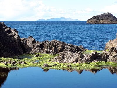
The track passes the small Culswick Chapel – this tiny methodist kirk still has services (although not weekly), and the annual carol evening is a firm favourite for people throughout Shetland who want to soak up the atmosphere of this peerie [small] place of love and worship.
At the end of the track, the imposing broch stands high on the hill with commanding views out to sea. The broch, constructed from red granite, is an excellent example of a 2,000-year-old Iron Age broch.
Allow an hour each way with an additional hour for exploring the ruined houses of Sotersta, a 19th-century township, as well as the broch and spectacular coastline.
The valley of Culswick itself is dramatic and lush, forking into two with a bog in the centre, separating the east and west side – at the head of the valley, a storm beach now blocks the sea from entering the sheltered confines, or basin, into what would have been a sea loch.
Top tip: this is also a fantastic track for mountain bikes.
Longer hike
For those keen to do a longer hike, this is one of the best that the West Mainland has to offer.
Deepdale is a long ayre (beach) set at the foot of some impressive, sheer cliffs in the Bay of Deepdale. The walk itself is 5 miles (8km) with some challenging terrain, particularly at the end of the walk, where it’s a dangerous scramble to get down to the beach. Please note that the views are just as impressive from the top, so don’t feel you have to go down to the beach.
To get to Deepdale, follow the A971 west towards Walls and then continue towards the Dale of Walls. Park at Netherdale or take the dirt track in the road at the left (before Netherdale) and park at the Voe of Dale (Dale o’ Waas beach).
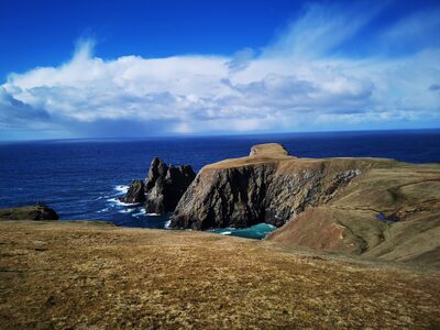
It’s best to allow at least three hours to do this walk. The views of the setting sun from the cliffs at Deepdale are unrivalled, but leave time to be back before dark.
Other places worth a visit in the West Mainland:
Da Brigs o’ Vementry – this is a fantastic walk to do with children, or in the winter when the ground is wet as there is a path most of the way.
Dale of Walls – This is where we begin the Deepdale hike, but it’s also a fantastic place to spend time on the beach and catch the sunset.
Grobsness – Lying between Voe and Aith, Grobsness is a beautiful and quiet spot with several ruined houses, a stone beach and a gentle coastline.
Sandsound – Turning off the main road at Tresta, follow the road right to the end and explore the beach and ruined houses at Sandsound. This is a popular place for local families to picnic and explore.
 Out now
Twice a year, to your door
One hundred and sixty pages of Scotland, every photograph commissioned, every word written by someone who went. Members get both issues posted and everything on screen.

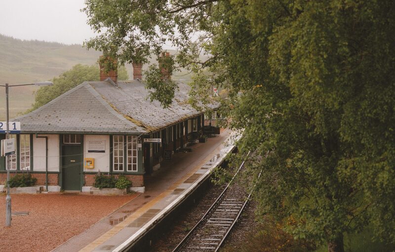 The Last Stop Before Nowhere
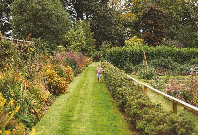 A Weekend Exploring the Isle of Mull
 What's On in Scotland: Autumn and Winter