
Machir Bay – Atlantic Sands and a Cemetery Above the Sea
About 1.9 miles on foot.
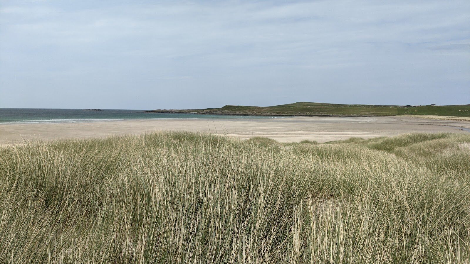
Machir Bay is a long sweep of pale sand and dunes on the west coast of Islay, open to the full Atlantic.
On the slope behind it is a small military cemetery, where many of the men lost when the troopship Otranto went down off this shore in 1918 are buried. An easy walk of about 3 km takes in the dunes and the beach, and the graves are a short way from the same car park.
- Time
- About an hour: some 3 km, a little under two miles, with almost no climb.
- The path
- A track that fades into grass, dunes and sand.
- Where to start
- The car park at the end of the road west of Kilchoman, behind the dunes. No charge.
- When to go
- All year in daylight. From November to January set off by 1.30pm. Every Islay ferry uses Port Askaig while Port Ellen's terminal is closed, until 2029. No ferry on 25 December or 1 January. Wind can stop the boat: look at CalMac's service status page on the morning you travel.
- Dogs
- On a lead: livestock graze round the road end.
- Children
- A big beach to play on, but not one to swim from.
- Before you set out
- The sea is not safe for swimming: the currents are strong. The cemetery is a place of remembrance. Every Islay ferry uses Port Askaig while Port Ellen's terminal is closed, until 2029. No ferry on 25 December or 1 January. Wind can stop the boat: look at CalMac's service status page on the morning you travel.
The walk
Park in the car park at the end of the road west of Kilchoman, right behind the dunes. There's no charge. The beach is a couple of minutes away: more than a mile of pale sand backed by dunes, with a stream running across it and the Atlantic breaking in long lines. A walker's guide gives the round here as about 3 km, a little under two miles, with almost no climb, and allows an hour. A clear track fades into grass and sand, and the way back is along the beach, so it's easy going throughout. The sea here is not for swimming: the currents are strong. Kilchoman Military Cemetery is 600 metres from the car park by the mapped path, on the slope above the bay.
On 6 October 1918 the troopship Otranto, carrying American soldiers to the war, went down in a storm not far from Machir Bay, and well over 400 of her British crew and American servicemen were lost. Many of them were buried here, in a walled plot that looks out over the ocean, and it is cared for by the Commonwealth War Graves Commission. It's a quiet place and still a place of remembrance. Livestock graze round the road end, so keep dogs on a lead. Don't count on toilets or anything to eat at the bay: bring a flask. From November to January, set off by 1.30pm. Machir Bay is 17 miles from the ferry at Port Askaig, about 35 minutes' drive.
Islay is reached on CalMac's car ferry from Kennacraig in Kintyre, a crossing of just under two hours. Port Ellen's ferry terminal is closed for rebuilding until 2029, so every boat lands at Port Askaig, in the north-east of the island. Book the car on before you travel, and be at the pier 30 minutes before the boat sails. On the winter timetable, from 19 October 2026 to 25 March 2027, the first boat leaves Kennacraig at 7am, or at 10am on a Tuesday and a Sunday. The last boat off the island leaves Port Askaig at 5.25pm on a Monday and a Wednesday, 6.05pm on a Tuesday and a Friday, and 6pm on a Thursday, Saturday and Sunday. Until 18 October the summer timetable applies, so read the times on CalMac's Islay page. Wind can stop the boat: look at CalMac's service status page on the morning you travel.
If it rains
There's no shelter at Machir Bay. In rain, walk down to the sand and back, which takes a few minutes, and keep the round for a dry day.
Before you go
Book the car onto CalMac's Kennacraig to Port Askaig ferry before you travel, out and back, and be at the pier 30 minutes before the boat.
For further reading, before you go.