
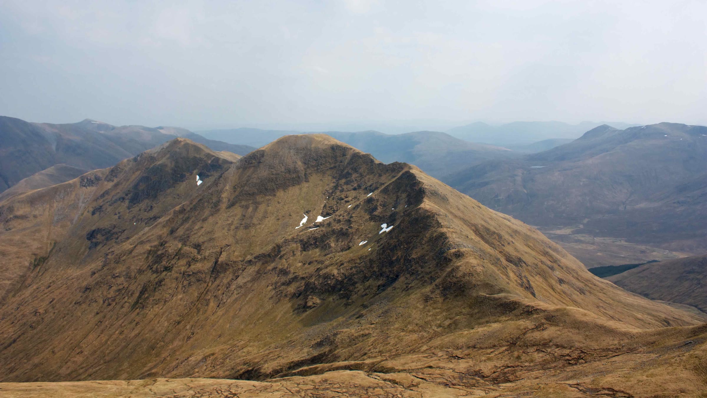
Aonach Meadhoin – Up the Long Ridge Above the Cluanie Inn
About 5 miles on foot.
Aonach Meadhoin, 1,001 metres, stands at the east end of the ridge on the north side of Glen Shiel in Kintail.
The usual way up on its own starts at the Cluanie Inn on the A87. It climbs the long south-east ridge over Sgurr an Fhuarail, the hill's own top, to the summit, and comes back the same way. By our map it is about 9 km there and back with about 1,000 metres of climb, and it takes about 4 to 5 hours. The ridge is steep near the top, narrow in places, and quick to fill with cloud. It is a day for hillwalkers who can find their way with a map and compass.
- Time
- About 4 to 5 hours there and back: about 9 km (5½ miles) and about 1,000 metres of climb by our map. From the Cluanie Inn up the south-east ridge over Sgurr an Fhuarail to the summit, 1,001 metres, and back the same way.
- The path
- A short walk on the verge of the A87, then a path across boggy ground with two small burns to ford, up a long, steep grass ridge. Above a hanging corrie it is very steep and the path fades; the ridge to the summit is narrow in places, with crags on the north side.
- Where to start
- The lay-by on the north side of the A87, about 300 metres west of the Cluanie Inn, by our map. The car park opposite the inn is marked for customers only on our map, so do not count on it.
- Set off
- By the A87 between Invergarry and Kyle of Lochalsh: the Cluanie Inn stands at the west end of Loch Cluanie. Our map marks a bus stop by the inn: check with Scottish Citylink before you rely on it.
- When to go
- Summer and early autumn in daylight, on a clear, dry day with a good forecast.
- Dogs
- Keep dogs close on the verge of the A87, a fast trunk road, and under control on the hill.
- Children
- A Munro climb of about 1,000 metres on a long, steep ridge, narrow near the top, with a fast road at the start. The weather can close in fast. For older children used to hill days, with an adult who can navigate.
- Toilets
- No source read lists toilets for walkers at the lay-by or on the hill, so plan for none.
- Before you set out
- Corrielair Estate stalks the land south and east of the ridge, which this walk crosses, from mid-September to 20 October, not on Sundays, the Heading for the Scottish Hills tables say: in those weeks phone the estate on 07775 818207 first. Under snow it is a winter mountain, and no avalanche forecast covers it.
The walk
The usual way up Aonach Meadhoin on its own starts at the Cluanie Inn on the A87. It climbs the long south-east ridge over Sgurr an Fhuarail, the hill's own top, to the summit. By our map it is about 9 km (5½ miles) there and back, with about 1,000 metres of climb. Allow about 4 to 5 hours, more with stops, in poor weather or under snow. The summit is 1,001 metres up, and the walk starts about 220 metres up, beside the road. No public body publishes a route, a distance or a time for it.
Aonach Meadhoin stands at the east end of the ridge on the north side of Glen Shiel, with Sgurr a' Bhealaich Dheirg and Saileag to the west. From the Cluanie Inn its summit is hidden behind Sgurr an Fhuarail, Wikipedia says. Many walkers climb it in a longer day along the ridge to the west, or with Ciste Dhubh to the north. This walk keeps to Aonach Meadhoin, there and back.
The Cluanie Inn stands at the west end of Loch Cluanie, on the A87 between Invergarry and Kyle of Lochalsh. Park in the lay-by on the north side of the A87, about 300 metres west of the inn: by our map it is a short loop of old road beside the main road. One guide of 2015 calls the car park opposite the inn, at the foot of the path, free. Our map now marks it for customers only, so do not count on it. No source read lists toilets for walkers, so plan for none. Our map marks a bus stop by the inn, but check with Scottish Citylink before you rely on a bus.
Before you set off, check the mountain forecast. The Mountain Weather Information Service's Northwest Highlands forecast and the Met Office's Northwest Highlands mountain forecast cover these hills. Conditions on the hills can be very different from those at the roadside and can change quickly, Kintail Mountain Rescue Team warns. Mobile coverage is poor in places, the team says, so plan for it. Carry a map and compass and know how to use them, with warm, waterproof clothing, food and drink.
From the lay-by, walk about 230 metres north-east along the A87 to the foot of the path, opposite the inn. By our map the A87 here is a trunk road with a 60 mph limit, no pavement and no lighting. Keep well in to the verge, in single file, and keep children and dogs close. Take the same care at the end of the day, on tired legs.
The path leaves the road opposite the inn and crosses boggy ground before the climb, one walker's report says. By our map it fords two small burns near the foot, with no bridge. They are small, but streams can rise markedly in a day after rain, MunroMagic warns. Then the path climbs the steep grass of the south-east ridge in long humps. It is very wet in places low down, the same report says, and drier higher up.
By our map the ridge rises about 620 metres in its first 2.2 km, to a top of 864 metres. One guide passes two cairned tops on this ridge. Beyond the 864 metre top the ridge dips a little, by our map, then turns to pass round the head of a hanging corrie. Here it becomes very steep, and one walker found the path fading out. Take it slowly, and in cloud check your line with the map and compass.
The ridge leads on to Sgurr an Fhuarail, 987 metres, listed as a top of Aonach Meadhoin. A cairn sits on its bouldery top, one guide says, and only from here does the main summit show, a little higher, to the west. The ridge splits at Sgurr an Fhuarail: a spur runs north towards Ciste Dhubh. That is not this walk. Note the place: on the way down in mist it is the turn to get right.
From Sgurr an Fhuarail the path heads west, then south-west, keeping a little below the crest, down to a wide col, one guide says. A steeper rise beyond it, about 50 metres of climb in 100 metres at its steepest by our map, leads to the broad, flat summit of Aonach Meadhoin. The summit is 1,001 metres, with a large, untidy cairn. MunroMagic calls these peaks a narrow, curving ridge. It lists narrow ridges with exposure, crags and steep slopes among the hazards here. The north face, above Coire nan Eun, is steep and craggy, so keep to the path and back from the edge.
This walk crosses Corrielair Estate's ground, south and east of the ridge. The Heading for the Scottish Hills tables say the estate stalks deer there from mid-September to 20 October, with no stalking on Sundays. They name a way onto the ridge from further west as always fine, but not the direct way from the Cluanie Inn. In those weeks, phone the estate on 07775 818207 before you go.
In mist the ridge and its tops can be hard to read, and visibility can change markedly with the cloud, MunroMagic warns. One guide calls this ridge a very serious undertaking in anything but dry summer conditions. If the cloud comes down, the wind rises or anyone is tiring, turn back by the way you came.
Under snow Aonach Meadhoin is a winter mountain, and its craggy north face holds snow well into summer, Wikipedia says. No Scottish Avalanche Information Service forecast area takes it in, which does not mean there is no risk under snow. One guide calls the ridge no place for the inexperienced in winter. Go then only with winter gear and the experience to use it.
The way down is the way you came. From the summit go back east, down to the col and up to Sgurr an Fhuarail. There keep to the south-east ridge, not the spur north to Ciste Dhubh. Paths also leave the summit south and west: neither is this walk. Go down the steep ground above the corrie with care, then walk the A87's verge back to the lay-by. In an emergency call 999 or 112 and ask for Police and Mountain Rescue, Mountaineering Scotland says. Give a six-figure grid reference and a named feature if you can. To be able to text 999 where a call will not connect, register first by texting the word register to 999.
If it rains
None on this walk: in rain, low cloud or a high wind, leave the summit for another day. The ridge is steep near the top and narrow in places, and quick to fill with cloud. If the cloud comes down, turn back by the way you came.
Before you go
Book accommodation nearby
If you are staying over: here are ours nearest where the day starts and ends.
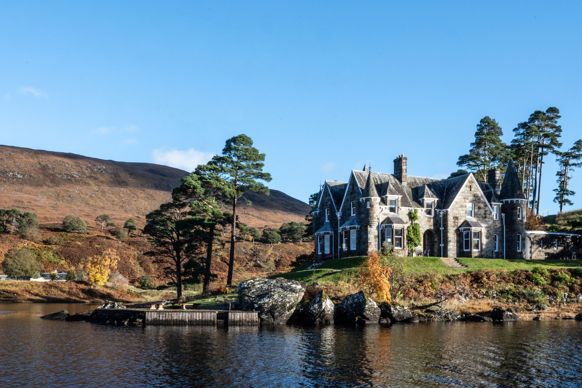
The nearest of ours is Glen Affric Estate, 10 miles away. Sleeps 24.
Find out more
For further reading, before you go.
- Aonach Meadhoin, the Munro page, Hidden Scotland↗
- Heading for the Scottish Hills: stalking in the Northern Highlands, Outdoor Access Scotlandoutdooraccess-scotland.scot↗
- Mountain safety, Kintail Mountain Rescue Teamkintailmrt.org.uk↗
- Calling for help, Mountaineering Scotlandmountaineering.scot↗
- The Northwest Highlands mountain forecast, the Mountain Weather Information Servicemwis.org.uk↗
- The Met Office's Northwest Highlands mountain forecastweather.metoffice.gov.uk↗
- Avalanche forecasts, Scottish Avalanche Information Servicesais.gov.uk↗
Maps from OpenFreeMap © OpenMapTiles, data © OpenStreetMap contributors; heights from Mapzen's terrain tiles.