
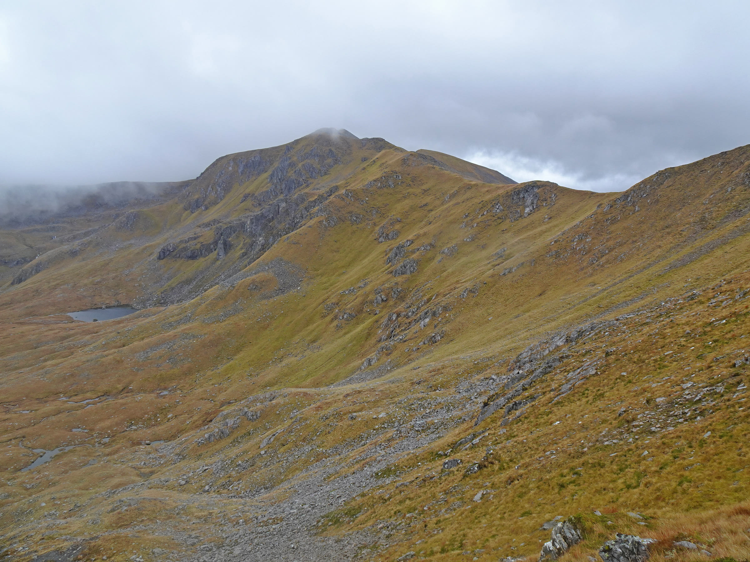
A' Chraileag – Up the south ridge from Loch Cluanie
4 miles · 3½ to 4½ hours · a hill · there and back
dogs welcome
A' Chraileag, 1,120 metres, stands on the north side of Loch Cluanie, the highest of the hills round it.
Climbed on its own, the usual way goes up a very steep path from the A87 to the south ridge and along the ridge north to the summit, and back the same way. By our map it is about 7 km there and back with about 910 metres of climb, and it takes about 3.5 to 4.5 hours. It is a short Munro, but a steep one, where cloud comes in fast: for hillwalkers who can find their way with a map and compass.
Where it starts
A parking place on the south side of the A87 at the west end of Loch Cluanie, at grid reference NH 091 120, about 1.5 km east of the Cluanie Inn by our map.
Is it for me?
Tap who is coming, or the day you have, for the answer on this walk.
Before you go
Getting there
One guide uses a long lay-by 500 metres west and walks back along the road. The start is reached by the A87 between Invergarry and Shiel Bridge. By our map Scottish Citylink coaches stop at the Cluanie Inn, about 1.5 km west along a road with no pavement: check with Citylink.
On the path
About 3½ to 4½ hours there and back: about 7 km (4¼ miles) and 910 metres of climb by our map. From the A87 at Loch Cluanie up a very steep path to the south ridge, then north along the ridge to the summit, 1,120 metres, and back the same way. A short walk on the verge of the A87 and a crossing, then a path that climbs about 550 metres in 1.4 km, steep, wet and slippery, with a small burn to cross low down. Then a clear path along the broad ridge to the summit. A very steep, slippery climb of over 900 metres, with a fast road at the start and weather that can close in fast: for older children used to hill days, with an adult who can navigate. The map to carry is OS Explorer 414, Glen Shiel & Kintail Forest (1:25,000); OS Landranger 33, Loch Alsh, Glen Shiel & Loch Hourn (1:50,000) shows the country round it.
Good to know
Summer and early autumn in daylight, on a clear, dry day with a good forecast: the steep path up the shoulder is at its worst when wet. Keep dogs close on the verge of the A87, a fast trunk road, and under control on the hill. No source read lists toilets at the start or on the hill, so plan for none. Corrielair Estate stalks west of the ridge from mid-September to 20 October, not on Sundays, but Heading for the Scottish Hills says the direct way up from the A87 and down the same way is always fine. Under snow it is a winter mountain with cornices on the ridge, and no avalanche forecast covers it.
The walk
The usual way up A' Chraileag starts on the A87 at the west end of Loch Cluanie. A path leaves the track into An Caorann Mor and climbs the hill's steep south ridge, then follows the ridge north to the summit. By our map it is about 7 km (4¼ miles) there and back, with about 910 metres of climb. Allow about 3.5 to 4.5 hours, more with stops, in poor weather or under snow. The summit is 1,120 metres up, and the walk starts about 225 metres up, beside the road. No public body publishes a route, a distance or a time for it. The first climb is very steep, wet and slippery, and it is harder on the way down. A' Chraileag is usually climbed with Mullach Fraoch-choire, along the ridge to the north, and Sgurr nan Conbhairean and Sail Chaorainn stand across the bealach to the east. This walk keeps to A' Chraileag and comes back the same way.
The walk starts by a parking place on the south side of the A87 at the west end of Loch Cluanie, at grid reference NH 091 120. By our map it is about 1.5 km east of the Cluanie Inn; MunroMagic puts the start 2 km east. One guide parks in a long lay-by at the west end of the loch and walks 500 metres back along the road, over the bridge on the Allt a' Chaorainn Mhòir. No source read gives a parking charge or lists toilets at the start, so plan for none. By our map Scottish Citylink's coaches stop at the Cluanie Inn: check times with Citylink before you rely on them.
Before you set off, check the mountain forecast. The Mountain Weather Information Service's Northwest Highlands forecast and the Met Office's Northwest Highlands mountain forecast cover these hills. Conditions on the hills can be very different from those at the roadside and can change quickly, Kintail Mountain Rescue Team warns. Mobile coverage is poor in places, the team says, so plan for it. Carry a map and compass and know how to use them: MunroMagic says the way needs map reading and the skill to navigate with a compass.
From the parking place, walk about 85 metres east along the A87 and cross to the track on the north side, where our map marks a signpost for Glen Affric. By our map the A87 here is a trunk road with a 60 mph limit, no pavement and no lighting. Keep well in to the verge, cross with great care, and keep children and dogs close. Take the same care at the end of the day, on tired legs.
About 50 metres up the track, by our map, a path leaves it on the right. One walker's report marks the turn with a tiny cairn less than fifty yards from the road, and another with a small pile of stones. One guide puts the cairn further up, where the track starts to level off, so look for the path as you go. By our map the path crosses a small burn soon after, with no bridge. It is small, but streams can rise markedly in a day after rain, MunroMagic warns.
The path then climbs very steeply north-east up the shoulder of the south ridge. By our map it rises about 550 metres in its first 1.4 km, and about 60 metres in its steepest 100 metres. One walker's report gives 570 metres of climb in about 1.4 km, a gradient of about 1 in 2.5. Reports call the path steep, wet and slippery, and one calls it extremely slippery. One guide finds wet grass for quite a way, firming up and drying out with height. Another walker calls it a steep and almost pathless slog. Take it slowly and keep to the line of the path.
At about 1.3 km out and about 750 metres up by our map, the path reaches the ridge and turns left, north, where one report notes a small cairn. The gradient eases here. Note this turn: in mist it is the place to find again, as the way down leaves the ridge here.
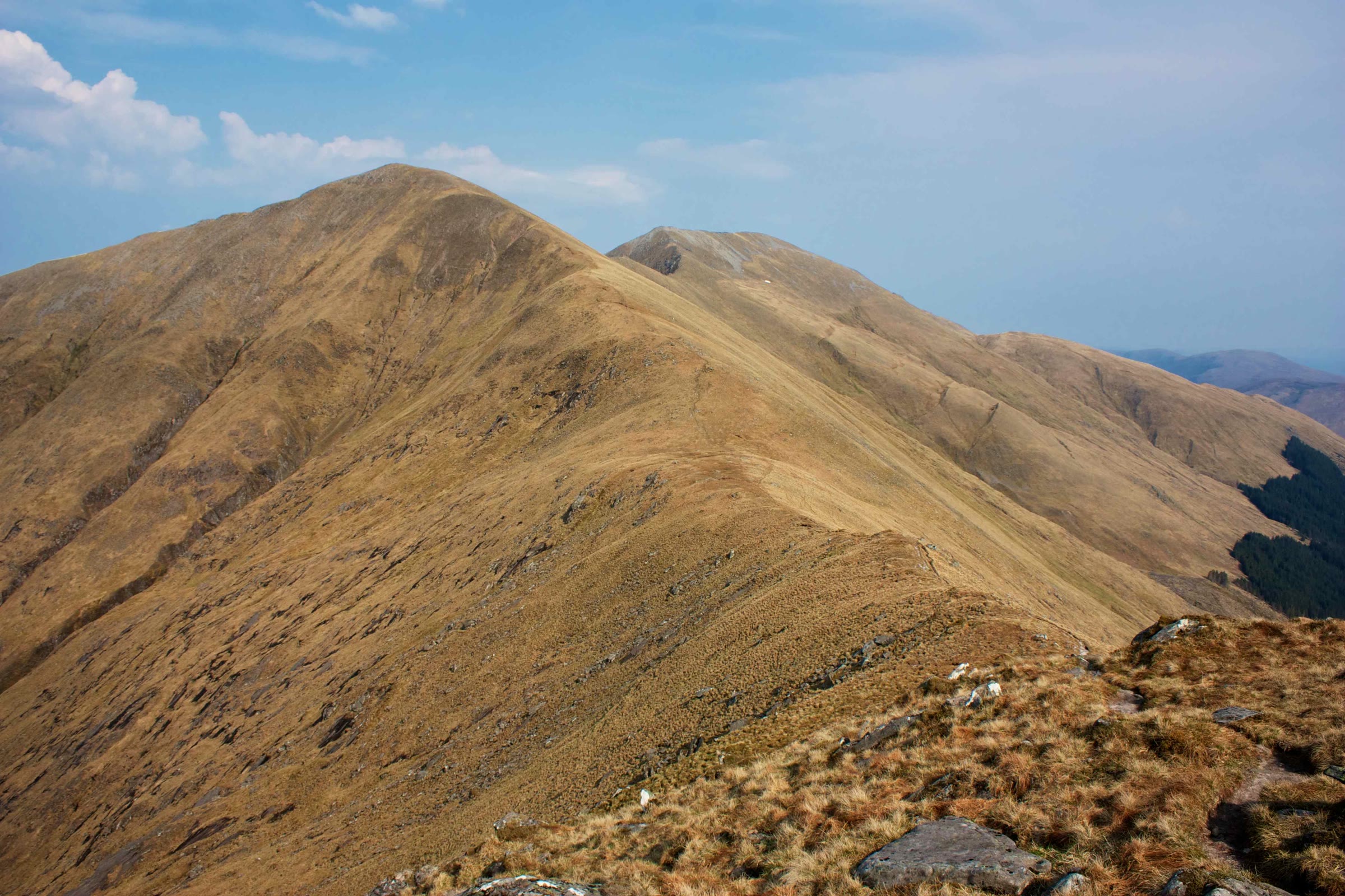
A clear path follows the broad ridge north, then north-west, to the summit, about 2 km on and about 360 metres higher by our map. One walker's report finds it clear and gently graded along the edge of a steep drop into the corrie. Keep to the path and back from the edge. MunroMagic lists steep slopes, stony and rocky ground and crags near the summit among the hill's hazards. Near the top the ridge narrows, and a huge cairn stands on the summit, 1,120 metres up. Mullach Fraoch-choire rises to the north along the ridge, and Sgurr nan Conbhairean to the east.
Turn back at the summit. North of it the ridge to Stob Coire na Craileig has a few places that need hands, one guide says, and walkers describe a clambery section. Beyond lie the pinnacles of Mullach Fraoch-choire, where one walker's report finds an arête with steep drops on either side. MunroMagic lists narrow ridges with exposure among the hill's hazards: that ground is off this walk.
In mist the ridges round the summit can be hard to read. From the top a ridge runs north to Stob Coire na Craileig, one curves east to Bealach Choire a' Chait, and one runs north-east from south of the summit to A' Chioch. For the way down you want the ridge running south: check it with your compass before you leave the cairn. On open ground in poor visibility, following a path without your compass may get you lost, MunroMagic warns. If the cloud comes down, the wind rises or anyone is tiring, turn back by the way you came.
The Heading for the Scottish Hills tables say Corrielair Estate manages the land west of the ridge and south of Stob Coire na Craileig. It stalks there from mid-September to 20 October, with no stalking on Sundays. The tables say the most direct way straight up A' Chraileag from the A87, and down the same way, is always fine. Forestry and Land Scotland manages the land east of the ridge, with no stalking issues.
Under snow A' Chraileag is a winter mountain. No Scottish Avalanche Information Service forecast area takes it in, which does not mean there is no risk under snow. Cornices form on the eastern and northern edges of the ridge and can last well into spring, guides and walkers warn: keep well back from the edge. One guide says snow banks and hard ice on these ridges make for serious mountaineering, with ice axe and crampons. Go then only with winter gear and the experience to use it.
The way down is the way you came, and on this hill the steep lower path is the harder half. From the summit follow the ridge path back south-east, then south, to the small cairn where the path leaves the ridge. There turn right, south-west, down the steep shoulder to the track, and left down the track to the A87. Go down with care, as the path is slippery when wet, then cross the A87 and walk the 85 metres west along the verge. In an emergency call 999 or 112 and ask for Police and Mountain Rescue, Mountaineering Scotland says. Give a six-figure grid reference and a named feature if you can. To be able to text 999 where a call will not connect, register first by texting the word register to 999.
If it rains
None on this walk: in rain, low cloud or a high wind, leave the summit for another day. The path up the shoulder is very steep, and slippery when wet. If the cloud comes down, turn back by the way you came.
Places to stay near the walk
Our places to stay nearest the start, by road.
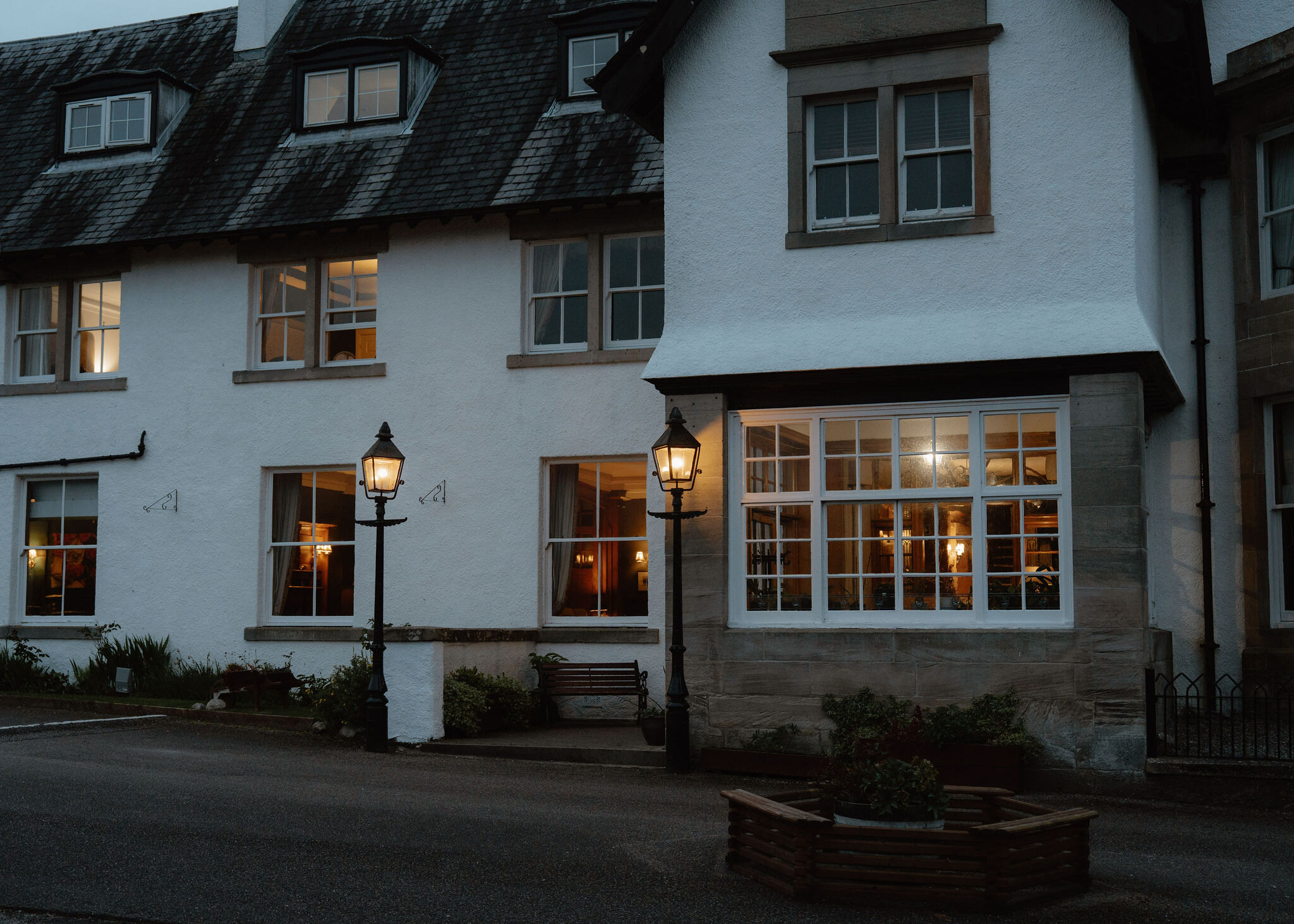
None of ours is close to the start. The nearest is The Lovat Hotel in Fort Augustus, 29 miles from the start. An advert.
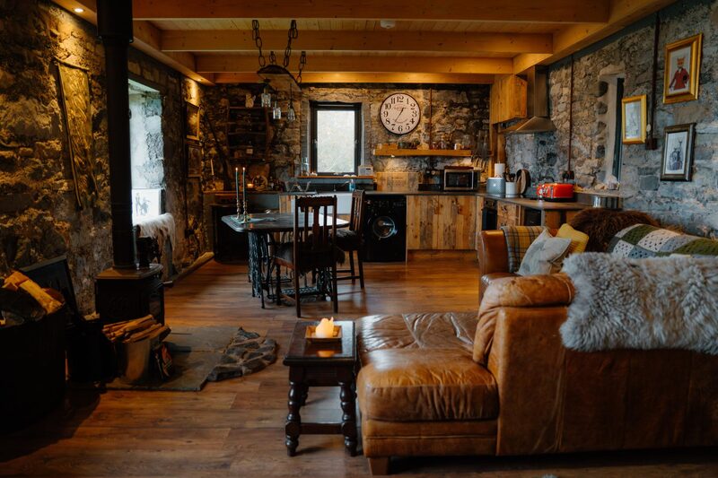
Then Lusa Bothy in Ashaig, 33 miles from the start. Sleeps 2.
More walks near here
Within a short drive of the start.
Did this walk?
Tell the next person how it went. The best go on this page, with your name.
Find out more
For further reading, before you go.
- A' Chraileag, the Munro page, Hidden Scotland↗
- Mountain safety, Kintail Mountain Rescue Teamkintailmrt.org.uk↗
- Northwest Highlands forecast, Mountain Weather Information Servicemwis.org.uk↗
- Northwest Highlands mountain forecast, Met Officeweather.metoffice.gov.uk↗
- Stalking tables for the Northern Highlands, Heading for the Scottish Hillsoutdooraccess-scotland.scot↗
- Scottish Avalanche Information Servicesais.gov.uk↗
- Calling for help, Mountaineering Scotlandmountaineering.scot↗
Maps from OpenFreeMap © OpenMapTiles, data © OpenStreetMap contributors; heights from Mapzen's terrain tiles.